

USE THE COUPON CODE “SPRING2026” AND GET 10 PERCENT OFF ON ANY PURCHASE

On & Off Showery Rains & Heavy Downpours Continue
As Slow Moving Low Meanders
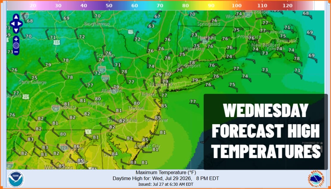
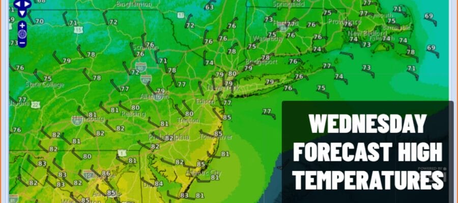
Overnight heavy rain fall is now shifting into New England and while the heavy rains are mostly done from New Jersey south and west, they are not done north and east of New York City. Low pressure is off the south coast of Long Island and it will gradually move northward today. Satellite and radar loops show how narrow the rain area is as it only stretches about 100 miles across from east to west. Showery rains are likely to develop later today as the low moves into Southern New England and some of the rain arcs back to the west southwest. This might add a quarter to a half inch or so to rainfall amounts over the next 25 hours. Most temperatures today will be in the muggy 70s with some warm spots getting close to 8
SATELLITE WITH LIGHTNING STRIKES

WEATHER RADAR

The main issue over the next couple of days will be the slow moving nature of the low pressure area and the associated upper trough. It will eventually exit the northeast but not until Friday so in the meantime we will continue see rotation of spokes around a closed upper air storm in New England. That will bring rounds of showery rains for Thursday but note that they will be the on and off variety and probably more off than on.
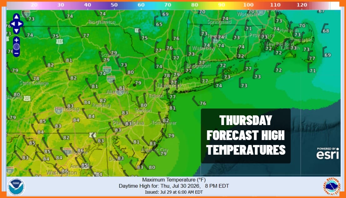 There will be lots of clouds around overnight and Thursday though the sun could poke through from time to time especially in areas to the south of New York City and Philadelphia. More than likely any sun will self destruct. Highs will generally be in the upper 70s and lower 80s. Friday we could see less in the way of any showers around and perhaps a better weather day sky wise with highs again in the upper 70s and lower 80s.
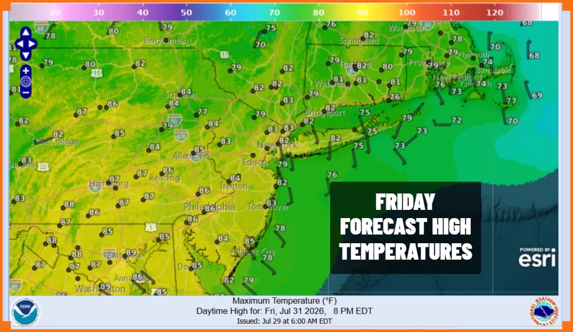
We should see this weather system finally be well to the east by Saturday. In general the weekend will see better weather but we can’t rule out a shower or thunderstorm at some point Saturday and possibly again late Sunday. Any activity will tend to be widely scattered and not an area wide impact type of event so overall the weekend should be okay. The overall pattern remains active so there will be rain risk from time to time next week. Temperatures over the weekend will be topping out in the low to mid 80s.
MANY THANKS TO TROPICAL TIDBITS FOR THE USE OF MAPS
Please note that with regards to any severe weather, tropical storms, or hurricanes, should a storm be threatening, please consult your local National Weather Service office or your local government officials about what action you should be taking to protect life and property.
