

USE THE COUPON CODE “SPRING2026” AND GET 10 PERCENT OFF ON ANY PURCHASE

Flash Flood Watches Severe Weather Risk & More
As Storm System Heads Eastward
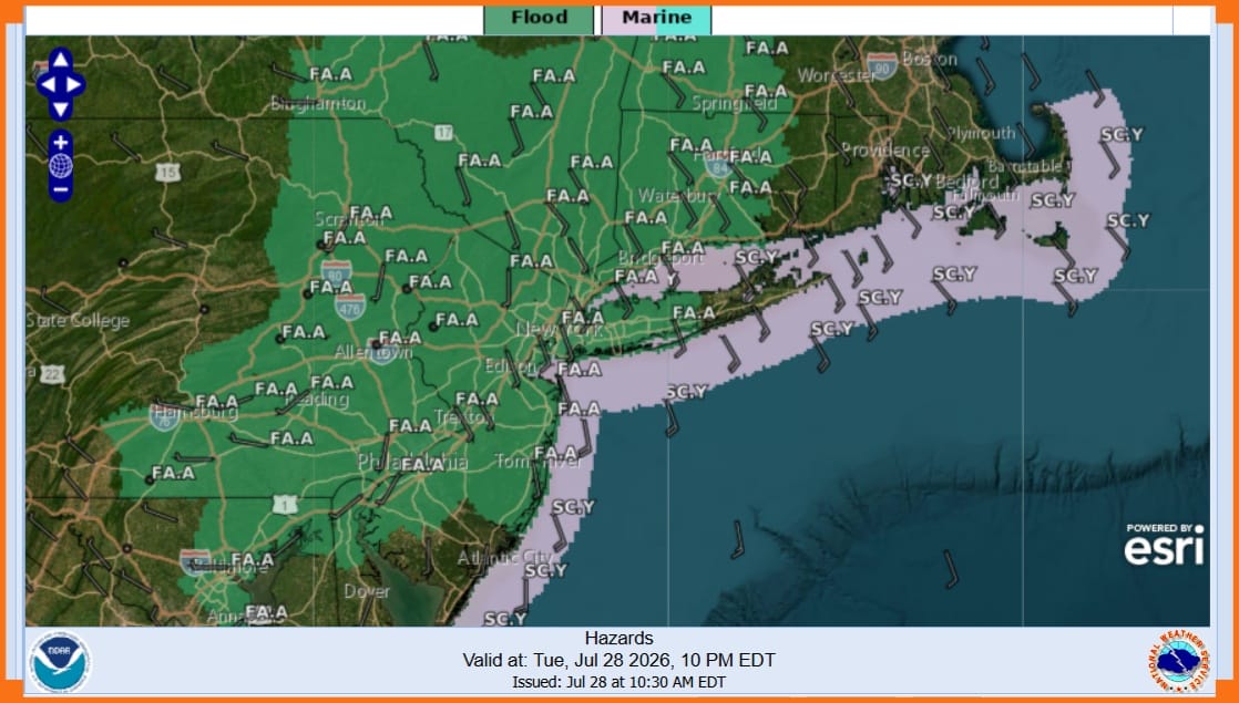
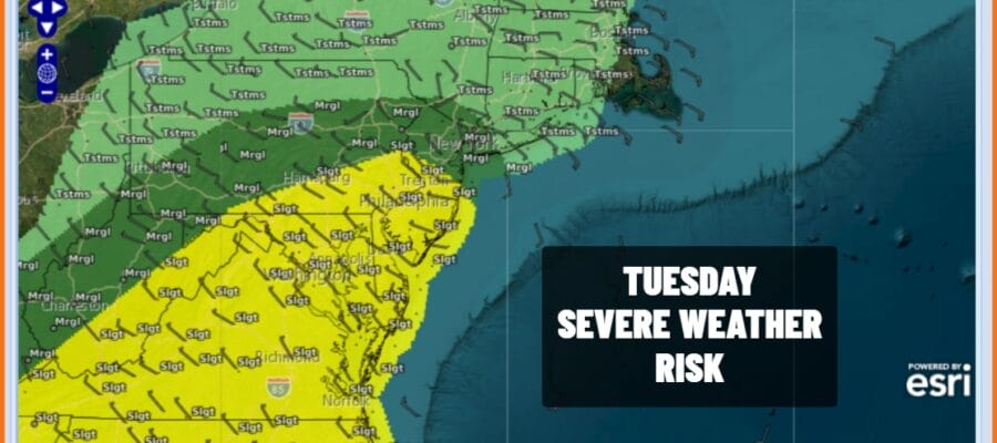
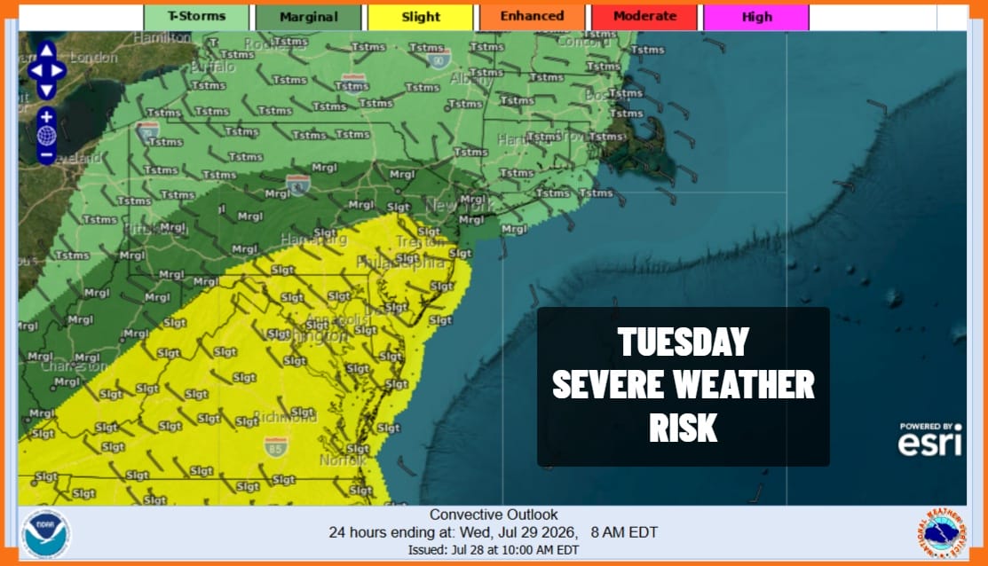
Flash Flood Watches are posted for much of Eastern Pennsylvania from Interstate 81 eastward. almost all of New Jersey, New York City, Long Island and Southern New England. Heavy rains could total 2 to 4 inches by Wednesday morning with locally higher amounts. The Weather Prediction Center is indicating a moderate risk for flash flooding for most of the area. The Storm Prediction Center is also indicating a risk for severe thunderstorms and the possibility of a few tornadoes spinning up.
Satellite and radar loops are already showing a growing area of downpours and thunderstorms and these will reach our zone late this afternoon and this evening. Eastern Pennsylvania will see the rains arrive earlier in the afternoon and then gradually reaching the coast during the evening hours. Rainfall rates could exceed 2 inches and hour in some places. 2 to 4 inches of rain is forecast for much of the area through 8am Wednesday but remember that in these types of situations, local amounts could be 50 or even 100 percent higher than the broad brush forecast.
SATELLITE WITH LIGHTNING STRIKES

WEATHER RADAR

The cold front and the associated low pressure area and upper trough will be taking it’s sweet time moving through the Northeast over the next couple of days. While the worst of it will be late today and tonight, showery rains are likely to continue through at least Thursday and there could even be some lingering showers into Friday. Hopefully we will see some general improvement over the weekend.
MANY THANKS TO TROPICAL TIDBITS FOR THE USE OF MAPS
Please note that with regards to any severe weather, tropical storms, or hurricanes, should a storm be threatening, please consult your local National Weather Service office or your local government officials about what action you should be taking to protect life and property.
