

USE THE COUPON CODE “summer2026” AND GET 10 PERCENT OFF ON ANY PURCHASE

Nice Sunny Weather Into Saturday Rain Likely Sunday Remnants of Isaias
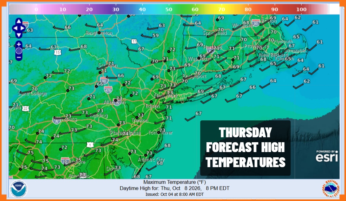
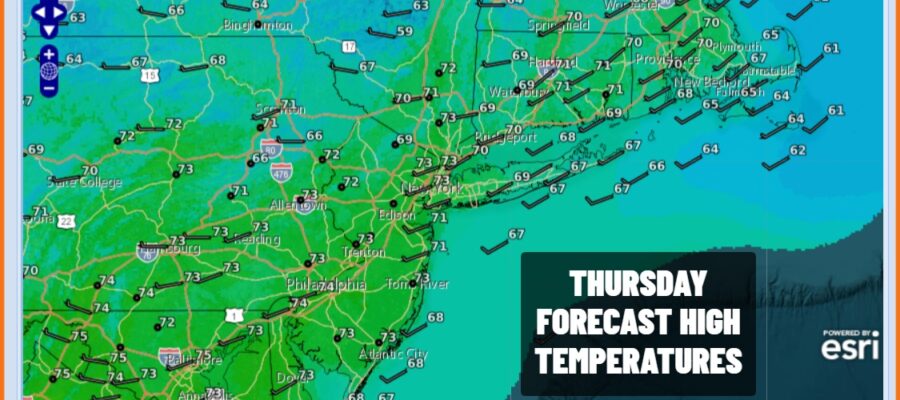
The Central Gulf Coast is bracing for the arrival of Hurricane Isaias late Friday evening. While that is going on to our south, we are in a different weather world. A cold front is moving offshore with little weather or even cloud cover and we are setting up for another day of sunshine and dry conditions. This dry air mass is not as cool as the one earlier this week so we have near normal temperatures. Highs today will reach the lower 70s in most places. Radars are silent and should remain so right through Saturday.
SATELLITE WITH LIGHTNING STRIKES

WEATHER RADAR

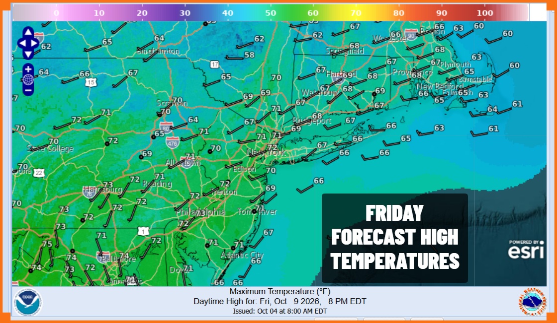
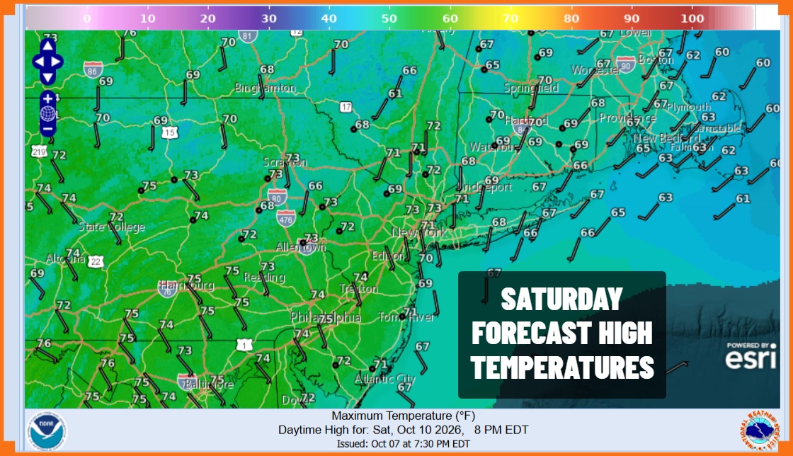
Nights are cool but not cold with clear skies tonight and Friday morning lows in the upper 40s to mid 50s from inland to coast and warmer urban locations. Friday we see sunshine to finish off the week and no issues regarding getaway day. Highs will be in the lower 70s. The same forecast holds for Saturday though there might be some high clouds coming in later in the day. Again no rain is forecast through Saturday night.
Now we turn our attention to Hurricane Isaias. We have experienced heavy rains and flooding from remnant hurricanes and tropical storms, especially if the core remains intact. That is one of the issues we are unsure of. Also the timing of the arrival of the rain is in question and will depend on the speed of the remnant system once it moves inland. Most of the models suggest the core will become diffuse and be less of an issue as it heads northeast and east across the Ohio Valley and toward the Northern Mid Atlantic coast.
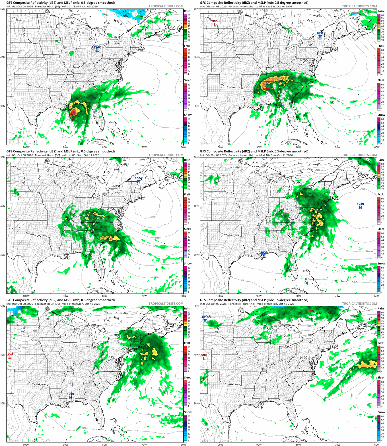
Most of the model guidance would suggest rainfall amounts of an inch to an inch and a half if the core gets absorbed by a developing frontal system and that is the way we are going with this. Rain arrives Sunday morning though the timing is at issue as well. A slower storm means rain holds off until later in the day Sunday vs daybreak Sunday. The faster it gets in, the faster it gets out so we will go with the idea that weather conditions will improve Monday as most if not all of the rain will be done by daybreak Monday. The forecast will likely require some adjustments going forward.
MANY THANKS TO TROPICAL TIDBITS FOR THE USE OF MAPS
Please note that with regards to any severe weather, tropical storms, or hurricanes, should a storm be threatening, please consult your local National Weather Service office or your local government officials about what action you should be taking to protect life and property.
