
Moderating Temps Continue Arctic Air for the Weekend
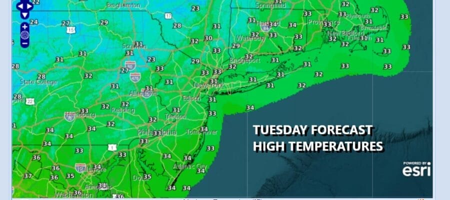
We continue to slowly recover from the bitter cold of the weekend. Temperatures yesterday went above 32 for the first time in a week and a half and we will do it again today. Some clouds will be on the scene today and that will hold temperatures down a bit but we should still see highs reaching the middle 30s in most places. We don’t see much of anything on radars to worry about as the weather pattern for this week remains on the quiet side.
SATELLITE WITH LIGHTNING STRIKES

WEATHER RADAR

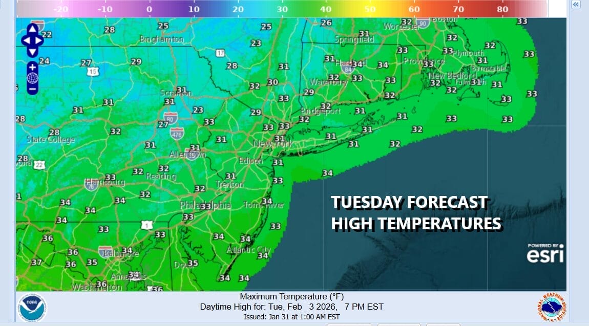
Over the next couple of days we have a series of waves of low pressure passing by to the south. The first one will move through tonight in areas to the south in Virginia and North Carolina. The wave moves offshore Wednesday morning and takes an area of light snow and rain out to sea. A second wave will follow this in the Southern Mid Atlantic. This leaves the Northeast and Northern Mid Atlantic dry through Friday.
 Friday brings an arctic front to the Northeast and Northern Mid Atlantic with a shot of bitter cold air for the weekend. We could see an area of snow or some snow showers and squalls late Friday into Friday night when the arctic front passes and a storm forms offshore. I don’t expect complications from this front so it is going to be a rollercoaster of sorts temperature wise.
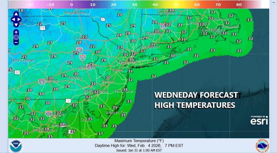
Wednesday should be no worse than partly sunny with highs again in the middle 30s. The same holds for Thursday though there might be more in the way of clouds around. Friday will be in the upper 20s and lower 30s ahead of the arctic front. By Saturday morning lows will be in the single digits to around 10 degrees. The weekend will be windy and bitter cold with most highs just in the teens to near 20 and nighttime lows in the single digits to below zero inland.
BE SURE TO DOWNLOAD THE FREE METEOROLOGIST JOE CIOFFI WEATHER APP &
ANGRY BEN’S FREE WEATHER APP “THE ANGRY WEATHERMAN!
MANY THANKS TO TROPICAL TIDBITS FOR THE USE OF MAPS
Please note that with regards to any severe weather, tropical storms, or hurricanes, should a storm be threatening, please consult your local National Weather Service office or your local government officials about what action you should be taking to protect life and property.


