
Major Storm New Jersey Hudson Valley Connecticut Friday
Very Cold Christmas Holiday Weekend
WEDNESDAY DECEMBER 21 2022
We are rapidly heading to the Christmas holiday weekend and there is an impediment. A major storm develops in the Plains and heads to the Great Lakes. Snow is not a real issue here but we do have the possibility of a flash freeze late Friday into Friday night. More on this in a moment because we do have other issues of importance. There are no weather problems as today will be nice and sunny though chilly with highs reaching the upper 30s and lower 40s.
SATELLITE

WEATHER RADAR

Weather conditions will deteriorate Thursday as rain moves northward up the coast from the Carolinas and Virginia. Rain will fall heavy at times Thursday night into Friday morning. Winds will be increasing Thursday night from the south and by Friday morning, winds will be gusting to 50 mph or more especially along coastal areas.
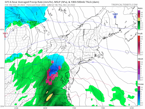
Friday is going to be a wild weather day with everything you can think of. Heavy rain will end in the morning early and then another round of rain comes around midday from west to east. A change to snow will occur in Eastern Pennslyvania and swing up to Northwest NJ and the Hudson Valley during the afternoon. Temperatures will be falling fast from the 50s at midday to the 20 by late afternoon and evening so any wet surfaces will freeze quickly.
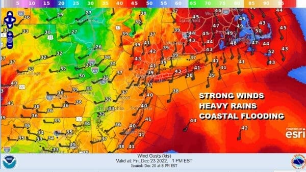
Winds will continue to howl from the south in the morning and then shift to the west and northwest 30 to 40 mph with gusts of 50 or more. As skies clear Friday night lows will be in the low to mid teens and wind chills will be below zero. Saturday Christmas Eve will be windy with ineffective sunshine and highs just into the 20s. Another cold night Saturday night with lows in the teens. Christmas Day will be sunny with a little less wind but still breezy and very cold with highs in the 20s.
We want to point out for those of you along the New Jersey Shore from Ocean county northward and in the counties surrounding NY Harbor moderate to isolated areas of major coastal flooding are likely Friday at high tide and we will be talking more about this as the weather situation unfolds.
BE SURE TO DOWNLOAD THE FREE METEOROLOGIST JOE CIOFFI WEATHER APP &
ANGRY BEN’S FREE WEATHER APP “THE ANGRY WEATHERMAN!
MANY THANKS TO TROPICAL TIDBITS & F5 WEATHER FOR THE USE OF MAPS
Please note that with regards to any severe weather, tropical storms, or hurricanes, should a storm be threatening, please consult your local National Weather Service office or your local government officials about what action you should be taking to protect life and property.