
USE THE COUPON CODE “SPRING2026” AND GET 10 PERCENT OFF ON ANY PURCHASE

Low Passes Offshore On A Cool Weekend
But Warming Up Early Next Week
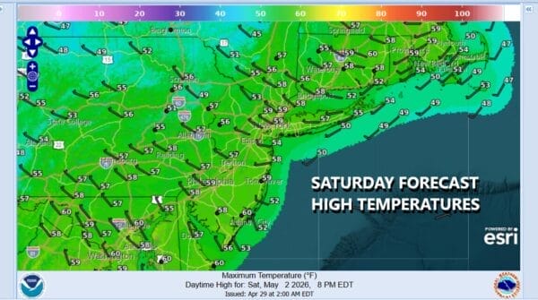
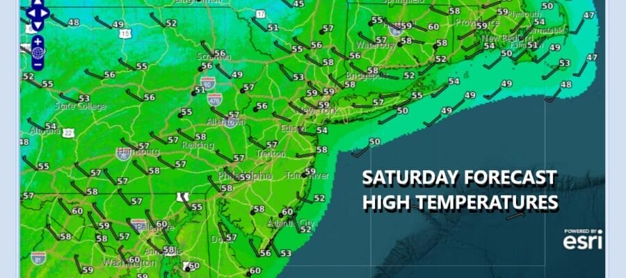
We are kicking off the weekend with clouds today. A system is passing east off the coast of New England taking showers out to the east. A second system, low pressure off the Southeast US coast will be heading northeast and offshore. Between the two systems we have cloud issues though some areas inland could see some sun. Rain from the southern system should stay east and just offshore, perhaps grazing Eastern Long Island and Southeastern New England briefly. Highs today will be mostly in the 50s though some of the warmest spots, if there are some breaks in the cloud cover could hit 60 degrees.
SATELLITE WITH LIGHTNING STRIKES

WEATHER RADAR

As the southern low pulls away to the east tonight, we should see skies clear. Morning lows Sunday will be in the upper 30s to mid 40s. Sunday should be no worse than partly sunny though it will be on the chilly side. High temperatures again will be in the upper 50s to around 60 degrees or so and it will also be a bit breezy, especially for the first part of the day. The core of this cold shot will move out Sunday night.

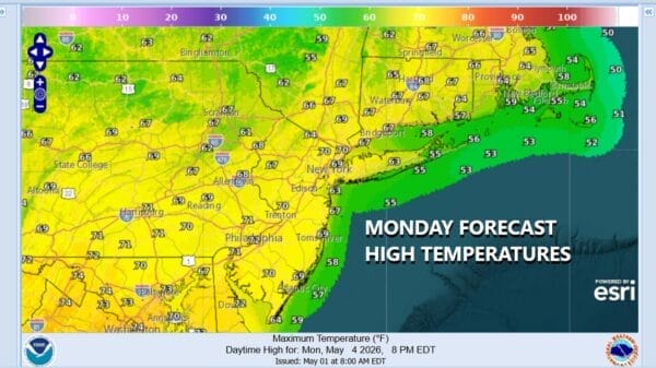
One positive about this time of year weatherwise is that when chilly air masses move in, they move out fast, and given the time of year, the strong May sun reflexively boost temperatures back up to where they should be or even above average for a day or so. Such is the case for Monday and Tuesday as we will see sunshine take highs back into the 70s Monday afternoon except for maybe a bit cooler along the immediate coast.
Tuesday we will see temperatures push even higher with west to southwest winds and sunshine. Highs should reach the upper 70s and lower 80s across most inland locations. We do have a cold front approaching for Wednesday and a second stronger front with deepening low pressure heading up the west side of the Appalachians and into New England for Thursday. This will set us up for some midweek showers and thunderstorms beginning late Wednesday and lasting into at least part of Thursday.
DOWNLOAD THE UPSIDE APP & EARN CASH AT GAS STATIONS, RESTAURANTS, & SUPERMARKETS

BE SURE TO DOWNLOAD THE FREE METEOROLOGIST JOE CIOFFI WEATHER APP &
ANGRY BEN’S FREE WEATHER APP “THE ANGRY WEATHERMAN!
MANY THANKS TO TROPICAL TIDBITS FOR THE USE OF MAPS
Please note that with regards to any severe weather, tropical storms, or hurricanes, should a storm be threatening, please consult your local National Weather Service office or your local government officials about what action you should be taking to protect life and property.


