

USE THE COUPON CODE “summer2026” AND GET 10 PERCENT OFF ON ANY PURCHASE

Low Humidity Mix Sun & Clouds Next 2 Days Severe Weather Risk Thursday
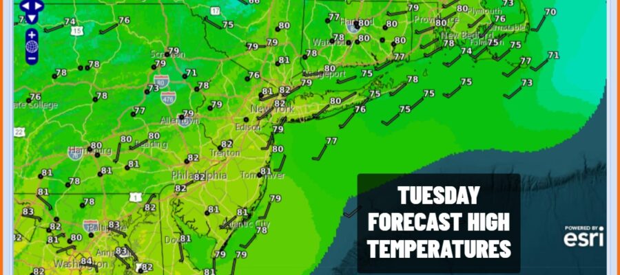
We continue to see rotation around an upper low in Eastern Canada. This upper low has funneled down a lot of dry air at the surface from New England to Georgia. Dew points are in the 50s and should remain so today across Eastern Pennsylvania to Southern New England. The cold air aloft makes for an unstable atmosphere and that could result in some scattered pop up showers or the odd thunderstorm but I think if that happens it should be mostly north of Interstate 84 in New York and New England. Otherwise it is no worse than a mix of sun and clouds today with most highs in the upper 70s and lower 80s. Most lows by Wednesday morning will be in the mid 50s to lower 60s from cooler inlands spots to warmer coast and urban areas.
SATELLITE WITH LIGHTNING STRIKES

WEATHER RADAR

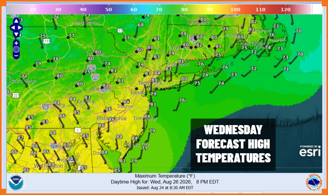
The upper trough pulling out tonight means that the atmosphere Wednesday will be more stable so we should see no showers popping up. Dew points will remain on the low side so it should be rather comfortable. Wednesday will see mainly sunny skies though some high clouds could come into the mix at some points. High temperatures Wednesday afternoon will reach the lower 80s in most places.
 Humidity levels will begin to rise late Wednesday and overnight into Thursday as we have another one of these warm front cold front combinations to deal with. Showery rains and thunderstorms will develop as the day wears on. The Storm Prediction Center as well as the Weather Prediction Center are indicating that we have a marginal risk for severe thunderstorms as well as a marginal risk for localized flash flooding.
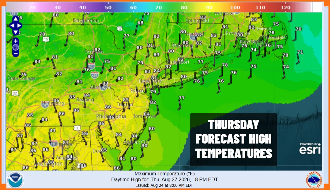
Thursday high temperatures will reach into the 80s before any rain arrives and then likely settle back into the 70s The front is forecast to pass Thursday night and lie far enough east and south to bring an end to any rain during the early morning hours Friday. However the front will close by and that could set off some more showers and thunderstorms later Friday afternoon and evening. Once that plays through, we can expect improving weather conditions and right now it looks like we are in store for a dry weekend.
MANY THANKS TO TROPICAL TIDBITS FOR THE USE OF MAPS
Please note that with regards to any severe weather, tropical storms, or hurricanes, should a storm be threatening, please consult your local National Weather Service office or your local government officials about what action you should be taking to protect life and property.
