Long Range Eastern Trough Means No Heatwaves

Long Range Eastern Trough Means No Heatwaves
This has been a very interesting summer so far. We have seen a few odd things like the beautiful dry air mass of last weekend where dew points were down in the 40s! We saw a rather uneven heatwave just prior to that the brought highs well into the 90s in some places but not in others. Thunderstorm activity has been rather minimal over the last month. 2 hurricanes have already come and gone and one other tropical storm; none of which had any impact here. Now we head into the warmest part of the summer (by averages) yet over the next 2 weeks or so we see an upper air pattern that suggests a limited amount of hot days over 90 degrees and cold fronts that will come through from time to time and take temperatures and humidity lower.
TELE-CONNECTIONS NEXT 2 WEEKS

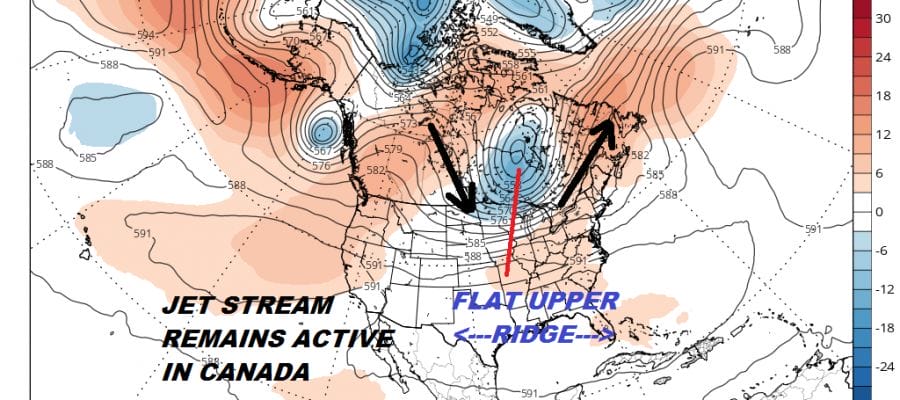
The tele-connections which we haven’t really looked at for quite some time show a very interesting combination of a slightly positive Pacific North America pattern (PNA) combined with a rather negative North Atlantic Oscillation (NAO) and a strongly negative East Pacific Oscillation (EPO). All these indices in this position point to a trough in the Eastern US and a rather persistent one at that.
EUROPEAN MODEL WEDNESDAY JUNE 18, 2018
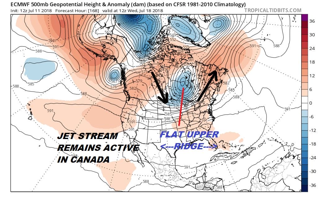
Take a look at the European for the middle of next week which swings the next trough around in South Central Canada while the ridge lies rather flat across the US from west to east. This means it can’t get too hot for too long here before a cold front comes along to cut the heat off. This pattern holds into week 2 of the long range as well.
JET STREAM FORECAST TUESDAY JULY 24, 2018
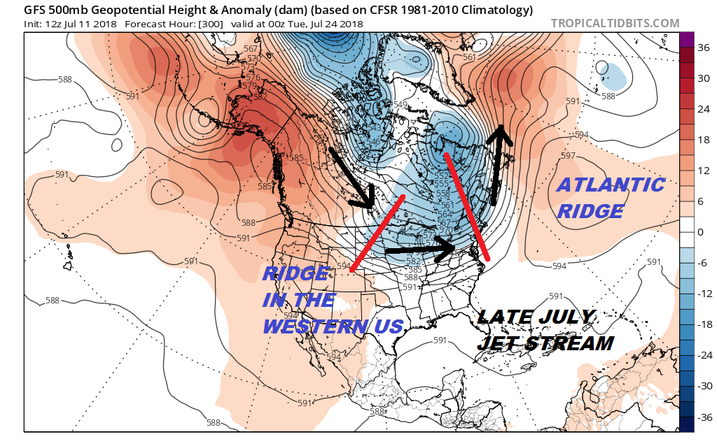
Frankly I can’t remember the last time the jet stream pattern was this active in mid summer. This upper air pattern has some implications going forward if (and its always a big if) this holds into August. Firstly you can expect some rather cool air masses to come into the Eastern US in the long long term. The other issue is with trough wanting to be in the Eastern US, it does seem to suggest that hurricane activity would respond to this by being more active off the Atlantic coast verses the Gulf of Mexico & the Caribbean. Of course you can have a trough in the East for weeks and nothing happens for a whole host of reasons. Yet the eastern trough would be a concern should a tropical storm or a hurricane pop up somewhere in the tropics or subtropics. Either way it does seem that at least from the standpoint of prolonged heat, that prospect will be severely limited under a long range eastern trough.
SHOP THE JOESTRADAMUS STORE
MANY THANKS TO TROPICAL TIDBITS FOR THE WONDERFUL USE OF THE MAPS

GET JOE A CIGAR IF YOU LIKE!
FiOS1 News Weather Forecast For Long Island
FiOS1 News Weather Forecast For New Jersey
FiOS1 News Weather Forecast For Hudson Valley
NATIONAL WEATHER SERVICE SNOW FORECASTS
LATEST JOESTRADAMUS ON THE LONG RANGE