
Improving Saturday Delightful Sunny Sunday Mothers Day Rain Back Tuesday
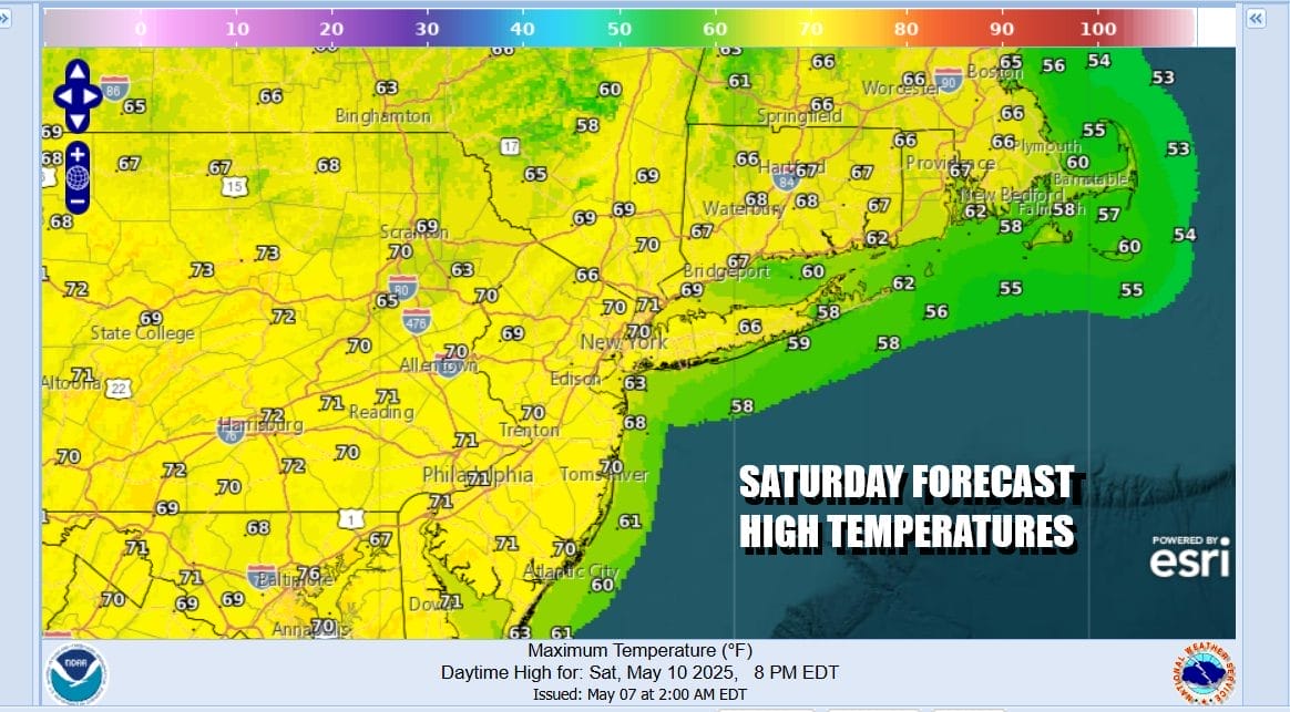
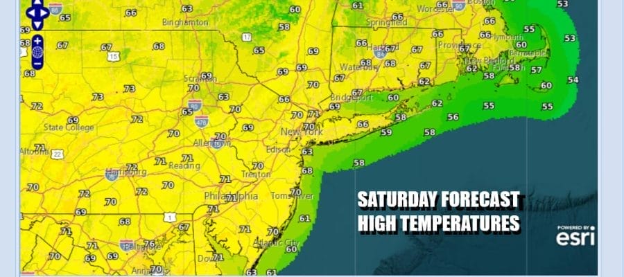
The weekend begins with improving weather conditions. Yesterday’s storm system is moving away faster and that means improving weather conditions have come in faster. Skies are going partly to mostly sunny from west to east and it will be a nice Saturday overall. Radars are nice and quiet with all the rain well to the north and east and no risks going forward. High temperatures should reach into the lower 70s in most places. Skies will be nice and clear tonight with most lows in the 50s except for 40s well inland.
SATELLITE WITH LIGHTNING STRIKES

WEATHER RADAR

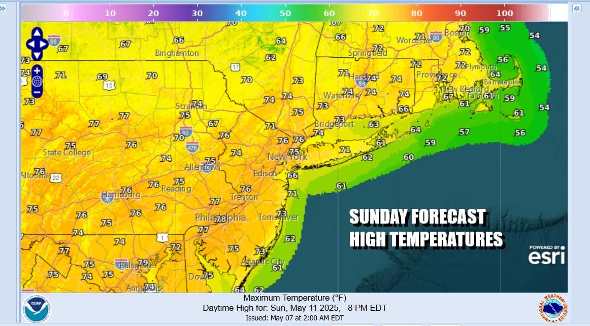
Sunday which of course is Mother’s Day will be a beautiful day from start to finish which contrasts with some of the very miserable weather days we have seen on and off over the last several years. This one features nice high pressure over New York State, mostly light breezes, and temperatures that will top out in the 70s except perhaps along the coast where local sea breezes will develop.
Moving into the new work week it seems that we will be holding on to nice dry weather for one additional day before things go downhill somewhat. This weekend we are seeing low pressure coming out of the Gulf (of whatever you want to call it) and spreading rain across all of the Gulf States from Mississippi to Georgia and then north into South and North Carolina.

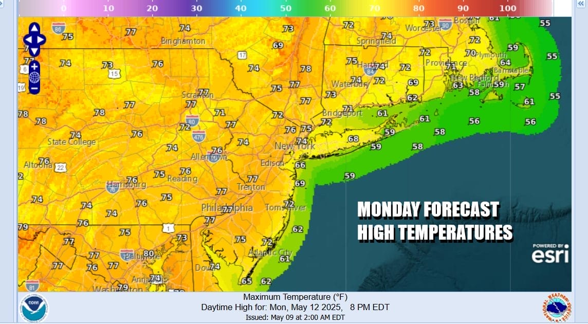
At least through the weekend, this system is pinned to the south thanks to a northwest flow in the upper atmosphere but that will eventually give way to that southern moisture. The question at this stage is how far north it gets before it hits a wall and slides out to the east. We certainly do not see this as an issue Monday which will be sunny for most of the day. Highs will be in the mid to upper 70s.
Clouds will increase Monday night and Tuesday we will likely see overcast skies with some rain. The best chances for rain look to be to the south of NYC across Central and South Jersey and Southeastern Pennsylvania southward. This system hangs close by so the risk for some rain likely lasts at least into Wednesday before it gets pushed away to the east. There is a higher degree of uncertainty here regarding this weather system and there could be some forecast adjustments coming over the next few days. For now lets call it cloudy and rainy for Tuesday with highs in the mid 60s to near 70 and the same could hold for Wednesday.
BE SURE TO DOWNLOAD THE FREE METEOROLOGIST JOE CIOFFI WEATHER APP &
ANGRY BEN’S FREE WEATHER APP “THE ANGRY WEATHERMAN!
MANY THANKS TO TROPICAL TIDBITS FOR THE USE OF MAPS
Please note that with regards to any severe weather, tropical storms, or hurricanes, should a storm be threatening, please consult your local National Weather Service office or your local government officials about what action you should be taking to protect life and property.


