

USE THE COUPON CODE “SPRING2026” AND GET 10 PERCENT OFF ON ANY PURCHASE

Friday Through Sunday Mostly Dry Windy Cool Saturday
With Storm To The East
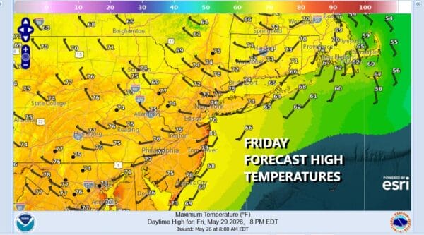
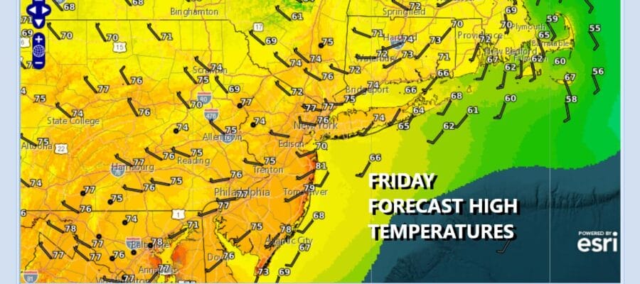
It is a bit of an unusual weather pattern that we have at the moment that will impact the weather through the weekend and into next week. Two storms in the North Atlantic, one southeast of Greenland. The other between Nova Scotia & Newfoundland have the traffic in the atmosphere bottled up. A third system is becoming evident on satellite loops dropping quickly southeastward from Hudson Bay in Eastern Canada and heading for New England tonight into Saturday. it leaves us today with no worse than partly sunny skies across Eastern Pennsylvania to Southern New England with highs mostly in the low to mid 70s.
SATELLITE WITH LIGHTNING STRIKES

WEATHER RADAR

A surface low will track into Vermont and New Hampshire and head southeast to Rhode Island tonight and Saturday morning. A trailing cold front passes through tonight with barely a shower for Eastern Pennsylvania to Southern New England while a cold rain is forecast for areas in Northern and Eastern New England. Winds will shift to the north and become strong and gusty late tonight especially along the coast.
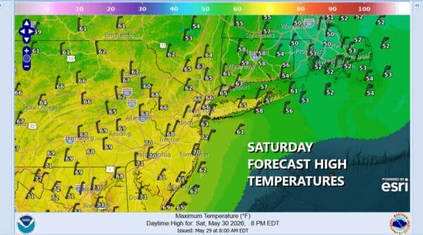
Note the wide spread in temperatures for Saturday ranging from the upper 60s for highs in Eastern Pennsylvania to low and middle 60s for New York City, Northern New Jersey, and the Hudson Valley, and only in the 50s across Connecticut. It will barely break 50 degrees with clouds and rain in Southeast New England. Most of our region I believe will be no worse than partly sunny though there likely will be more clouds in eastern areas verses western areas. Gusty northerly winds especially along the coast could reach 30 to 35 mph which is rather unusual for this time of year.
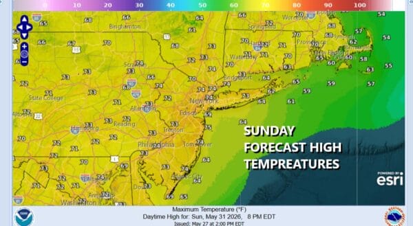
Of the two weekend days, Sunday is likely to be the better of the two mainly because there will be less wind. We will start off the morning with temperatures in the cool 40s inland and lower 50s coast and warmer urban areas. We will see sunshine but highs will be back into the low and middle 70s just about everywhere. Dry weather with seasonal temperatures continue into the first half of next week with the next chance for any showers coming late Sunday night into Early Monday as another upper trough drops southeast from Canada and yet another Tuesday night or Wednesday. Have a great weekend.
