Fios1 News Weather Broadcast For Tuesday Night
We have had rain for much of the day and now as we move through the overnight, there is still some rain to get through. The rain will total between 1/2 inch and an inch before it is all said and done. None of the rain has been especially heavy and it has been spread out so there have been no flooding issues to speak of.
The coastal low responsible for this will begin to move east and offshore later tonight. It has also captured Tropical Storm Kate. Eventually the two systems will merge into 1 and become a rather formidable Atlantic Ocean storm as it moves rapidly northeast. The storm is inside the warm sector of the coastal low. Northeast winds have picked up and temperatures have dropped into the upper 40s and lower 50s and they will probably settle in the mid 40s to near 50 overnight. The entire overnight will have that damp raw feeling especially with the gusty northeast wind.
Look for slow improvement on Wednesday as dry air comes in and brings with it some sunshine especially in the afternoon. There could still be some rain leftover along the coast around daybreak but it should pull out quickly. A mix of sun and clouds should be the rule during Wednesday afternoon and Wednesday night should be at least partially clear with lows in the mid 30s to mid 40s.
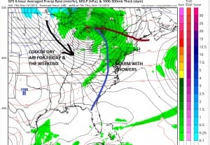
Thursday we have a cold front that will be approaching and moving through with a few showers. Friday through Tuesday of next week look good with dry days and some sunshine. It will be cool over the weekend temperatures in the low to mid 50s for highs and nights in the 30s to near 40 which is right around normal for this time of year.
MARINE FORECAST: GALE WARNINGS IN EFFECT
JOESTRADAMUS ON THE LONG RANGE
JOESTRADAMUS WINTER 2015-2016 FORECAST


