Columbus Day Holiday Weekend Starts Nice Finishes Wet
WEATHER IN 5 SATURDAY DAY OCTOBER 10, 2020
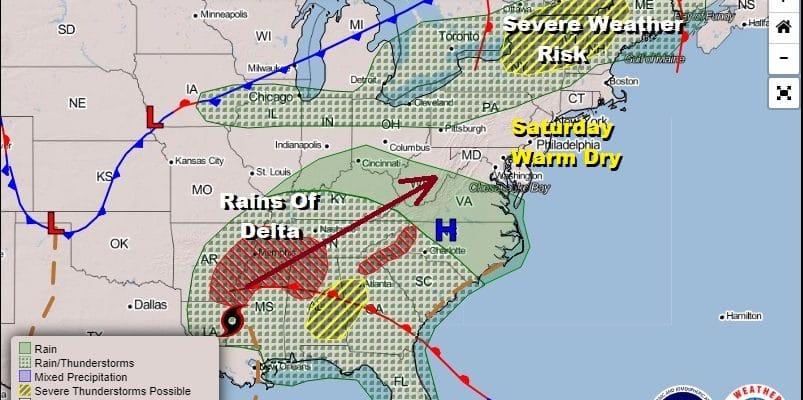
Finally the holiday weekend is here and we are going to start it off on a warm note. There are some high clouds to the south which parts of the area will get into from time to time. We also have a cold front dropping southward from upstate NY that runs the risk of triggering off another severe weather event in Upstate NY and Northern New England like we saw earlier this week. In fact the Storm Prediction Center has a large area of “slight” risk for severe weather for Upstate New York & Northwestern New England.

Meanwhile in downstate NY southward into Eastern Pennsylvania to Southern New England which includes New Jersey, the Lower Hudson Valley & Long Island, we are going to have a warm Saturday with some sunshine along with some clouds in the mix. Highs today will reach the middle to upper 70s in most places.
SATELLITE

REGIONAL RADAR

Tropical moisture has been surging into the Southeast and has pushed into Virginia. This is moisture that has come in from the Gulf of Mexico as part of the sweep ahead of what was Hurricane Delta. It is now weakening and will soon become a remnant low but those rains will eventually get here. First things first is a cold front dropping southward and moving through tonight with little fanfare. Any upstate NY thunderstorms that develop will fall apart long before the front gets to the coast. Look for clouds around tonight with lows in the mid 50s to lower 60s.
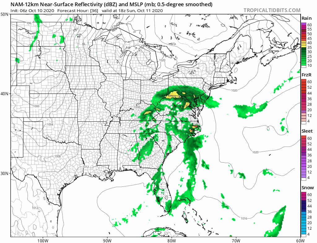
Judging from how things are moving today with the remnants of Delta, it seems things are happening a bit faster. Rain will develop across Southern Pennsylvania and Southern New Jersey by midday and reach NYC and points north and east late Sunday afternoon and evening. Temperatures will eventually settle in the 60s everywhere. Then as the NAM model shows, it rains all night and most of Monday with some heavy downpours in the mix. A couple of inches of rain seems like a rather good bet here.
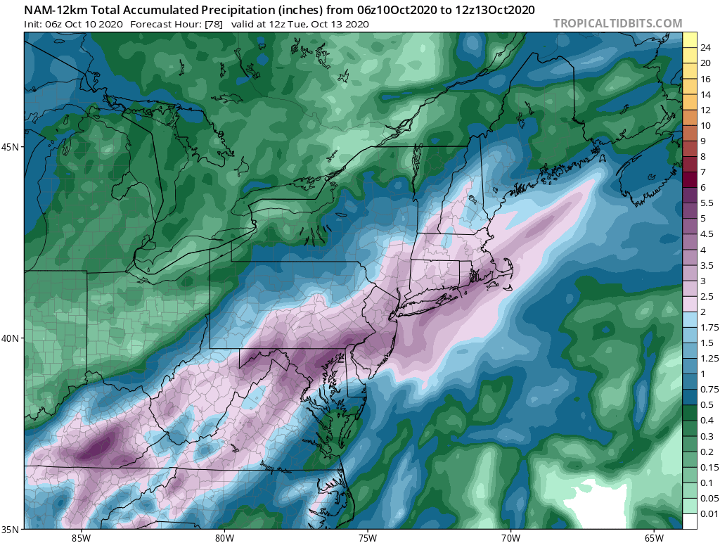
NAM model rainfall amounts are rather aggressive showing 2 to 3 inches or more of rain in some places and given the tropical moisture that is involved here plus a bit of an onshore flow off the Atlantic ocean to add some moisture, those rainfall amounts are certainly doable. Temperatures on Monday will struggle in the low to mid 60s and areas north and east of NYC might not get out of the 50s with the ocean wind. The Weather Prediction folks are indicating a marginal risk for flash flooding in much of Eastern Pennsylvania to Southern New England for Monday. Weather conditions should improve for Tuesday. Event though another cold front will be approaching, it could turn out that most of the showers with it will go to our north and we will see leftover clouds and perhaps some sun on Tuesday.
BE SURE TO DOWNLOAD THE FREE METEOROLOGIST JOE CIOFFI WEATHER APP &
ANGRY BEN’S FREE WEATHER APP “THE ANGRY WEATHERMAN!
MANY THANKS TO TROPICAL TIDBITS FOR THE USE OF MAPS
Please note that with regards to any severe weather, tropical storms, or hurricanes, should a storm be threatening, please consult your local National Weather Service office or your local government officials about what action you should be taking to protect life and property.