
Colder Weather Into Midweek Gusty Winds Moderation Late Week

Colder Weather Into Midweek Gusty Winds Moderation Late Week

It is a quiet start to the new week and we do not have any important weather systems to deal with. No rain or snow is in the forecast through at least Friday and probably into the start of the weekend. This week is all about temperature change. We will begin and end of the week with temperatures close to average and spend the middle part, Tuesday through Thursday with colder than average temperatures. Look for sunshine today with just some passing clouds. A cold front moves through late today with little fanfare. Highs this afternoon will be in the upper 30s and lower 40s.
SATELLITE WITH LIGHTNING STRIKES

WEATHER RADAR

Colder air will be coming into tonight on northwest winds and most lows will be in the 20s under a clear sky. Tuesday brings sunshine, a gusty wind and colder temperatures. We have an upper trough that will pass through creating lake effect snows in Western and North Central New York. Other than maybe a stray snow shower or two inland, we expect no precipitation.
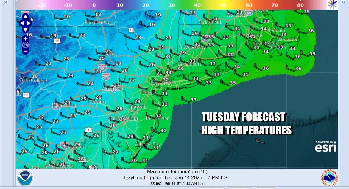
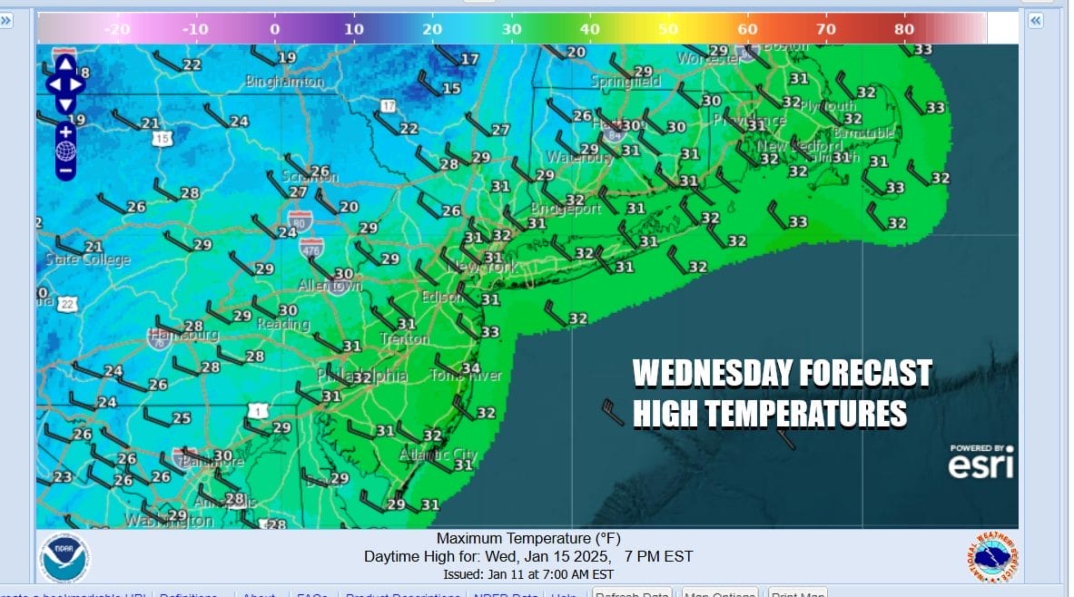
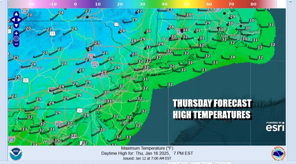
Tuesday highs will be in the upper 20s and lower 30s. Tuesday night into Wednesday morning lows will be in the teens and low 20s. Wednesday will be partly to mostly sunny and cold with highs in the upper 20s and lower 30s. Thursday will be the same, partly to mostly sunny with highs in the upper 20s and lower 30s. Nights will be in the teens to lower 20s.
Friday we will see temperatures warm up a bit as the cold air mass moves offshore. Temperatures will reach the upper 30s and lower 40s Friday with sunhine. Over the weekend a cold front will approach with maybe some rain showers Saturday night into Sunday morning. The more important part of this is whether a wave develops on the front as colder air returns behind the front later Sunday and Monday. That could mean a rain or rain changing to snow set up for Sunday night into Monday but there is uncertainty as to how this all plays out.
BE SURE TO DOWNLOAD THE FREE METEOROLOGIST JOE CIOFFI WEATHER APP &
ANGRY BEN’S FREE WEATHER APP “THE ANGRY WEATHERMAN!
MANY THANKS TO TROPICAL TIDBITS FOR THE USE OF MAPS
Please note that with regards to any severe weather, tropical storms, or hurricanes, should a storm be threatening, please consult your local National Weather Service office or your local government officials about what action you should be taking to protect life and property.


