
Cold Front Passing Offshore Cold Air Monday & Tuesday Moderating Wednesday & Thursday
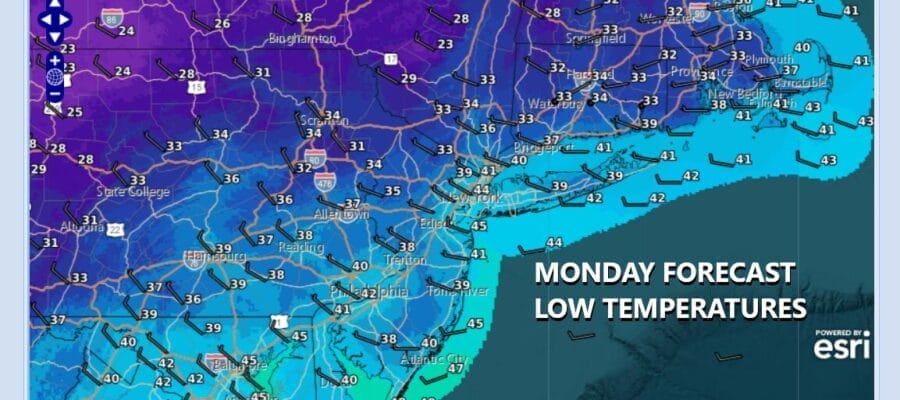
A cold front is passing offshore and any showers with this front will be exiting to the east this afternoon. This is going to be followed by a cold air mass that will bring widespread frosts and freezes across much of Eastern Pennsylvania to Southern New England. The highest risk for this will come Monday night and Tuesday morning when that cold high is overhead. In the meantime temperatures today will be in the 50s at best all day. We should see decreasing clouds later this afternoon and skies should clear tonight. By Monday morning, lows will be in the 30s to around 40 degrees. Some of the coldest inland spots will be in the upper 20s to around 30. All of this will come with a gusty northwest wind.
SATELLITE WITH LIGHTNING STRIKES

WEATHER RADAR

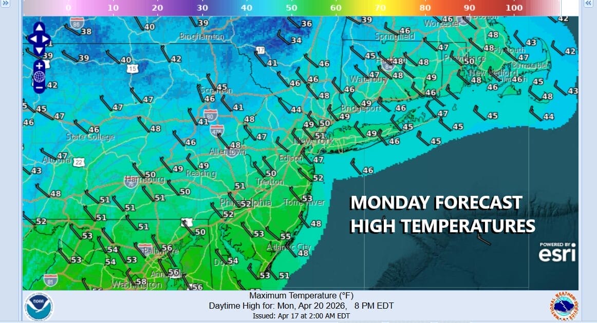
Not only do we have cold air at the surface but we will have cold unstable air aloft Monday. This means that any sunshine likely “self destructs” as instability clouds develop. A few pop up scattered showers would not be a surprise though any rain won’t amount to much. Monday high temperatures will be in the upper 40s to lower 50s at best.
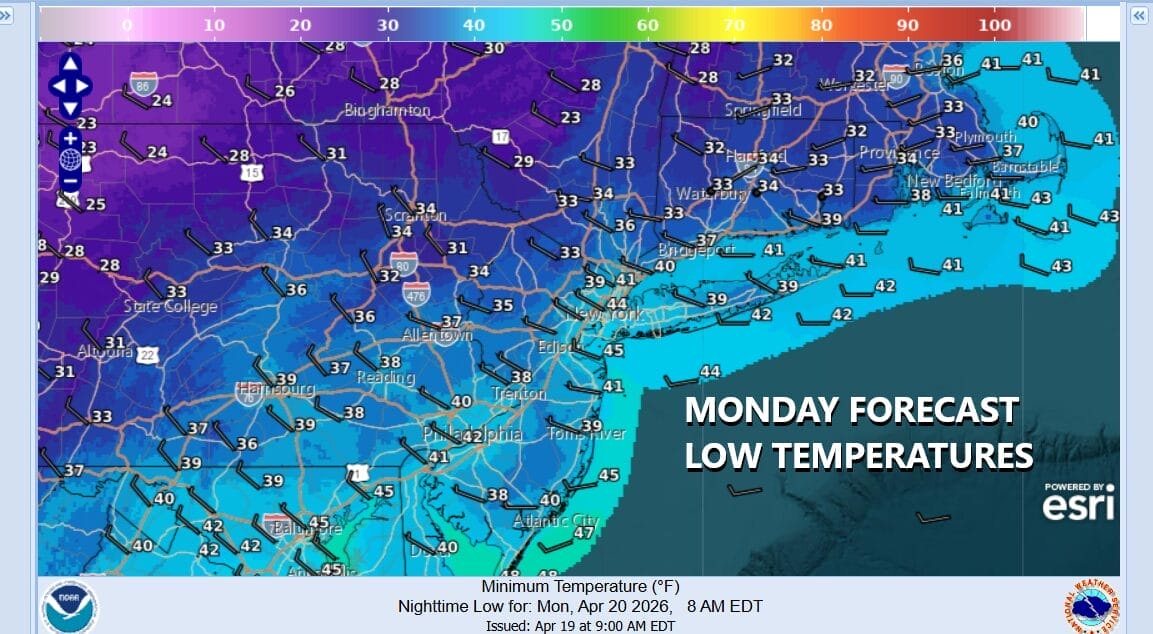
The core of the cold air mass will move overhead Monday night into Tuesday morning. This sets up a night of clear skies and diminishing winds. Areas of frost and freezes are likely across much of Eastern Pennsylvania to Southern New England. Tuesday morning lows will be in the mid to upper 20s in many inland areas and upper 20s and lower 30s along the coast and in warmer urban locations.

Tuesday we will see temperatures back in the low to mid 50s for highs with more in the way of sunshine. Tuesday night into Wednesday morning thanks to clouds and a south wind, we probably bottom out in the upper 30s to mid 40s. Wednesday look for clouds and some sun along with some scattered showers as an upper air disturbance moves through. Most highs will be back into the 60s. We will warm a bit more Thursday and Friday before a weather front brings some showers at some point next weekend. We do not see a return to 80s and 90s anytime soon.
BE SURE TO DOWNLOAD THE FREE METEOROLOGIST JOE CIOFFI WEATHER APP &
ANGRY BEN’S FREE WEATHER APP “THE ANGRY WEATHERMAN!
MANY THANKS TO TROPICAL TIDBITS FOR THE USE OF MAPS
Please note that with regards to any severe weather, tropical storms, or hurricanes, should a storm be threatening, please consult your local National Weather Service office or your local government officials about what action you should be taking to protect life and property.


