

Chilly Next 2 Days Thursday Warm Rain & Thunderstorms Severe Weather Risk
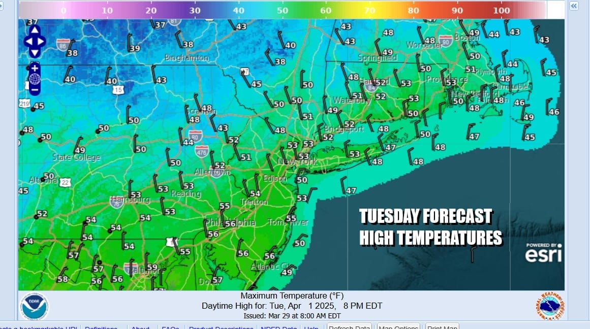
Last night’s thunderstorms are long gone and we are left with a chilly drier air mass. Temperatures are going to be much cooler today for most of the area. Coastal locations yesterday didn’t get out of the 50s so for those areas the temperature change is smaller. Inland temperature changes from yesterday are on the order of 25 degrees cooler. We will see a fair amount of sunshine with some passing clouds. Most highs today will be in the low to middle 50s. Radars are nice and quiet. Most lows tonight will be in the upper 20s to mid 30s under mainly clear skies.
SATELLITE WITH LIGHTNING STRIKES

WEATHER RADAR

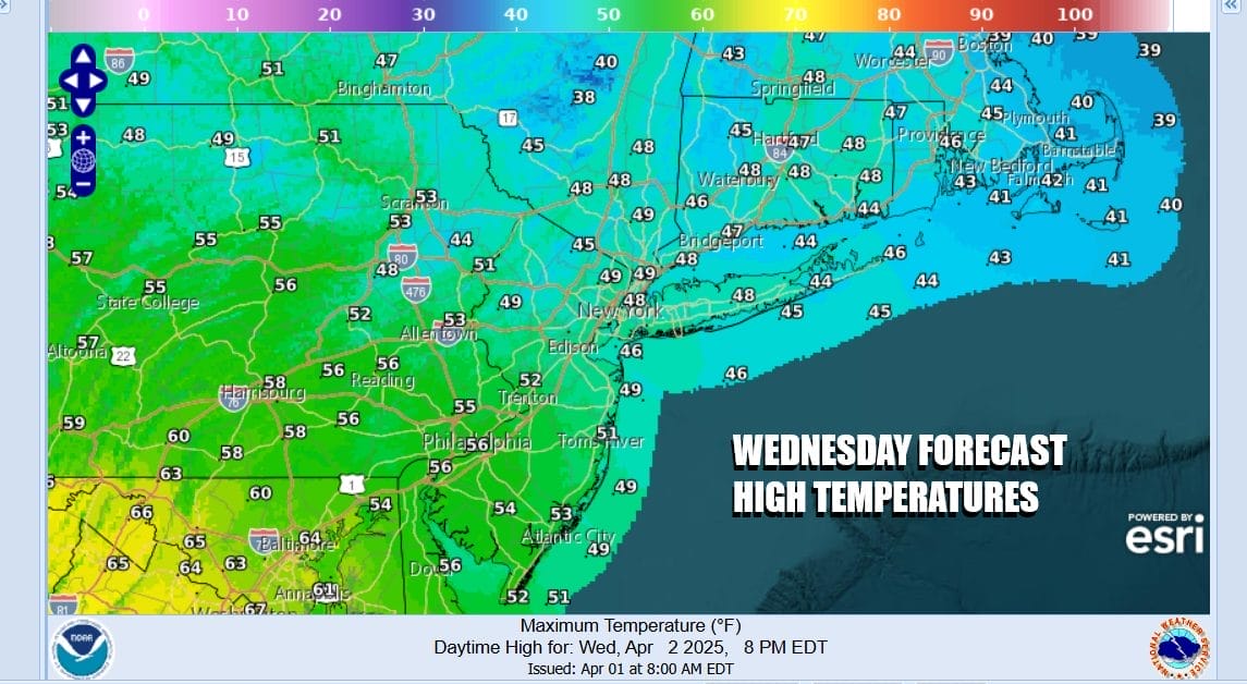
High pressure in Eastern Canada and New England is feeding colder air southward. This is going to leave us with a chilly Wednesday. Sunshine should be abundant but temperatures are going to struggle as most highs will just be in the upper 40s to lower 50s from north to south. No rain is forecast for Wednesday.
While our weather remains relatively calm, a new storm system is forming today in the Central Plains. This will bring another round of severe weather today for the Central and Southern Plains as well as parts of the Middle Mississippi Valley. Wednesday the storm will be in the Northwestern Great Lakes with a trailing cold front. Another day of widespread severe weather is expected up and down the Mississippi Valley as well as the Ohio & Tennessee Valleys.

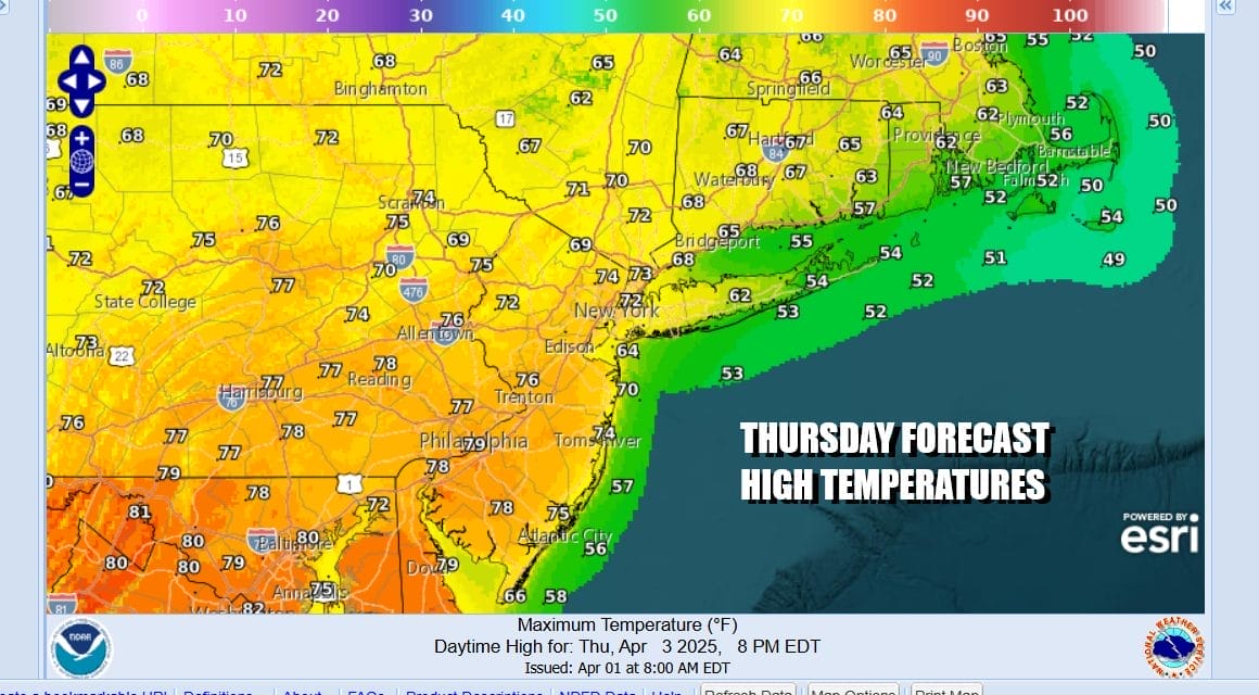
As the low moves into Eastern Canada there will be a northeast southwest cold front that will approach. Ahead of this Thursday we will warm up significantly and with enough sunshine we will see another round of high temperatures in the mid to upper 70s in most locations. Areas along the coast will be a little cooler.
The front moves southward Thursday night and we will likely see some shower and thunderstorm activity. The risk time could begin as early as Thursday evening but the bulk of this will likely be Thursday night into Friday morning. The Storm Prediction Center is indicating a marginal risk for isolated severe thunderstorms when the front passes late Thursday night or early Friday morning.

We should dry out somewhat Friday and temperatures will ease back into the 50s for highs. Some sunshine should return but we are setting up for another warm front cold front combination for the weekend. This could mean a gloom & doom type day for Saturday with clouds, showers and temperatures in the 50s. Sunday will be the warmer day with another ride higher in temperatures and the risk for showers and thunderstorms late in the day.
BE SURE TO DOWNLOAD THE FREE METEOROLOGIST JOE CIOFFI WEATHER APP &
ANGRY BEN’S FREE WEATHER APP “THE ANGRY WEATHERMAN!
MANY THANKS TO TROPICAL TIDBITS FOR THE USE OF MAPS
Please note that with regards to any severe weather, tropical storms, or hurricanes, should a storm be threatening, please consult your local National Weather Service office or your local government officials about what action you should be taking to protect life and property.


