
Burst of Snow to Rain Tuesday A Dry Christmas
& Snow Ice & Rain Likely Late Week
It is Christmas week and we have two weather systems ahead of us but for Christmas Eve and Christmas Day there will be no weather related travel issues as both days will be dry. Today is going to be a sunny cold day with high temperatures mostly in the upper 30s and lower 40s. Satellite views show mostly cloud free skies and it should be mostly sunny until perhaps later this afternoon when some high clouds with next weather system begins to approach from the west. Radars locally are nice and quiet.
SATELLITE WITH LIGHTNING STRIKES

WEATHER RADAR

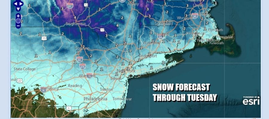
The first weather system tonight approaches as low pressure moves across Southern Canada and a warm front extends southward from the low. An area of snow will form ahead of the warm front and we will see some snow arrive between 4 and 7am Tuesday. Warm fronts can be tricky sometimes as they can surprise on occasion with a burst of heavier accumulating snow. We will watch for that possibility.

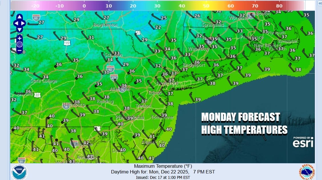
The cold air mass overhead will be heading east so there will not be much cold air around for Tuesday. We expect the see snow change to rain in New York City and along the coast but inland it could last a little longer. The amount of moisture is limited so we think in general a coating to an inch or 2 is possible with the highest chances for a few inches inland north and northwest of the coast.
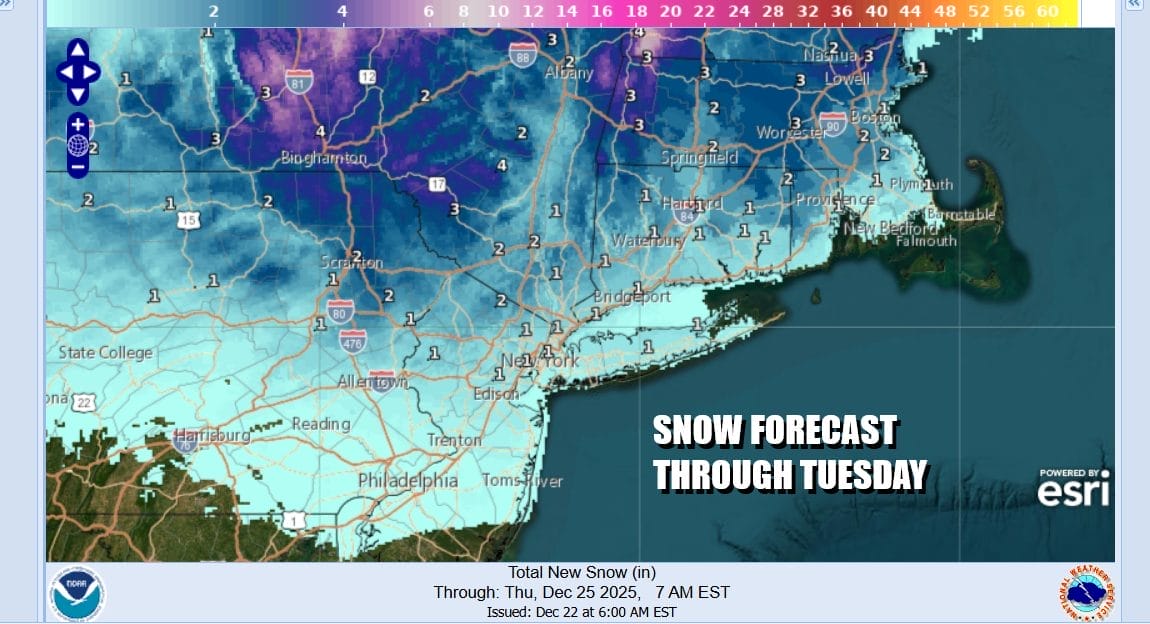
Temperatures will be close to freezing at the onset but by the end of day and once the snow ends, temperatures will move higher to the upper 30s and lower 40s so whatever does stick will likely melt on roads rather quickly. Temperatures overnight will likely hold in the low to mid 30s so unless skies completely clear, we do not expect much of a refreeze.
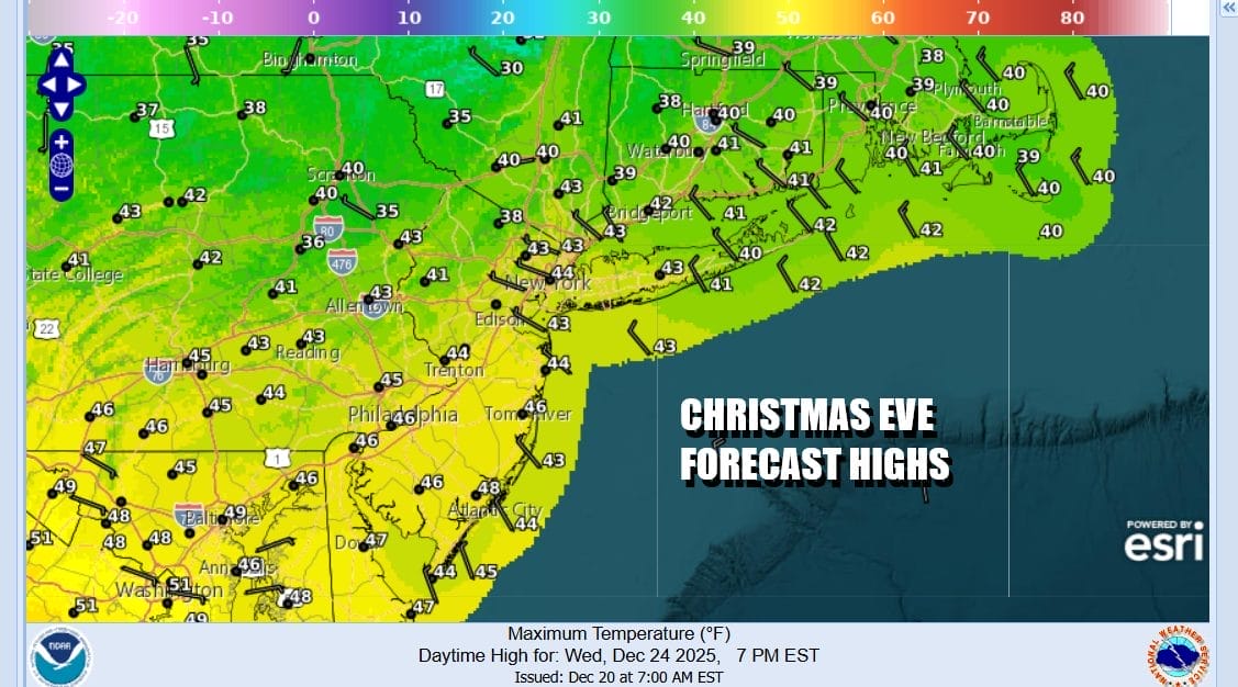
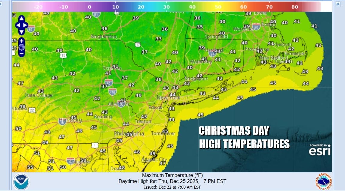
Wednesday Christmas Eve will be a nice weather day overall with no issues to speak of. Skies should be no worse than partly sunny with temperatures topping in the lower 40s in most places. It will not be overly cold at night with lows generally in the upper 20s and lower 30s. No rain or snow is forecast for Wednesday or Christmas Day. Another cold front passes through Thursday with little in the way moisture so it will be no worse than partly sunny with highs in the lower 40s.
High pressure will build into Eastern Canada Friday and we do have blocking in the North Atlantic that will be holding this high in place while an other Pacific system makes its way east across the Ohio Valley. This will force low pressure to head to our south with a more developed area of precipitation to the north of the low track. We expect to see it cloud up quickly Friday and some snow could develop later Friday afternoon and perhaps last into the first part of Saturday.
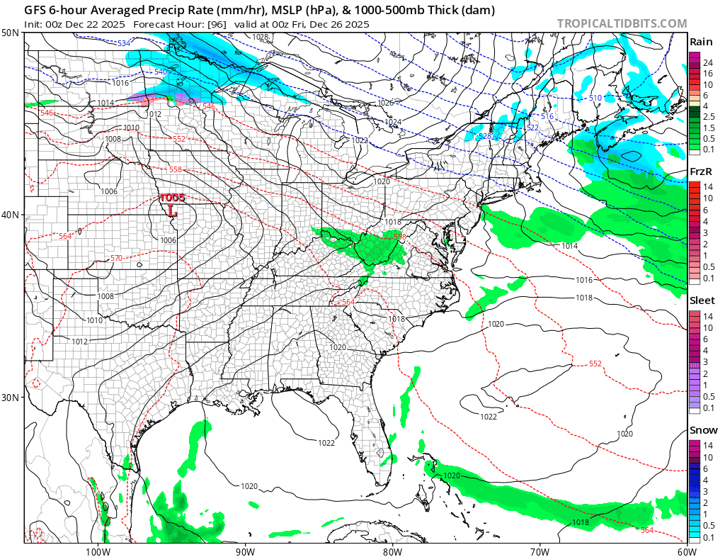
Obviously it is too early to speculate on what all this means as we need to see if the block is strong enough to hold cold air in as the surface low tracks off the Middle Atlantic coast. A stronger block would make things colder and possibly drier as the system takes a more southern track, and of course further north means more of snow to rain situation. We will be monitoring this system and its possibilities closely in the coming days.
BE SURE TO DOWNLOAD THE FREE METEOROLOGIST JOE CIOFFI WEATHER APP &
ANGRY BEN’S FREE WEATHER APP “THE ANGRY WEATHERMAN!
MANY THANKS TO TROPICAL TIDBITS FOR THE USE OF MAPS
Please note that with regards to any severe weather, tropical storms, or hurricanes, should a storm be threatening, please consult your local National Weather Service office or your local government officials about what action you should be taking to protect life and property.


