

USE THE COUPON CODE “summer2026” AND GET 10 PERCENT OFF ON ANY PURCHASE

Another Day of Blue Skies Sunshine & Low Humidity Temps Warm
But No Rain Through Saturday
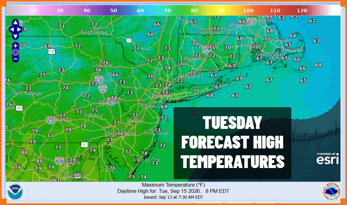
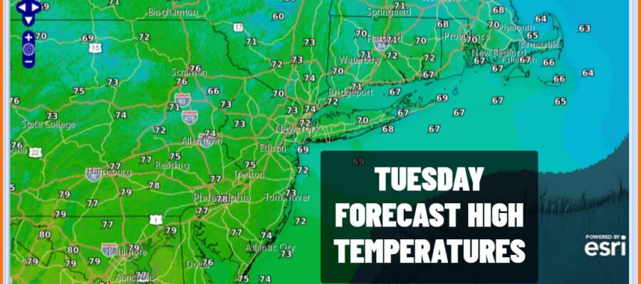
We hit bottom with the coolest temperatures we have seen since back last spring. Most lows were in the 40s away from the coast and warmer urban areas. Those areas bottomed in the low to mid 50s. We are being covered with a dome of high pressure which is sitting overhead today. Satellite loops show mainly clear skies and radars are nice and quiet. Skies will be mostly sunny today. High temperatures this afternoon will be in the low to mid 70s with very low humidity. Tonight will not be as cool and Wednesday morning lows will be mostly in the low to mid 50s with some 40s in a few inland cold spots. Overnight we will see nothing more than a few passing clouds.
SATELLITE WITH LIGHTNING STRIKES

WEATHER RADAR

We have two cold fronts in our future. The first one approaches Wednesday but it gets into Upstate New York and falls apart before it reaches the coast. All the showers with that front will fall apart as well. A second front will approach Thursday evening but this front also will fall apart before it gets here. We remain rain free across Eastern Pennsylvania to Southern New England for the rest of the week and into the start of the weekend.
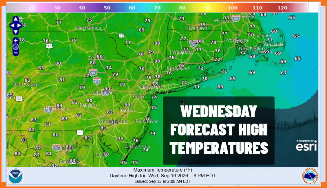
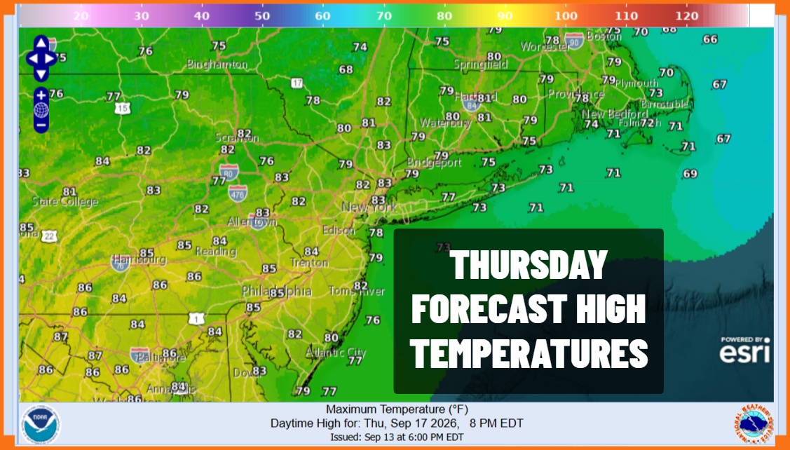
Wednesday brings no worse than partly sunny skies. The dry high will be offshore so temperatures will be heading higher and the humidity levels are going to go up as well though not to anything we can’t handle. High temperatures Wednesday will reach the upper 70s to around 80. Thursday as the second cold front approaches it will be warm and warm humid with again no worse than partly sunny skies. Thursday highs will reach the low and middle 80s.
Another dry high will build in Friday and Saturday so expect slightly lower temperatures Friday with some sunshine and highs in the lower 80s for the most part. An onshore flow will develop so Saturday will be even cooler with highs in the 70s. Look for sunshine and some arriving clouds ahead of another weather system. This system will likely bring some rain Saturday night into at least part of Sunday. Next week brings a more active and wetter pattern to the Northeast and Mid Atlantic states.
MANY THANKS TO TROPICAL TIDBITS FOR THE USE OF MAPS
Please note that with regards to any severe weather, tropical storms, or hurricanes, should a storm be threatening, please consult your local National Weather Service office or your local government officials about what action you should be taking to protect life and property.
