

USE THE COUPON CODE “summer2026” AND GET 10 PERCENT OFF ON ANY PURCHASE

A Sunny Finish to the Labor Day Weekend Low Humidity & Sunshine
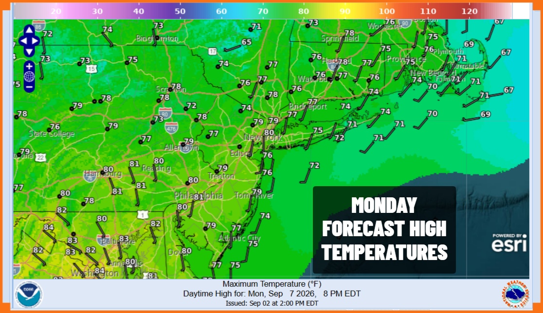
We are wrapping up the Labor Day holiday weekend with a beautiful finish. Satellite loops show mostly cloud free conditions. Radars are nice and quiet. Dew points are in the 50s in most places. Finally we have reasonable temperatures. Highs today will be in the mid to upper 70s. We will have lots of sunshine all day long. Skies tonight will be mostly clear with light winds. Most inland lows will be in the 50s while along the coast and warmer urban areas will bottom in the lower 60s.
SATELLITE WITH LIGHTNING STRIKES

WEATHER RADAR

Tuesday will bring another day of sunshine with relatively low humidity. High pressure will be hanging on and slowly sliding to the east. We have no issues regarding showers. High temperatures will reach into the lower 80s. Dew points will hold in the 50s all day making for another winner of a day.
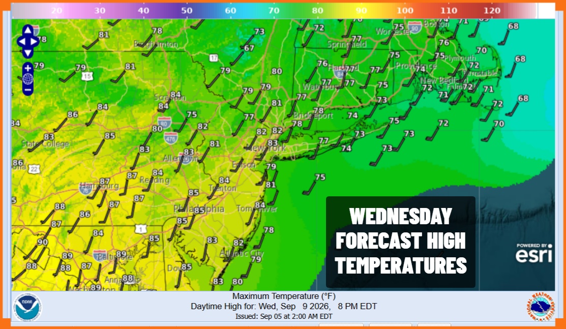
Wednesday brings more of southwest wind so both temperatures and humidity will be rising however dew points Wednesday will be in the lower 60s which is not terrible. Skies should be no worse than partly sunny. After a cool start in the 50s to lower 60s, highs Wednesday will reach the lower to some middle 80s. Thursday brings the arrival of the next cold front so dew points will push above 70, highs will be in the middle 80s and there will be the risk for showers and thunderstorms. The front is forecast to move along so we should see improving weather conditions. Sunshine returns Friday with lower humidity and most highs in the 70s.
MANY THANKS TO TROPICAL TIDBITS FOR THE USE OF MAPS
Please note that with regards to any severe weather, tropical storms, or hurricanes, should a storm be threatening, please consult your local National Weather Service office or your local government officials about what action you should be taking to protect life and property.
