
A Cold Breezy Saint Patrick’s Day
Mostly Dry Mid March Cold Next Few Days
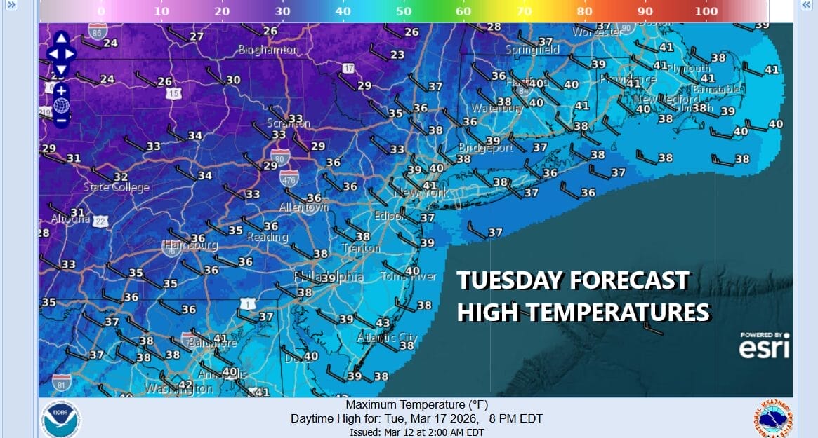
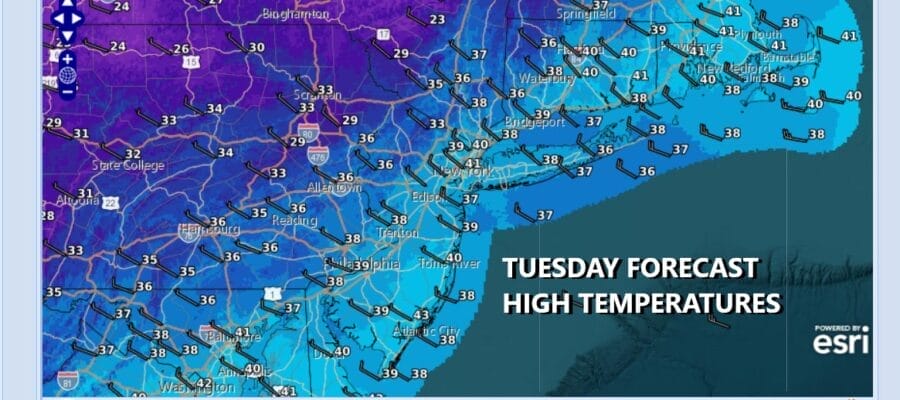
Last night’s storm system and cold front have moved along and in its wake we have a very cold air mass moving in. Saint Patrick’s Day is going to be a day of sunshine and clouds. There will be a gusty wind and it is going to be cold with temperatures basically hovering in the upper 30s and lower 40s. Winds will make it feel at least 10 degrees colder thanks to the tight pressure gradient behind the cold front. We will throw in the chance there could be the odd isolated snow shower or two as the lagging upper trough passes. Otherwise it should be an okay day though if you are out at parades today, bundle up.
SATELLITE WITH LIGHTNING STRIKES

WEATHER RADAR

Tonight skies will be partly mostly clear and it will be very cold with most lows in the upper teens to mid 20s. The core of the cold air mass will be overhead Wednesday which will leave us with plenty of sunshine. Winds will ease as we go through the day and high temperatures again will be in the upper 30s and lower 40s.

Not much is on the horizon for the remainder of the week but temperatures will be trending higher with some sunshine for both Thursday and Friday. Thursday highs will be in the 40s to near 50 and Friday highs will reach into the 50s. Thursday night into Friday morning a weak disturbance will go by with perhaps the risk for a passing shower or two. The same holds for the upcoming weekend where a weak weather system will bring some shower risks over the weekend but long dry periods in between with temperatures around where they should be for this time of year. No major storms lie ahead.
BE SURE TO DOWNLOAD THE FREE METEOROLOGIST JOE CIOFFI WEATHER APP &
ANGRY BEN’S FREE WEATHER APP “THE ANGRY WEATHERMAN!
MANY THANKS TO TROPICAL TIDBITS FOR THE USE OF MAPS
Please note that with regards to any severe weather, tropical storms, or hurricanes, should a storm be threatening, please consult your local National Weather Service office or your local government officials about what action you should be taking to protect life and property.


