

USE THE COUPON CODE “summer2026” AND GET 10 PERCENT OFF ON ANY PURCHASE

Cooler With Onshore Winds Today Showers Tonight & Late Friday Cold October Weekend
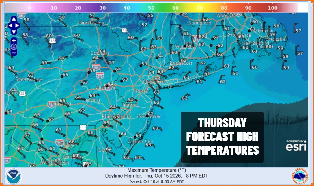
A cold front is passing through this evening and as the satellite loop shows us, we just have some clouds rolling through. Showers on the radar are well to the north this evening and not an issue. Skies should at least partially clear out tonight with Thursday morning lows in the 50s. Thursday is going to be a much cooler day with an ocean wind and good deal of sunshine. High pressure to our north will be in control but it will be a short lived dry air mass as the next warm front cold front combination will be approaching. Highs Thursday will be primarily in the low to middle 60s across Eastern Pennsylvania to Southern New England.
SATELLITE WITH LIGHTNING STRIKES

WEATHER RADAR

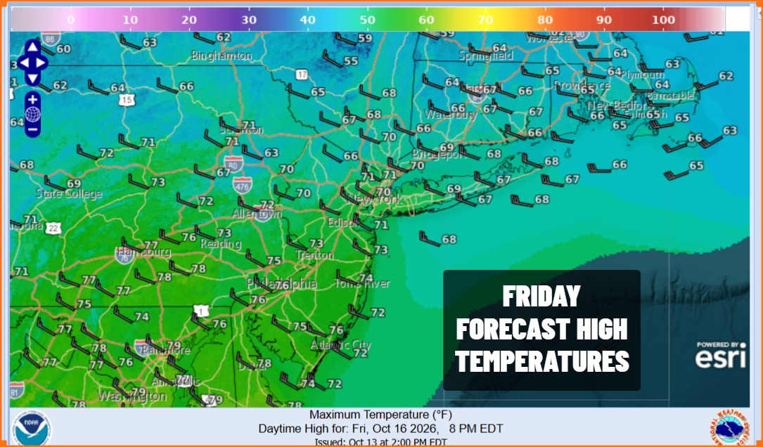
The warm front arrives Friday morning and ahead of it Thursday night we will see clouds and some showers around during the hours surrounding daybreak. Then a short break in the rain followed by some more showers late Friday and perhaps a rumble or two of thunder. We are not expecting to see much rain out of this. Most areas will see a quarter of an inch or less. Highs Friday will be in the 70s until the front passes.
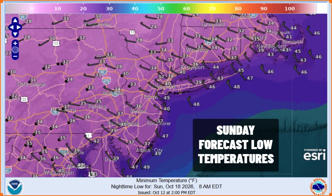
Now we move on to the weekend. The front is offshore. The front may linger along the coast for awhile leaving us with leftover clouds in the morning but clouds should decrease Saturday afternoon. Northwest winds will pick up bringing down colder air and temperatures Saturday will be in the 50s. Then we head down to the 30s in many locations by Sunday morning under clear skies. Warmer urban centers and the coast will be closer to 40 but some inland areas could see their first freezes of the season.
Sunday will be a chilly day with some sunshine. Highs will be just in the 50s. Models differ beyond Sunday in that a stalled front along the coast creates a developing low off the Southeast US coast Sunday night into Monday. Even if this happens we expect this system to stay offshore, leaving us with some sunshine Monday and highs back into the 60s.
MANY THANKS TO TROPICAL TIDBITS FOR THE USE OF MAPS
Please note that with regards to any severe weather, tropical storms, or hurricanes, should a storm be threatening, please consult your local National Weather Service office or your local government officials about what action you should be taking to protect life and property.
