
USE THE COUPON CODE “SPRING2025” AND GET 10 PERCENT OFF ON ANY PURCHASE

Below Average Temps Into Next Week
Coastal Low Could Graze The Coast Late Saturday
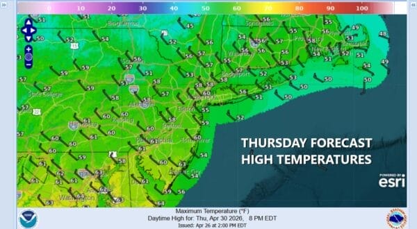
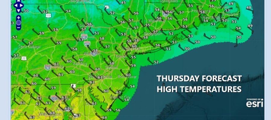
A cold front has passed offshore and has taken the rain from overnight out to the east. We are now going to be under the influence of a cold northwest flow in the upper atmosphere and that pattern is going to hold as we go into the first couple of weeks of May. Leftover clouds today and the risk there could be another scattered shower or two, will give way to breaks of sunshine. Temperatures today will be mostly in the upper 50s and lower 60s along with a bit of a gusty northwest wind. Skies should at least partially clear tonight with most lows in the upper 30s to mid 40s.
SATELLITE WITH LIGHTNING STRIKES

WEATHER RADAR

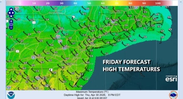
Moving on to Friday we have an upper trough that will be moving through creating an unstable cold upper atmosphere. While we may start off with sunshine Friday morning, expect some developing clouds and there is the risk that there could be some scattered showers around in the afternoon and evening though it is not a guarantee for everyone. Temperatures Friday will top out mostly in the 50s.
Let’s move on to the weekend where we have a minor complication. Low pressure will develop across the Deep South on the old cold front that will stall out later today across the Gulf States. This low is going to turn northeastward off the Southeast US coast. From there it seems that the track will be close enough to the coast to bring in cloud cover Saturday. There is also a fair chance that the coast could be grazed with a bit of rain from Coastal New Jersey to Long Island and South Coastal New England.

Of the two weekend days Sunday to me looks better than Saturday. Saturday temperatures will be in the low to mid 50s for highs, and if it rains, temperatures will likely drop into the 40s. There is also a chance that the low passes further east keeping rain offshore. Either way we are looking at some sunshine returning for Sunday through it will be on the chilly side again. High temperatures will be just in the 50s. You can expect the new weather pattern to continue next week with chances for rain midweek with a strong cold front.
DOWNLOAD THE UPSIDE APP & EARN CASH AT GAS STATIONS, RESTAURANTS, & SUPERMARKETS

BE SURE TO DOWNLOAD THE FREE METEOROLOGIST JOE CIOFFI WEATHER APP &
ANGRY BEN’S FREE WEATHER APP “THE ANGRY WEATHERMAN!
MANY THANKS TO TROPICAL TIDBITS FOR THE USE OF MAPS
Please note that with regards to any severe weather, tropical storms, or hurricanes, should a storm be threatening, please consult your local National Weather Service office or your local government officials about what action you should be taking to protect life and property.


