
90 Degree Highs Possible Inland Through Thursday Cold Front Arrives Sunday

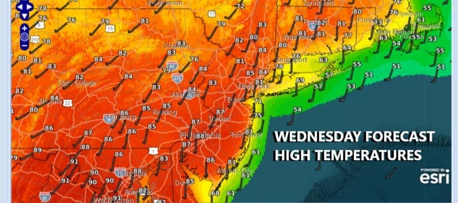
After a very warm, and in some cases hot Tuesday we are set to do it all over again today. We are starting out the day with temperatures in the upper 50s to mid 60s which is a solid launching pad. There is nothing really to stop temperatures from reaching the lower 90s inland with sunshine. This time of year temperature guidance is always too low so it is usually a good idea to up your numbers by at least a few degrees and that is what we did for today. We should see some sunshine today but there is the risk for a shower or thunderstorm popping up. The Storm Prediction Center has a marginal risk for isolated severe thunderstorms.
SATELLITE WITH LIGHTNING STRIKES

WEATHER RADAR

We have been dealing with ripples in the atmosphere moving across the Great Lakes and into the Northeast. Another one comes later today and there is the risk that there could be an isolated severe thunderstorm or two popping up but I also think that most of you may not see much of anything when it comes to rain.
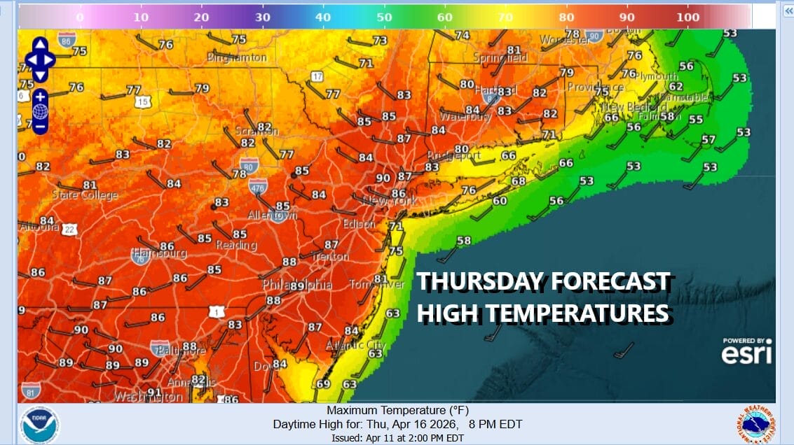
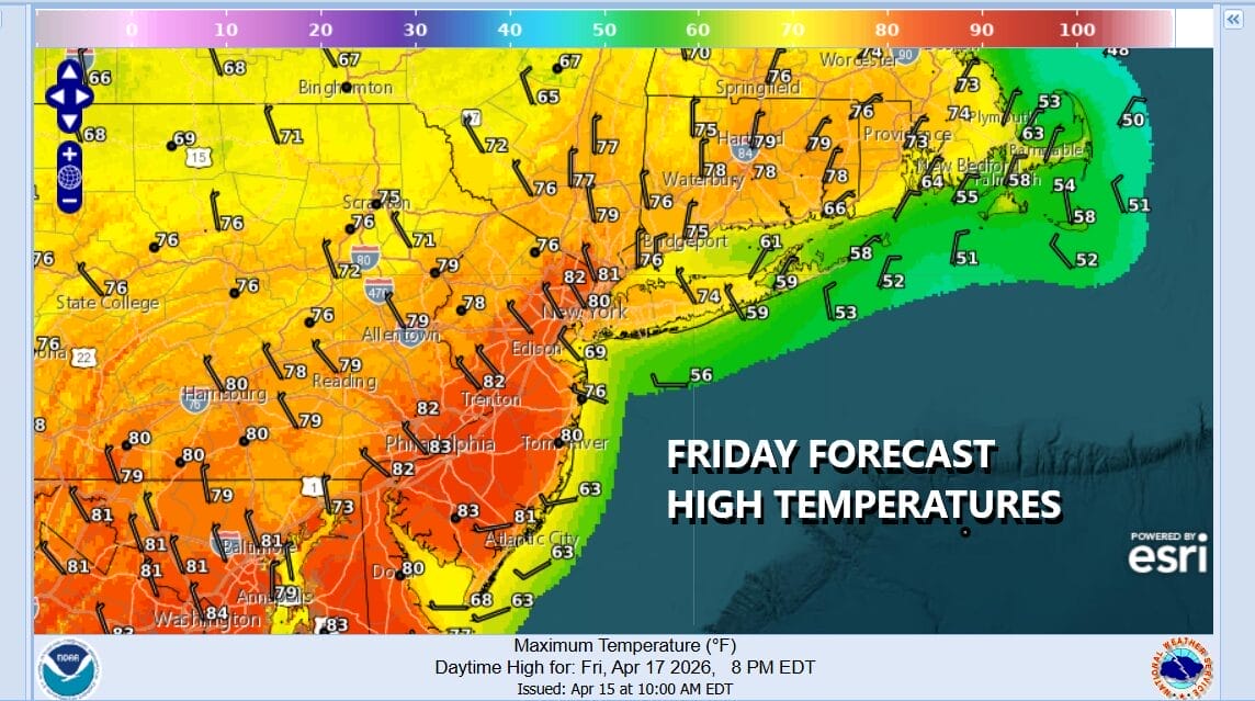
Thursday looks to be another very warm to hot day with highs reaching the upper 80s to some lower 90s with sunshine. We will leave in the chance for an isolated shower or thunderstorm but the chances Thursday are on the low side. Friday temperatures will probably be lower but it will still be very warm with limited sun and the chance for a shower or thunderstorm. Inland highs will be in the low to middle 80s with cooler readings along the coast.
Over the weekend we will see a cold front move through Sunday so ahead of this Saturday we will see clouds and some sunshine along with an ocean wind and that will mean lower temperatures overall. Inland highs will be in the 70s to near 80 while areas closer to the coast will be in the mid 60s to lower 70s. Sunday will bring the risk for showers and thunderstorms as a sharp cold front moves through. Highs will be mainly in the 60s. Much colder air returns for the start of next week.
BE SURE TO DOWNLOAD THE FREE METEOROLOGIST JOE CIOFFI WEATHER APP &
ANGRY BEN’S FREE WEATHER APP “THE ANGRY WEATHERMAN!
MANY THANKS TO TROPICAL TIDBITS FOR THE USE OF MAPS
Please note that with regards to any severe weather, tropical storms, or hurricanes, should a storm be threatening, please consult your local National Weather Service office or your local government officials about what action you should be taking to protect life and property.


