

Warm Humid Wednesday Chance For Severe Storms Thursday
Beautiful Independence Day
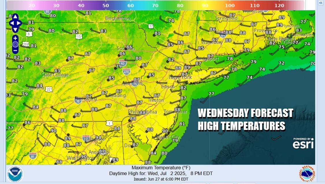
We are starting off the day with leftover clouds and some rain along the coast but as we move through this morning and into this afternoon the front should start shifting eastward. Any coastal rain ends and then we have leftover clouds giving way to some sunshine. We do not expect any thunderstorms developing this afternoon. It will be humid however and temperatures will be topping out in the mid to upper 80s. Most lows tonight will be in the mid 60s to lower 70s with mainly clear skies.
SATELLITE WITH LIGHTNING STRIKES

WEATHER RADAR

Thursday we will be watching low pressure moving southeast in Eastern Canada and eventually heading for New England Friday. There is a trailing east west cold front that will push southward from upstate New York and move through the coast Thursday evening. This is a strong short wave trough that we will be dealing with and that brings in the chance of thunderstorms and the risk for severe weather.
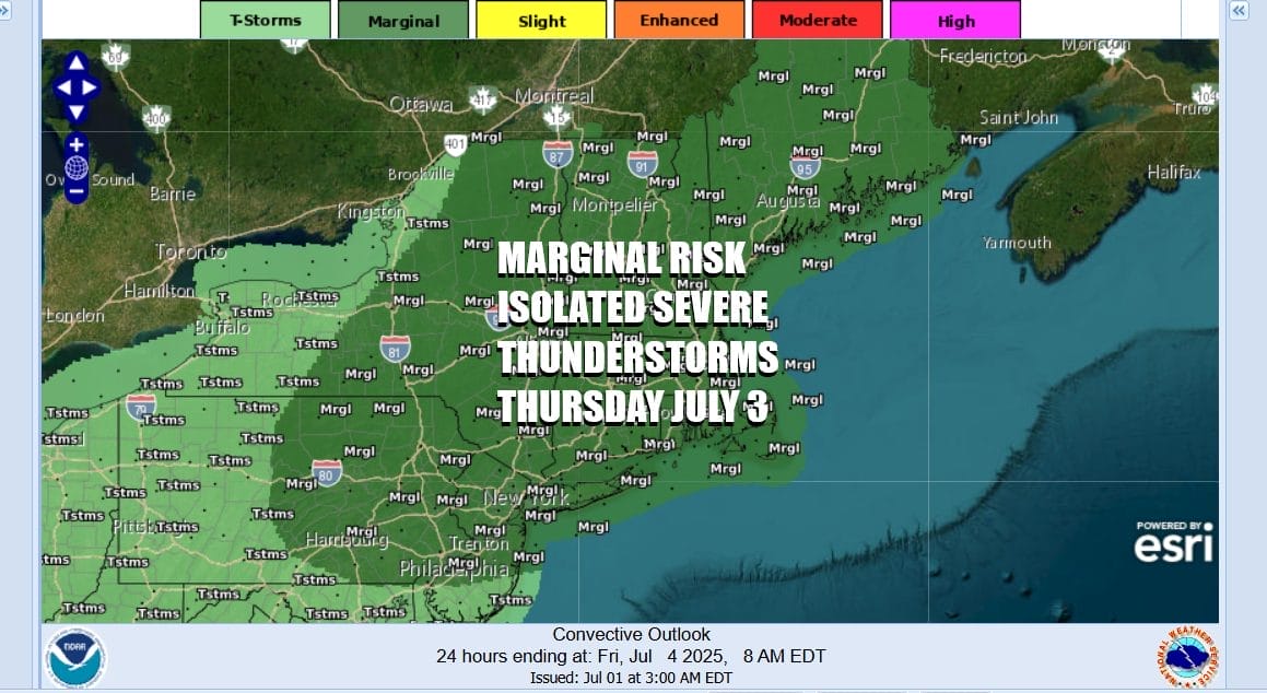
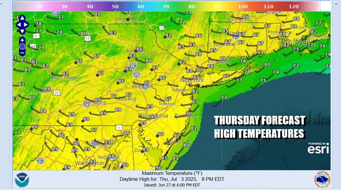
The Storm Prediction Center is indicating a marginal risk for severe weather and that means isolated severe storms are possible. These sorts of fronts and upper troughs have a habit of sometimes producing some fast moving short lived thunderstorms so it is something we want to watch carefully. It will be very warm and humid Thursday ahead of all this with high temperatures in the 80s and humidity on the high side.
This weather front will move offshore Thursday night as low pressure surface and aloft moves into the Gulf of Maine. The resulting northwest flow aloft brings down a shot of very nice dry air from Eastern Canada. This will effectively lower dew points considerably later Thursday and and Friday. It will also lower temperatures somewhat and making for a very nice low humidity sunny day for Friday Independence Day.
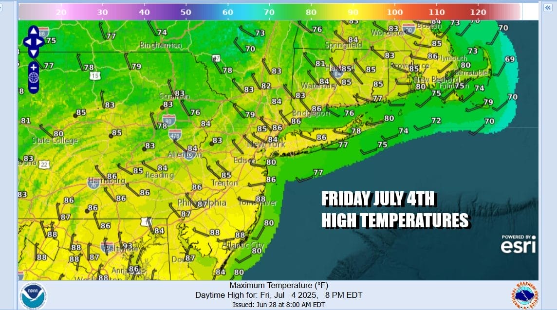
High temperatures Friday will be in the low to mid 80s. Dew points will be in the 50s and that makes for a very pleasant 4th of July. We will hold on to that dry air somewhat for Saturday which is looking to be a mostly sunny day. High temperatures will be a little higher reaching the mid to upper 80s but dew points will still be lingering in the upper 50s so that is considered manageable.

Winds will be slowly shifting to the south Saturday and continuing from that direction Sunday. That will start to bring up humidity levels so that Sunday will be more humid. We will see some sunshine Sunday with highs in the mid 80s to around 90 degrees. Temperatures will be cooler both weekend days at shore locations with local sea breezes. No showers or thunderstorms are forecast Friday through Sunday making for a very nice rain free summer holiday weekend. We could see a couple of hot days to start off next week with Tuesday being the first day we see some shower and thunderstorm risk appearing later in the day.
BE SURE TO DOWNLOAD THE FREE METEOROLOGIST JOE CIOFFI WEATHER APP &
ANGRY BEN’S FREE WEATHER APP “THE ANGRY WEATHERMAN!
MANY THANKS TO TROPICAL TIDBITS FOR THE USE OF MAPS
Please note that with regards to any severe weather, tropical storms, or hurricanes, should a storm be threatening, please consult your local National Weather Service office or your local government officials about what action you should be taking to protect life and property.


