

Winter Weather Advisories Freezing Rain
Mainly North of Interstate 84 New York & Connecticut
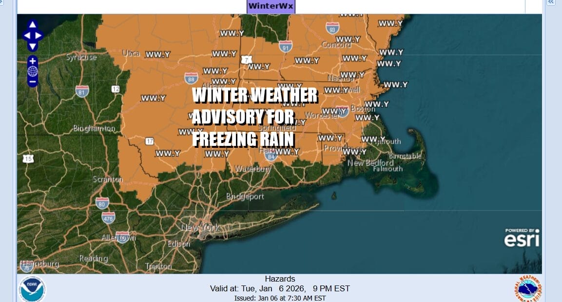
Winter Weather Advisories are posted for inland areas north of Interstate 84 from extreme Northeast Pennsylvania, across the Hudson Valley into Connecticut, Northern Rhode Island and points north into Massachusetts and Northeastern New York State. The main issue is going to be freezing rain that will develop late this afternoon and tonight. Warmer air is surging northeastward from the Ohio Valley but we will see areas of cold air trapped especially in valleys tonight and that could create some icing.
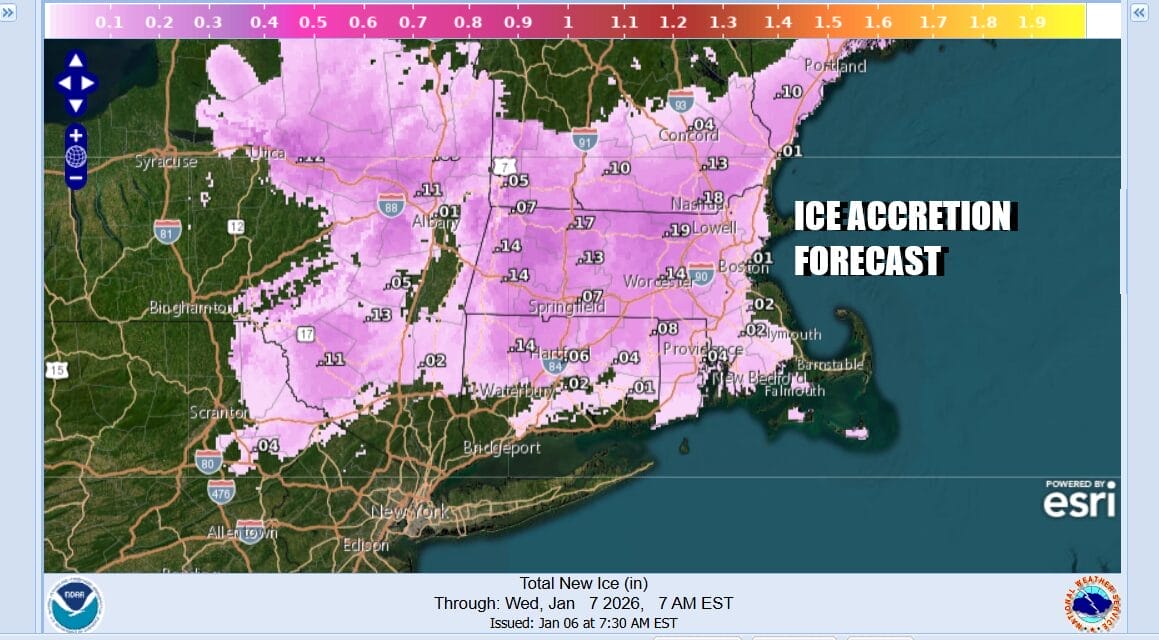
This doesn’t appear to be a big deal as the system coming east with a warm front is not particularly strong. Most areas are likely to see ice accretion of up to a tenth of an inch in some places. By Wednesday morning most of the region in the Lower Hudson Valley and Connecticut will be above freezing. Snow will be confined to areas north of Interstate 90.
SATELLITE WITH LIGHTNING STRIKES

WEATHER RADAR

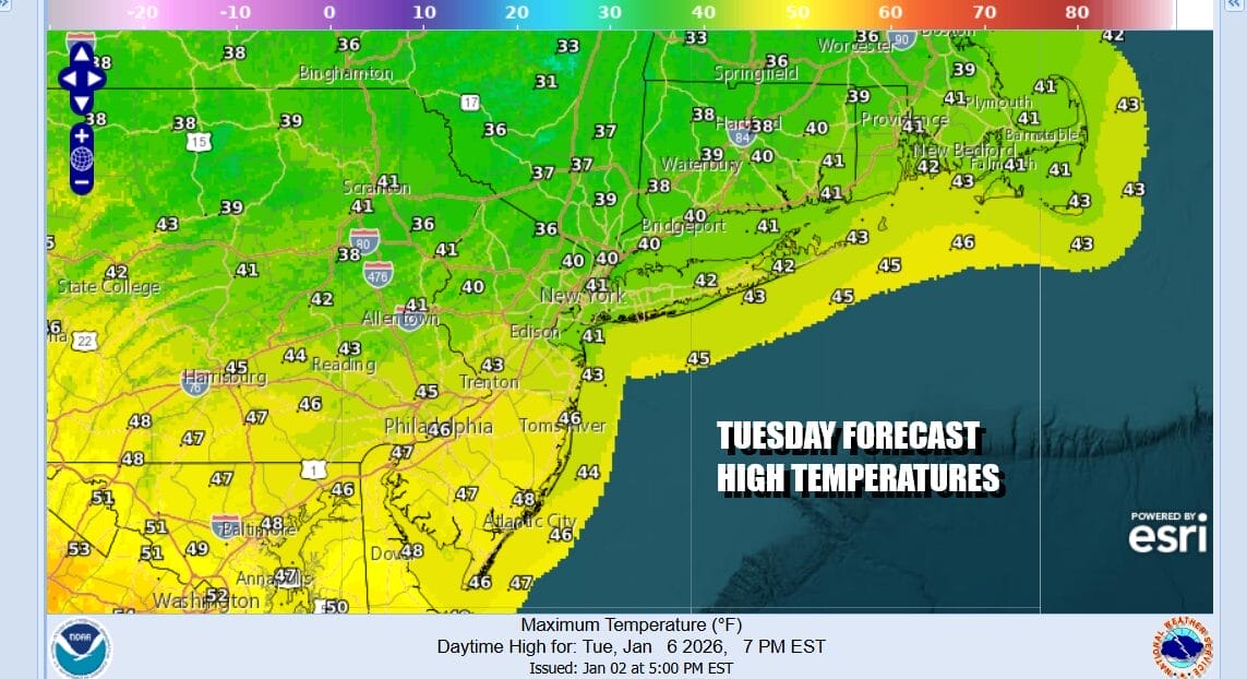
Ahead of this today we have clouds already rolling in and while we do see precipitation echoes on the radar they are all aloft and not an issue at least during the dayside. Clouds will continue to increase and thicken up. We could see a little light rain develop late this afternoon or evening. Temperatures today will generally top out in the upper 30s and lower 40s New York City and points north & mid to a few upper 40s from Philadelphia and Southern New Jersey
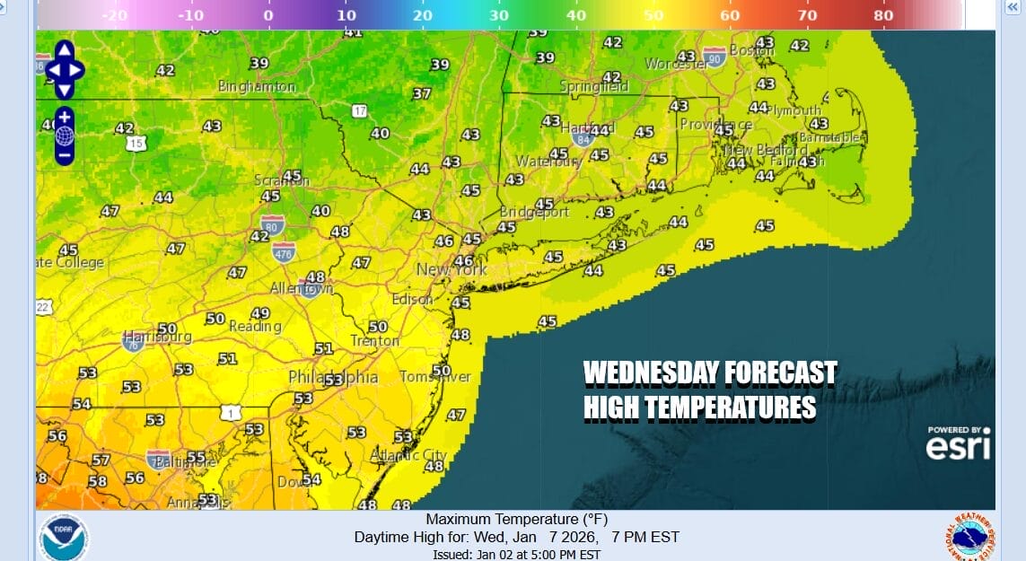
Not much in the way of rain is expected to fall tonight and it will just be cloudy overnight with nearly steady temperatures. Wednesday is going to be a warmer day, probably starting out with clouds and some leftover light rain or drizzle but some breaks of sunshine should develop later in the morning and in the afternoon. High temperatures are going to reach the mid to upper 40s inland and upper 40s to lower 50s New York City and points southward.
The January thaw takes a strong hold Thursday and Friday as both days we will see highs reach the 60s especially away from the ocean. Thursday should see a fair amount of sunshine as high pressure sits along the Virginia coast and a southwest wind takes hold. Friday brings sun and arriving clouds as a cold front approaches. Highs again could reach the 60s away from the ocean.

The cold front drops south and stalls as one wave of low pressure goes by in New England and a second wave develops in the Plains and heads to the Great Lakes. This will bring more showers Saturday before the front passes offshore Saturday night and the rain ends. Highs Saturday will be in the mid 50s to lower 60s. Once the front goes by, colder air returns Sunday and for the start of next week.
BE SURE TO DOWNLOAD THE FREE METEOROLOGIST JOE CIOFFI WEATHER APP &
ANGRY BEN’S FREE WEATHER APP “THE ANGRY WEATHERMAN!
MANY THANKS TO TROPICAL TIDBITS FOR THE USE OF MAPS
Please note that with regards to any severe weather, tropical storms, or hurricanes, should a storm be threatening, please consult your local National Weather Service office or your local government officials about what action you should be taking to protect life and property.


