
Winter Storm Warnings Hudson Valley New York City
Northern New Jersey Long Island Connecticut
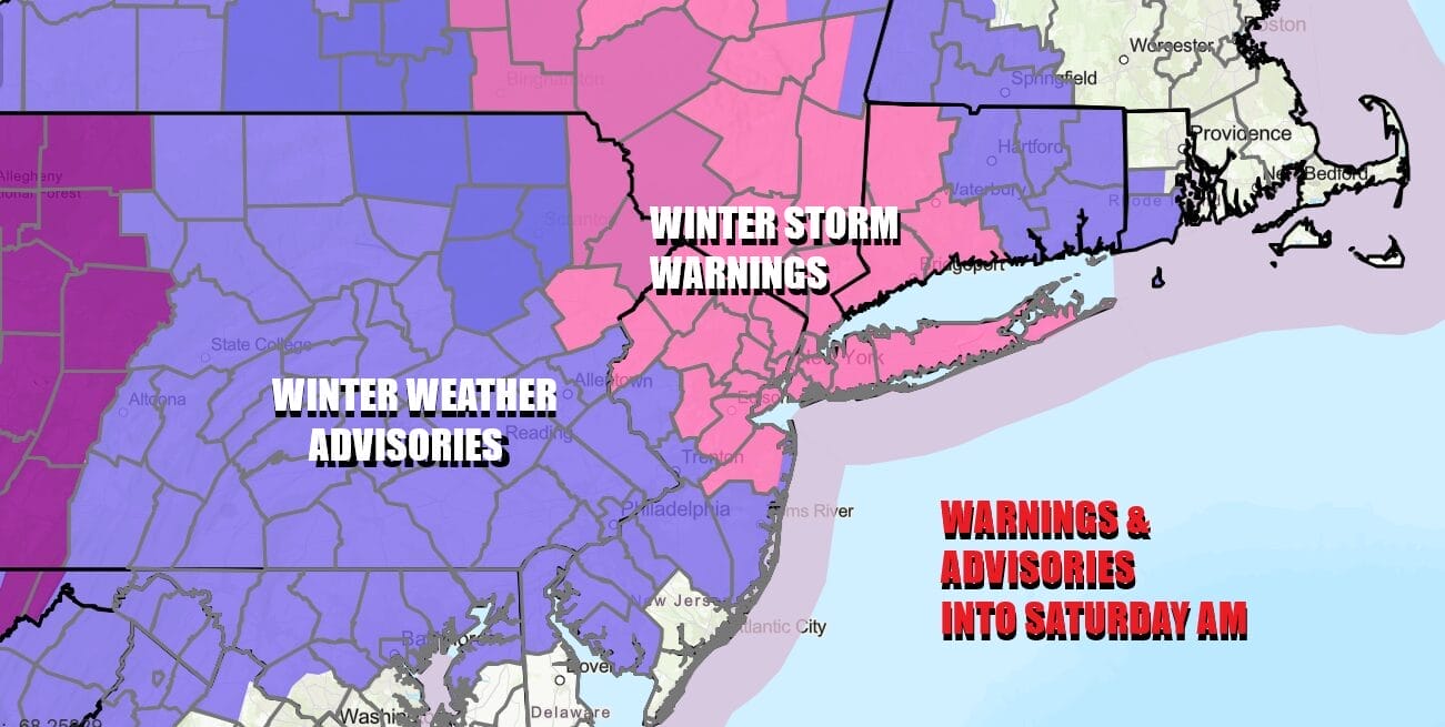
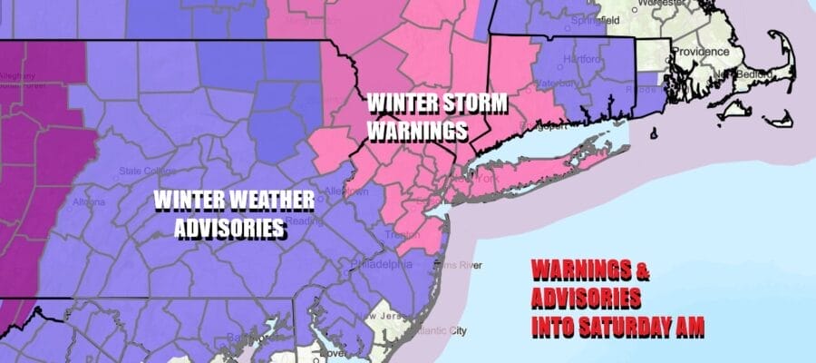
Winter Storm Warnings are posted for New York City, Long Island, the northern half of New Jersey, Northeastern Pennsylvania, the Lower Hudson Valley and Western Connecticut with Winter Weather Advisories on either side of the warning zone extending into Southeast and South Central Pennsylvania and Southern New Jersey. Low pressure is moving across the Southern Great Lakes and clouds are increasing from west to east. We also bottomed in the teens and lower 20s this morning as a cold high pressure area builds in Southeastern Canada providing ample cold air.
SATELLITE WITH LIGHTNING STRIKES

WEATHER RADAR

Radars are loading up to the northwest and we will see snow develop late this afternoon and then spread eastwawd into Southern New England and Long Island. The heaviest snow is likely to fall between 7pm and 2am in most places and then wind down from there. Across Southeast Pennsylvania to Southern New Jersey it is going to be snow at the start and a change to sleet and freezing rain in many locations.
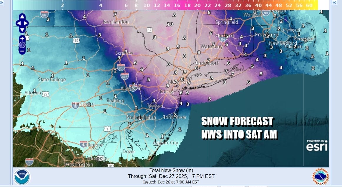
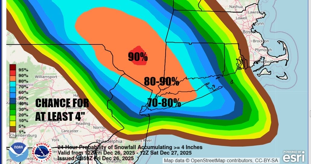
The National Weather Service is forecasting a general area of 5 to 8 inches across much of the warning zone with less amounts to the southwest and also lesser amounts to the northeast. The Weather Prediction Center is indicating a high probability of at least 4 inches across much of the warning zone and there will be probably a few jackpot zones. Orange County in the Hudson Valley, parts of Northwest New Jersey and Long Island are at risk for this.
All of this should be winding down and ending early Saturday morning by 7am or so plus or minus and hour or two. Temperatures in many areas will be in the 20s through all of this so there will be some fluff factor in snow amounts. Saturday should see leftover clouds with temperatures in the low to mid 30s. Sunday we see an approaching cold front so expect sunshine giving way to arriving clouds with highs in the upper 30s and lower 40s. Rain ahead of a warm front Sunday night might start as some ice inland for a brief time. Showers are likely Monday as a cold front passes and then it turns much colder as we head into the New Year’s celebrations.
BE SURE TO DOWNLOAD THE FREE METEOROLOGIST JOE CIOFFI WEATHER APP &
ANGRY BEN’S FREE WEATHER APP “THE ANGRY WEATHERMAN!
MANY THANKS TO TROPICAL TIDBITS FOR THE USE OF MAPS
Please note that with regards to any severe weather, tropical storms, or hurricanes, should a storm be threatening, please consult your local National Weather Service office or your local government officials about what action you should be taking to protect life and property.


