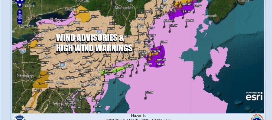

Wind Advisory Overnight Into Friday Rain Thunderstorms Into Midday Friday
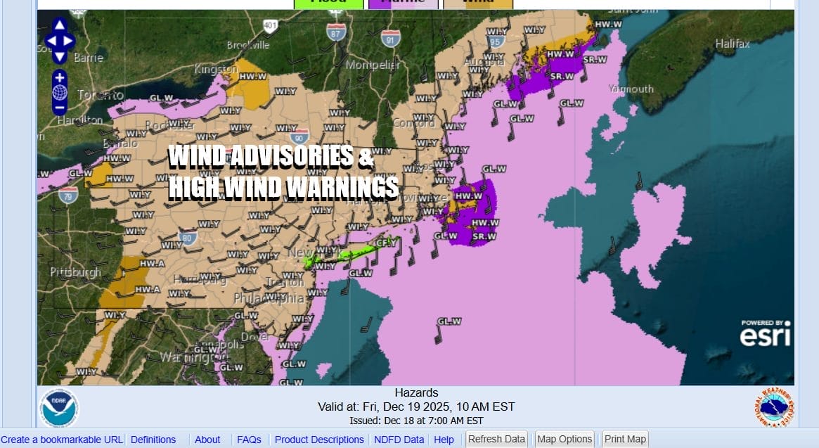
Much of Eastern Pennsylvania to Southern New England is under a wind advisory for overnight into Friday afternoon. We have a powerful storm in the Northern Plains heading eastward across the Northern Great Lakes and Southeastern Canada. The Gulf of America is wide open as moisture is surging up the East Coast. A strong upper trough is driving all this and it will lead to some rough weather issues.
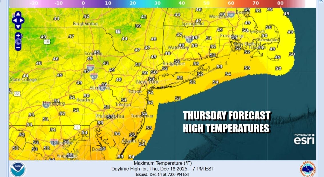
During the day today though we are not going to have too much going on. We will see some sunshine at least for awhile before clouds start to roll in from the south and from the west. I am not expecting any showers during today and winds from off the ocean will not be a concern. High temperatures this afternoon will reach the 50s just about everywhere. Radars do not show showers anywhere close to us at the moment.
SATELLITE WITH LIGHTNING STRIKES

WEATHER RADAR

Weather conditions will deteriorate tonight as the front draws closer. Winds will increase and start gusting to near 30 mph by midnight and then increase further. The strongest winds will occur roughly between 2am to 2pm Friday and winds will be gusting to 40 to 50 mph at times both inland and along the coast. Along with the wind we will have rain and thunderstorms coming in overnight and lasting into the first part of Friday morning when the front will pass eastward and move offshore.
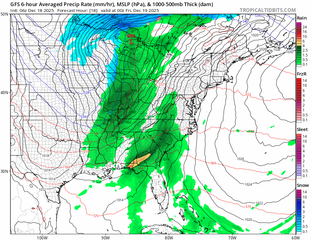
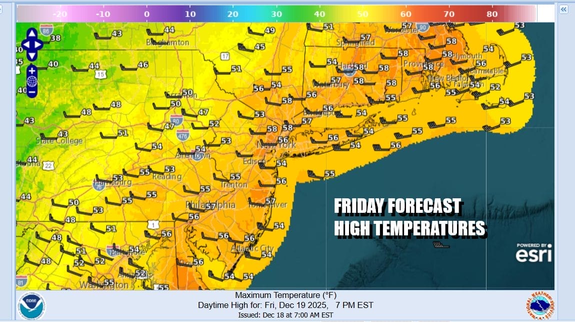
Rainfall amounts will likely be an inch or so give or take a quarter of an inch. Winds will shift from south to northwest around midday. Rain will end from late morning to early afternoon in west to east fashion. Clouds will likely give way to some breaks of sun later in the afternoon as temperatures which will rise through the 50s to near 60 degrees, hold these levels until colder air arrives late in the day and Friday night.
Behind the front is a very quick shot of colder air which basically comes in Friday and starts to pull out later Saturday. The shot of cold air is not exceptionally cold by any means. Saturday morning lows will be in the 20sa. The weekend itself will be nice and dry and we will have some sunshine Saturday. Most highs will be in the upper 30s and lower 40s. Sunday we will be higher ahead of another cold front. This front will pass through with nothing more than a few clouds and a wind shift. Skies will be no worse than partly sunny. Highs Sunday will be in the mid to upper 40s. Then colder air follows for the start of next week as we march toward the Christmas holiday.
BE SURE TO DOWNLOAD THE FREE METEOROLOGIST JOE CIOFFI WEATHER APP &
ANGRY BEN’S FREE WEATHER APP “THE ANGRY WEATHERMAN!
MANY THANKS TO TROPICAL TIDBITS FOR THE USE OF MAPS
Please note that with regards to any severe weather, tropical storms, or hurricanes, should a storm be threatening, please consult your local National Weather Service office or your local government officials about what action you should be taking to protect life and property.


