
Wind Advisories for Most of Eastern Pennsylvania
to Southern New England As Cold Front Passes
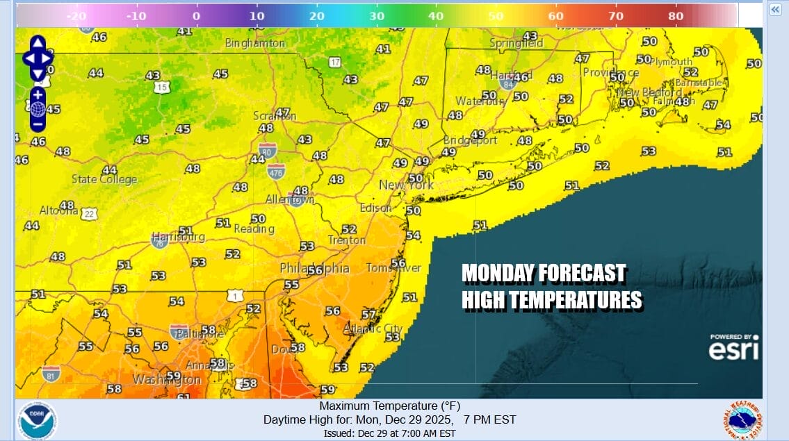
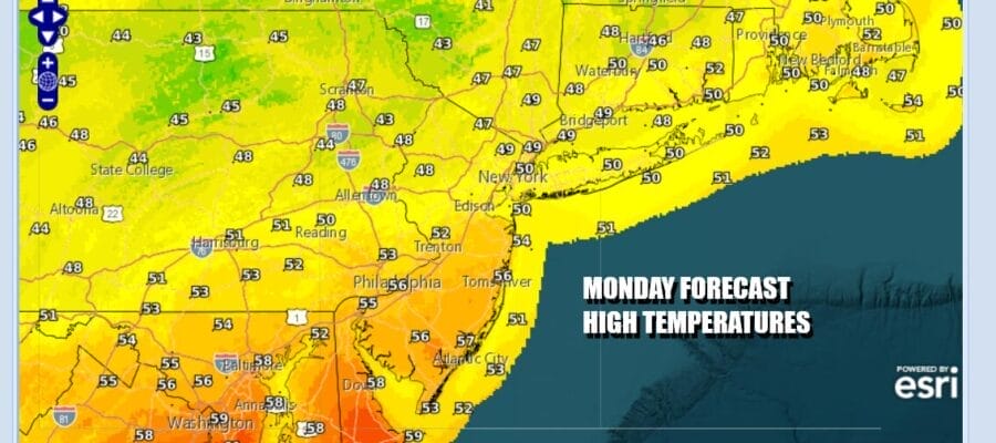
A major storm is sitting over the Great Lakes and making its way eastward. A warm front is pushing northwad and now the cold front arrives and that means showery rains into midday. We have patchy dense fog around as well this morning and that is eating away at the snow cover in a big way. Once the front passes winds will shift to the northwest and increase and that is when Wind Advisories take effect for this afternoon into Tuesday for much of the area from New Jersey west and north. Other places from NYC eastward to Long Island are borderline wind advisory criteria. Temperatures today warmed overnight and highs will be into the 50s briefly before it starts to turn colder and temperatures ease late today.
SATELLITE WITH LIGHTNING STRIKES

WEATHER RADAR

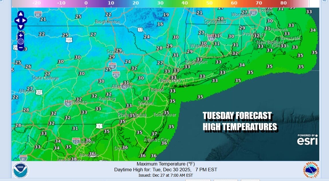
Radar shows showers heading east and they pass through and move out to sea early this afternoon. Tonight will be windy and much colder with skies at least partially clearing out with lows in the 20s. Tuesday we have a very cold air mass building in against the major storm that by Tuesday will be in Eastern Canada. Windy conditions with gusts to or over 40 mph continues with clouds and some sunshine. We will throw in the chance for the odd snow shower. Highs Tuesday will be only just into the 30s.
Often times when you have a major storm on the weather maps, it tends to basically use up all the available energy and that is followed by a relative period of calmness in the weather world. That seems to be the case for the rest of the week and into next weekend as weather systems moving along in the flow remain on the weak side. One such system is going to moving southeastward in the northwest flow aloft Wednesday and Thursday.

The lead disturbance Wednesday moves into Western Pennsylvania and West Virginia and basically fizzles out. The second one behind it holds on a bit stronger but we are talking a weak-ish system that brings snow showers or maybe a period of light snow that whitens the ground in places Thursday New Year’s Day.

As long as there are no last minute surprises , Wednesday will be a cold day that is no worse than partly sunny with highs in the 30s, Wednesday night we see no issues if you happen to be out and about for New Years Eve. It will just be cold with lows in the mid teens to lower 20s. Look for a period of light snow or flurries Thursday morning but New Year’s will be cold and mostly dry with some sunshine and highs only in the 20s. The same holds for Friday with sunshine and temperatures not getting out of the 20s.
BE SURE TO DOWNLOAD THE FREE METEOROLOGIST JOE CIOFFI WEATHER APP &
ANGRY BEN’S FREE WEATHER APP “THE ANGRY WEATHERMAN!
MANY THANKS TO TROPICAL TIDBITS FOR THE USE OF MAPS
Please note that with regards to any severe weather, tropical storms, or hurricanes, should a storm be threatening, please consult your local National Weather Service office or your local government officials about what action you should be taking to protect life and property.


