
Weather Conditions Will Improve Later Today Cool Sunny Start to the Week Ahead
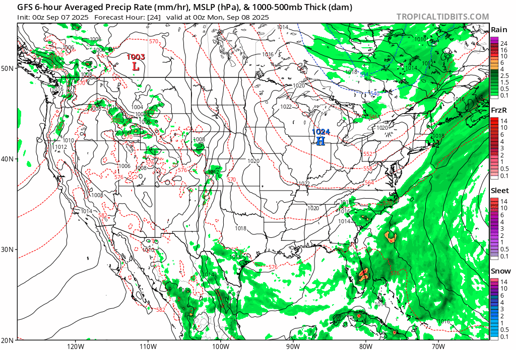
Severe weather from Saturday afternoon and evening is now long gone but we still have a cold front that is nearby. This has created some rain along the coastal plain. However as we move through the morning the rain will shift to the east and this afternoon we will see some slow improvement as clouds begin to decrease and dry cool air overwhelms the Northeast and Middle Atlantic states. Temperatures much of the day will be in the 60s though we could sneak up above 70 in spots if it clears out fast enough.

This cool air mass will cause temperatures to drop tonight to the lowest levels we have seen since last spring. Skies will be mostly clear tonight with a north northwest wind. Temperatures by Monday morning will bottom in the low and middle 50s across warmer urban and coastal areas but inland lows in many areas will bottom
SATELLITE WITH LIGHTNING STRIKES

WEATHER RADAR

High pressure will be building across the Eastern US over the next couple of days with the high center gradually settling over Upstate New York and New England. Once that high passes to the east another high pressure cell is forecast to build in Eastern Canada and points southward and this is going to keep weather conditions dry and on the cool-ish side for the remainder of the week and probably into next weekend.
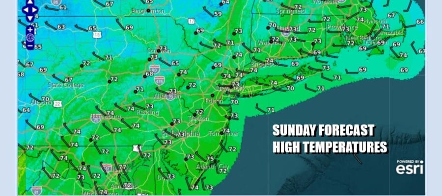
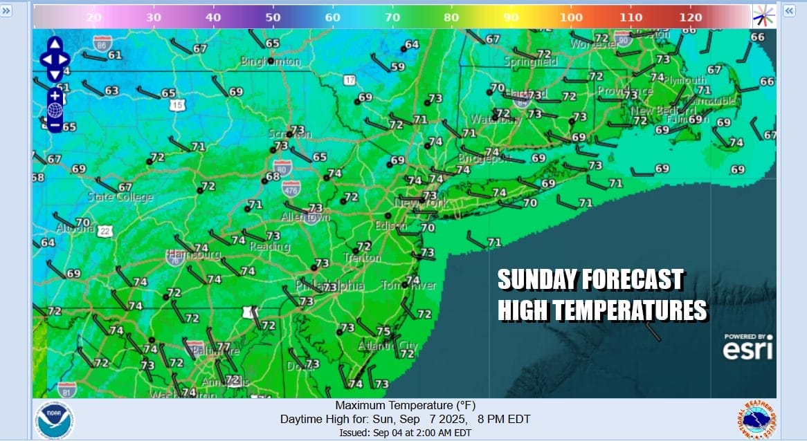
Yesterday’s rainfall as well as the rain this morning will lessen the dry the conditions somewhat but the weather pattern is hostile to rain events and we probably won’t see rain for awhile. No rain is in the forecast at all for the next 7 days. Monday will be partly to mostly sunny but it will be on the cool side as most highs will average in the lower 70s across Eastern Pennsylvania to Southern New England and Long Island.
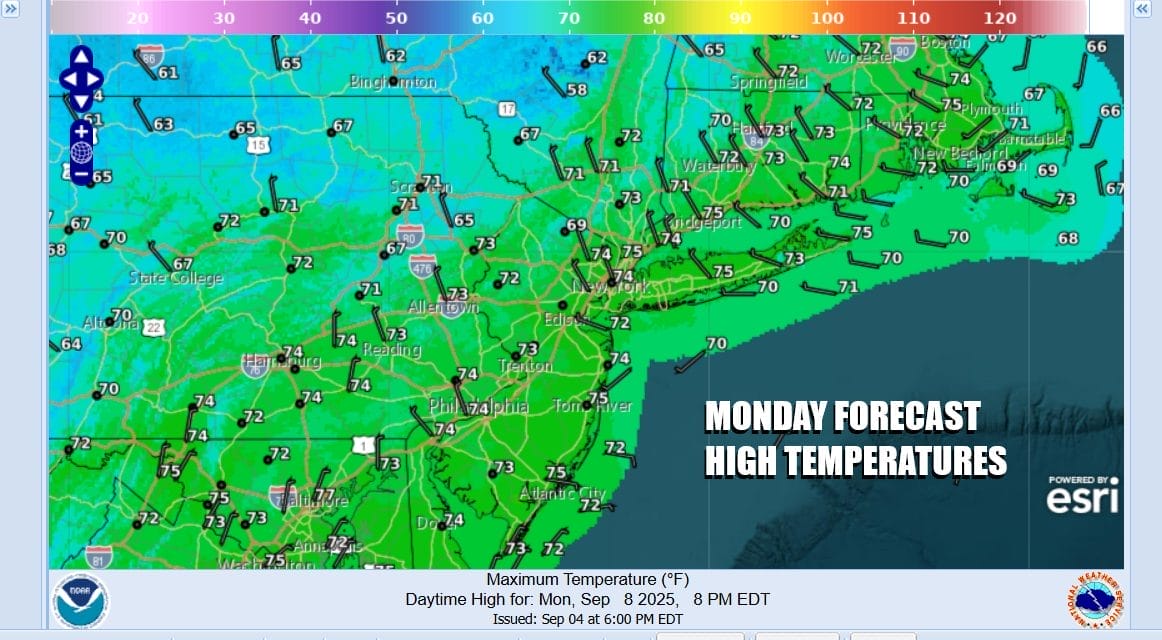
Nothing much will change for Tuesday and Wednesday as we have another chilly start to the day both Tuesday and Wednesday morning with lows both days in the 40s inland and 50 to 55 degrees along the coast. Tuesday highs will once again be in the lower 70s. Wednesday we might nudge up a little higher with readings topping in the low to mid 70s. Skies both days will be partly to mostly sunny. Thursday likely will be the warmest day of the week until another cold front passes through late Thursday. Sunshine will take highs to the upper 70s to near 80 degrees or so. The front will come through dry and as the next high pressure area builds in, northeast winds and sunshine will mean lower temperatures Friday with highs in the low 70s but it will be a sunny finish to the work week.
BE SURE TO DOWNLOAD THE FREE METEOROLOGIST JOE CIOFFI WEATHER APP \\\&
ANGRY BEN’S FREE WEATHER APP “THE ANGRY WEATHERMAN!
MANY THANKS TO TROPICAL TIDBITS FOR THE USE OF MAPS
Please note that with regards to any severe weather, tropical storms, or hurricanes, should a storm be threatening, please consult your local National Weather Service office or your local government officials about what action you should be taking to protect life and property.


