
Warming Up Rain Wind And Some Thunder Thursday Night Into Friday Morning
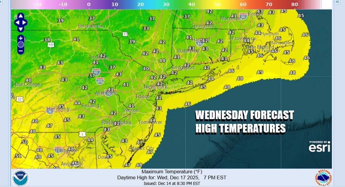
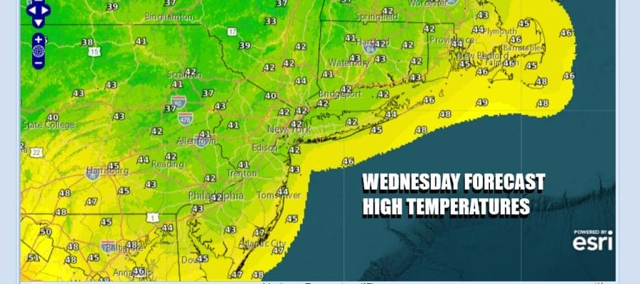
The latest shot of cold air has played itself out and now we begin a warming trend today. West to Southwest winds will at least allow temperatures to rise back up into the lower 40s across Eastern Pennsylvania to Southern New England this afternoon. Skies should be no worse than partly sunny. There may be some high clouds around as we get blow off from the next storm system heading for the Great Lakes along with a trailing cold front that will extend southward to the Gulf Coast. Radars are nice and quiet with no issues.
SATELLITE WITH LIGHTNING STRIKES

WEATHER RADAR

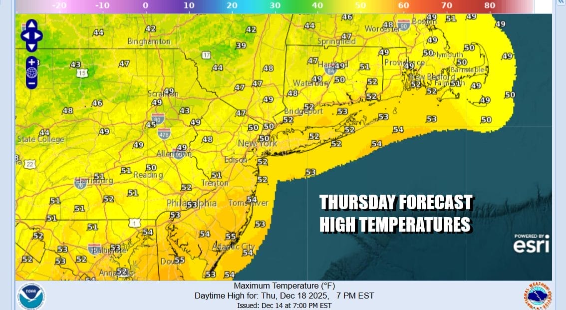
Cold spots tonight under what should be mainly clear skies will drop down to the upper teens and lower 20s while everyone else will be in the mid to upper 20s. Thursday we will warm up as winds bend more to the southwest and eventually to the south by evening. Any early sun will give way to arriving clouds as a strong cold front pushes eastward through the Ohio Valley and into Western Pennsylvania. We might see some renegade showers late in the afternoon and evening in a few places but the main body of rain waits for Thursday night. Highs Thursday will reach into the 50s in most places.
The cold front will have ample energy and moisture with it and showery rains will develop Thursday night as winds increase toward Friday morning, gusting past 40 mph at times as we near daybreak. We could see up to an inch of rain and there might even be a thunderstorm or two in the mix, washing the snow cover away. Temperatures will likely rise and we could some 60 degree readings by Friday morning ahead of the passage of the cold front.

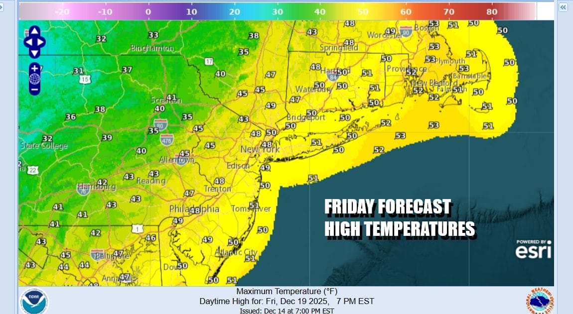
Since this is about 6 to 8 hours of rain, rainfall amounts are in the order of 3/4 inch to maybe an inch to an inch and a quarter in places that might see convection. Winds shift to the northwest as rain ends from west to east by midday and we will have leftover clouds and windy conditions Friday afternoon. Temperatures will be in the 50s to near 60 until the upper trough passes and then they will drop late in the day.
The weekend is looking dry. Saturday we will see some sunshine and highs in the upper 30s and lower 40s. We will be in the 40s Sunday ahead of another cold front but this front will come through dry with no precipitation and then we turn colder again to start next week. There is the chance for a little light snow or rain late Tuesday or Tuesday night. One and only one model is showing the chance for a moderate snowfall on Christmas Day, the rest are mainly on the dry side. We will dismiss this possibility for now until we see what other models do in the coming days.
BE SURE TO DOWNLOAD THE FREE METEOROLOGIST JOE CIOFFI WEATHER APP &
ANGRY BEN’S FREE WEATHER APP “THE ANGRY WEATHERMAN!
MANY THANKS TO TROPICAL TIDBITS FOR THE USE OF MAPS
Please note that with regards to any severe weather, tropical storms, or hurricanes, should a storm be threatening, please consult your local National Weather Service office or your local government officials about what action you should be taking to protect life and property.


