
Warming Up Quickly Through the Weekend No Rain Until Wednesday
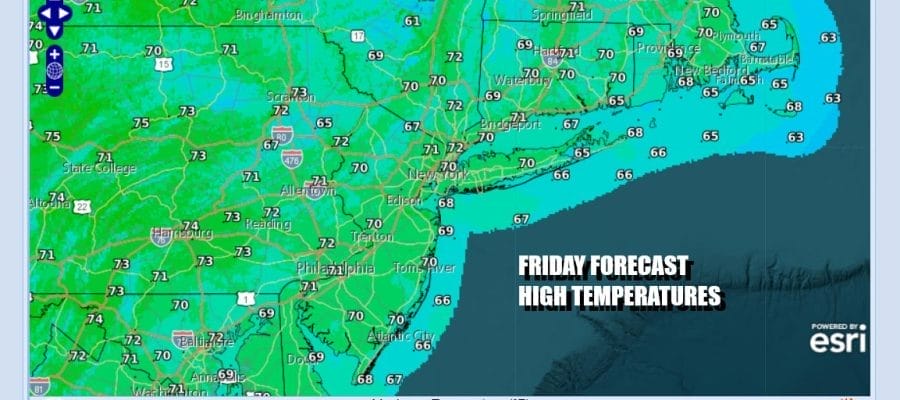
Another cool morning start is going to lead to a nice warm up over the weekend. Skies up and down the East Coast and west to the Rockies are mainly clear. High pressure is holding on in the East and will eventually settle over the Middle Atlantic states for the weekend. This leaves us with no issues. Sunshine today from start to finish and high temperatures should reach the upper 60s to lower 70s. Temperatures tonight won’t be as cool as past nights with most lows in the 40s inland, 50s coast, and upper 50s to near 60 in warmer urban locations.
SATELLITE WITH LIGHTNING STRIKES

WEATHER RADAR

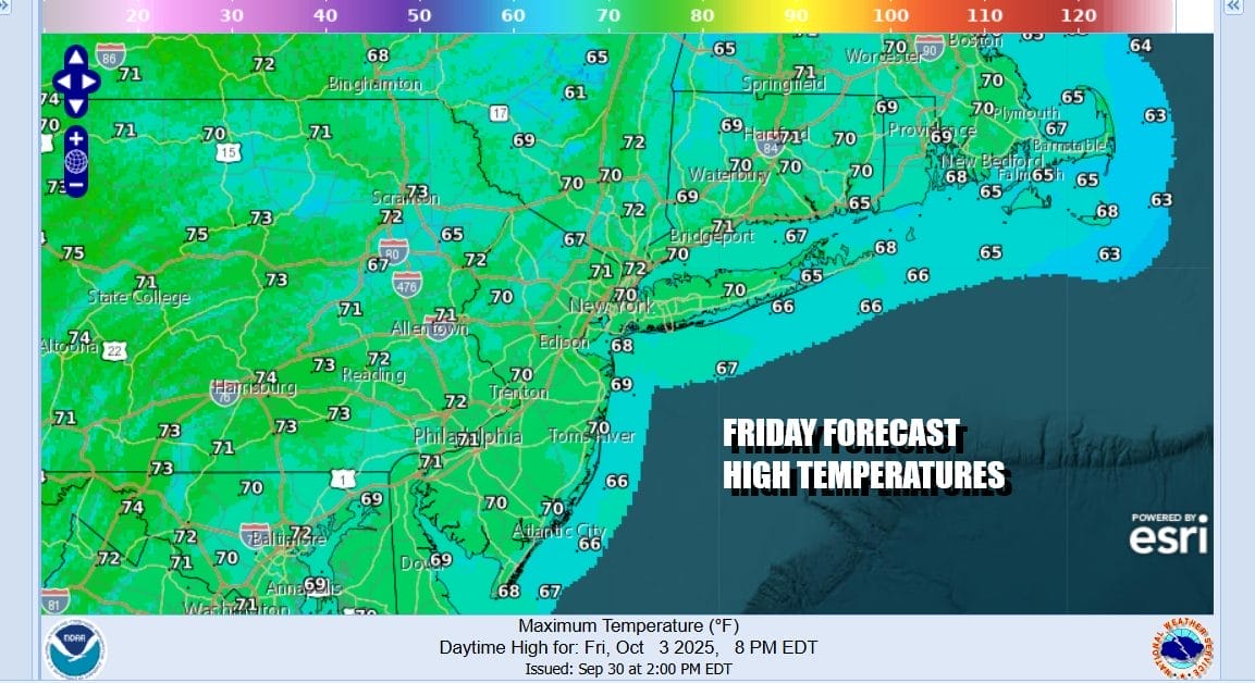
Let’s move on the weekend where not much is going to change. High pressure will be along the Middle Atlantic coast. Winds are going more southwest and that means temperatures will warm up rather fast. Skies Saturday will be partly to mostly sunny. High temperatures will reach the upper 70s to around 80 degrees though ocean winds will likely keep it cooler along south and east facing shorelines.
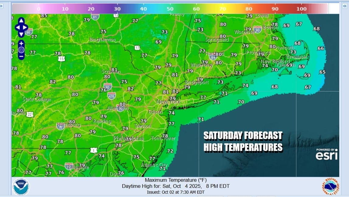
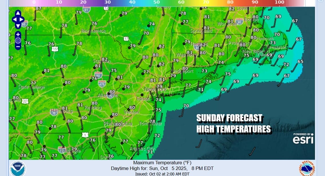
Sunday will also be a partly to mostly sunny day. Some low clouds and patchy fog could start the day off in some places but that will quickly burn off. Once again we will see temperatures reaching the upper 70s to lower 80s across Eastern Pennsylvania to Southern New England. A cooler ocean means south and east facing shorelines of New Jersey, Long Island and Connecticut will be about 5 to 10 degrees lower.
Not much changes for Monday and Tuesday of next week. Both days will be dry and warm. Skies will likely be no worse than partly sunny on either day. Highs will reach into the 80s inland and 70s along the coast. This will break Wednesday as a weather front approaches from the northwest bringing showers in for the first time in over 10 days. No major rainfall is forecast though and no major storms or tropical systems are in the cards anytime soon. Enjoy the late summer/early fall weekend.
BE SURE TO DOWNLOAD THE FREE METEOROLOGIST JOE CIOFFI WEATHER APP &
ANGRY BEN’S FREE WEATHER APP “THE ANGRY WEATHERMAN!
MANY THANKS TO TROPICAL TIDBITS FOR THE USE OF MAPS
Please note that with regards to any severe weather, tropical storms, or hurricanes, should a storm be threatening, please consult your local National Weather Service office or your local government officials about what action you should be taking to protect life and property.


