
Warming Up But Showers Late Tuesday & More Rain Late Week

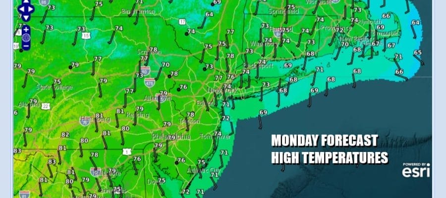
The work week begins with warmer temperatures today. Winds are going to turn more southeast and south. We should be no worse than partly sunny today. There are some clouds that will be moving through from time to time as a cold front makes its way eastward from the Saint Lawrence Valley to the Midwest. High temperatures this afternoon will be in the mid to upper 70s in most places and again temperatures will likely be cooler along south and east facing shorelines. While dew points will remain reasonable today we are going to see them climb into and through the 60s tonight and Tuesday and this is a sign that the dry weather pattern is about to come to an end.
SATELLITE WITH LIGHTNING STRIKES

WEATHER RADAR

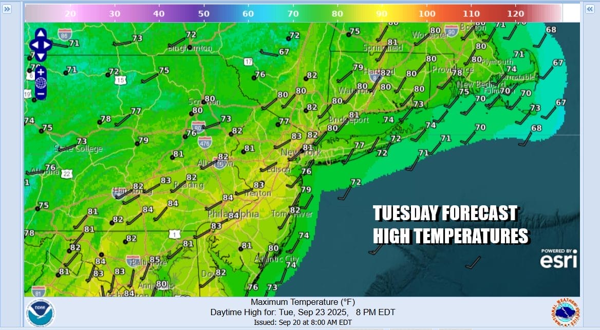
This next weather front is going to approach Tuesday from the west and northwest. Ahead of this we have a warm night into Tuesday morning with most lows in the 50s to lower 60s. Tuesday ahead of the front we will see sunshine and, for the first time in quite awhile, significantly higher humidity. Late in the day and into Tuesday night there will be some showers and thunderstorms running around. Highs Tuesday will reach the 80s in most places except it will be a little cooler along south and east facing shorelines.
This weather front is going to stall out to the south and then we will see energy dropping southeast from Central Canada and into the Ohio Valley creating a north south upper trough from the Lower Great Lakes to the Gulf Coast. A southerly flow aloft develops along the East Coast and this is going to create a moisture feed northward. Another low forms in the lower Ohio Valley and heads northeast to the lower Great Lakes.

We probably see a short break Wednesday with clouds around and high temperatures in the 70s. Dew points will remain high at least through Thursday and possibly into Friday. As low pressure heads into the Eastern Great Lakes we will open the door to showery rains and maybe a thunderstorm or two Thursday into Friday. This weather front will be very slow moving so we have a chance to see 2 or more inches of rain this week from the weather systems coming through. Temperatures will still be in the 70s to near 80 or Wednesday but we will see them a little lower Thursday and Friday.
BE SURE TO DOWNLOAD THE FREE METEOROLOGIST JOE CIOFFI WEATHER APP &
ANGRY BEN’S FREE WEATHER APP “THE ANGRY WEATHERMAN!
MANY THANKS TO TROPICAL TIDBITS FOR THE USE OF MAPS
Please note that with regards to any severe weather, tropical storms, or hurricanes, should a storm be threatening, please consult your local National Weather Service office or your local government officials about what action you should be taking to protect life and property.


