
Warming Up Ahead of Cold Front Showers of Rain & Snow Wednesday Night
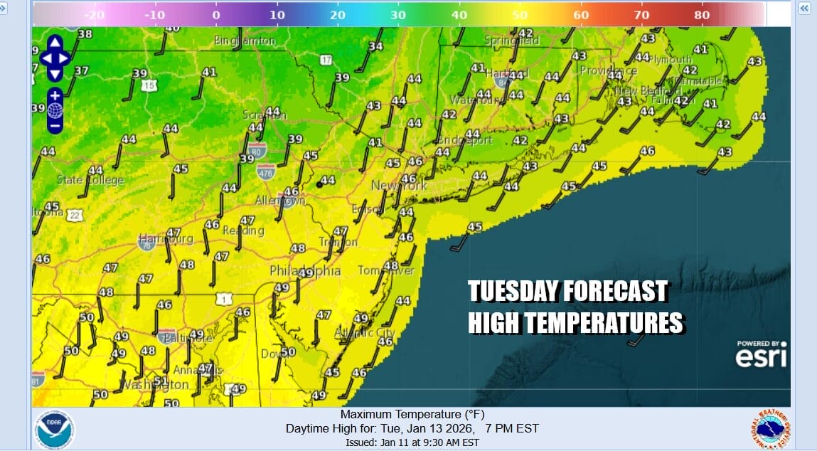
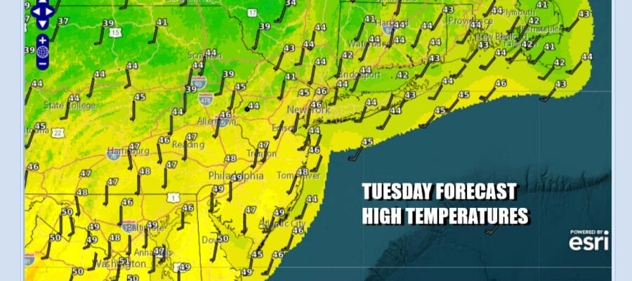
Our rather benign weather pattern continues and we continue to be in a world where weather systems are moving from west to east across the Great Lakes and Southern Canada. This leaves us dealing with systems that don’t have much moisture with them. Ahead of these cold fronts, temperatures move higher and we are seeing this today with sunshine across Eastern Pennsylvania to Southern New England. Temperatures this afternoon will be topping out mostly in the low to middle 40s. Radars are nice and quiet and should remains o into the first part of tonight.
SATELLITE WITH LIGHTNING STRIKES

WEATHER RADAR

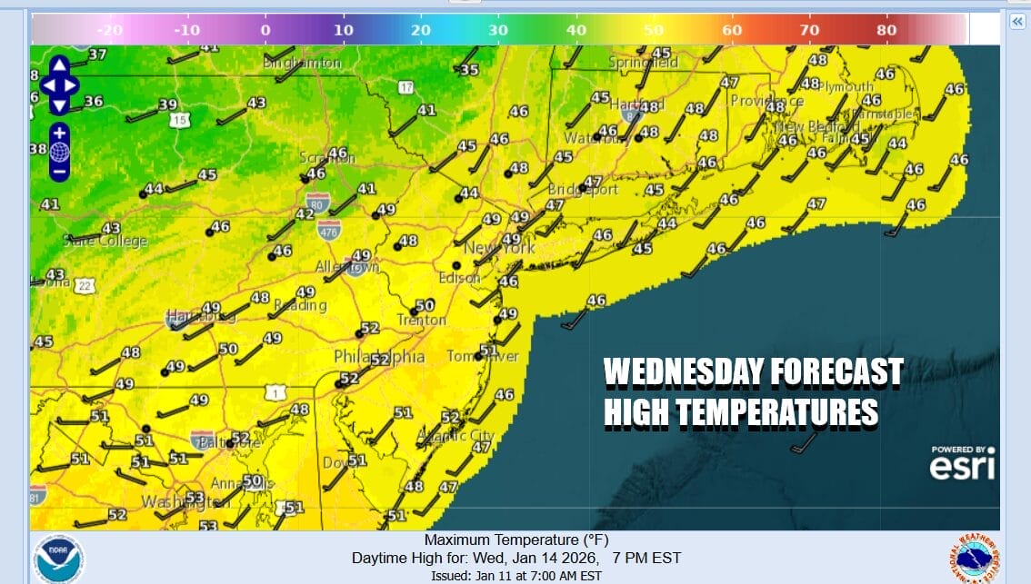
Overnight we will see clouds and as warmer air continues to stream northward, a couple of widely scattered showers could pop up before daybreak. Temperatures tonight will be on the warm side with most lows in the 30s to around 40 degrees. A weather front approaches Wednesday. We will likely be in clouds all day and highs will be in the upper 40s and lower 50s.
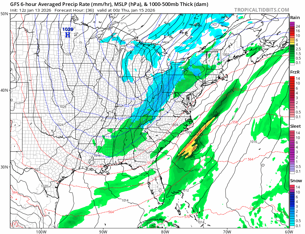
Low pressure will be moving from the Great Lakes to Southeastern Canada with a trailing cold front. The front will likely produce a relatively brief period of showers Wednesday night, mainly between 10pm to 6am Thursday. The front will pass and there might be a brief change to some wet snow on the back side but it will be fast and even if it does happen it won’t amount to much.
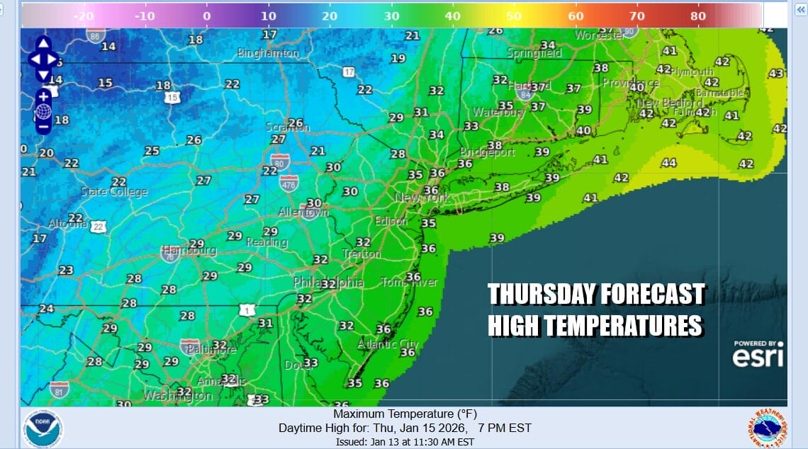
Weather conditions will improve somewhat Thursday but we will have gusty northwest winds and cold air returns. We will drop to the low and mid 30s Thursday morning and likely hold at those levels all day long. Look for clouds and some sunshine and there could be some scattered snow showers running around as the upper trough moves through. By Friday morning lows will be in the teens to near 20 degrees.
Friday will be cold with some sunshine. Highs will be in the low to middle 30s. Winds will turn more to the south and over the weekend we will have another low moving from the Northern Great Lakes and Southeastern Canada and another cold front that is likely to pass through Sunday. This is similar to what we are dealing with Wednesday night and Thursday and we expect a similar outcome though it appears to have even less moisture than the system for Wednesday night. Saturday highs will be in the upper 30s to lower 40s and then it turns colder again Sunday. For now it seems much of the time this weekend will be dry.
BE SURE TO DOWNLOAD THE FREE METEOROLOGIST JOE CIOFFI WEATHER APP &
ANGRY BEN’S FREE WEATHER APP “THE ANGRY WEATHERMAN!
MANY THANKS TO TROPICAL TIDBITS FOR THE USE OF MAPS
Please note that with regards to any severe weather, tropical storms, or hurricanes, should a storm be threatening, please consult your local National Weather Service office or your local government officials about what action you should be taking to protect life and property.


