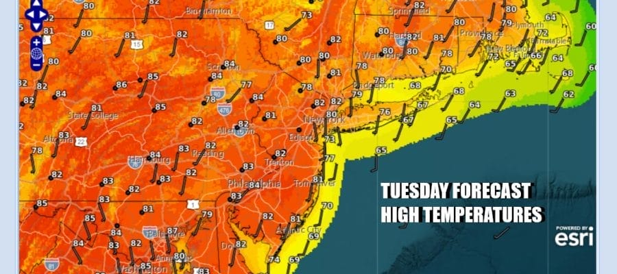

Warming Into the 80s Today Mid 80s to Near 90 Degrees Wednesday & Thursday

A cool start to the day is going to lead to a much warmer finish. Satellite and radar loops confirm that weather conditions are nice and quiet and we have a long way to go regarding any risks for rain. Today is going to be a partly to mostly sunny day. There is still a bit of a smokey haze from the Canada wild fires but that should continue to diminish over the next day or two as the upper flow becomes more southwest. Temperatures today should reach to the upper 70s and lower 80s for highs though it may be a shade lower along coastal locations with local sea breezes.
SATELLITE WITH LIGHTNING STRIKES

WEATHER RADAR

There are two weather systems that we are watching. One is a weather front that likes across the Upper Mississippi Valley to the Southern Plains. Showers and thunderstorms are breaking out along that boundary today but high pressure off the Mid Atlantic coast is keeping that front from making much eastward progress.

We also have a non tropical low pressure arear off the East Coast of Florida that initially is not making much northward progress though it will start to edge its way northward later in the week. We are sandwiched between the two systems and leaves Eastern Pennsylvania to Southern New England and Long Island in a sweet spot right into Friday.
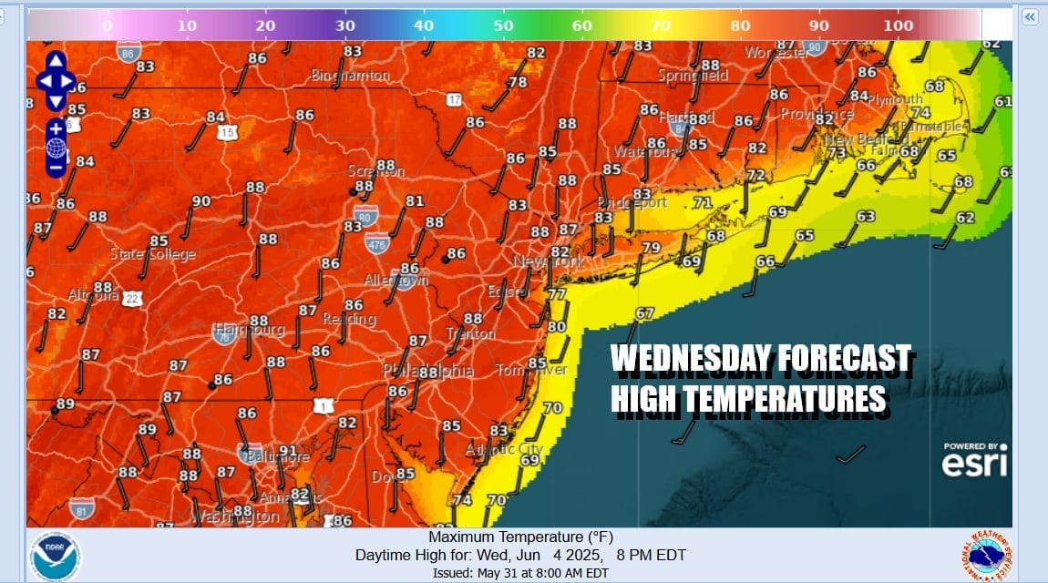
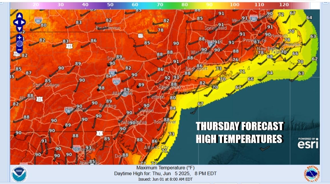
Wednesday will be a sunny very warm but not humid kind of day. Dew points will still be holding in the 50s to near 60 which is reasonable. Highs Wednesday will reach the middle and perhaps in even some upper 80s although there will be local sea breezes at the coast. Thursday we will see dew points rise and humidity go up as will temperatures. Skies should be no worse than partly sunny and highs will be in the mid 80s to near 90 degrees in some places.
We see things changing somewhat on Friday. A second front is going to be pressing eastward. Meanwhile the Florida low heads for the North Carolina coast. This low effectively slows the approaching front down and that means that it may take some time for that front to clear the coast. Friday look for increasing clouds and the risk for showes and thunderstorms late in the day especially inland. Highs will be mostly in the lower 80s. Then as the European model loop above shows, showers and thunderstorms likely become more numerous Friday night and through much of Saturday. Saturday temperatures will be in the 70s to near 80. The front should finally clear the coast Saturday night leading to a better Sunday of sunshine with highs reaching the upper 70s to around 80 degrees. In the coming days we will try to figure whether the Friday night Saturday stalled front will create problems with severe weather and localized flash flooding.
BE SURE TO DOWNLOAD THE FREE METEOROLOGIST JOE CIOFFI WEATHER APP &
ANGRY BEN’S FREE WEATHER APP “THE ANGRY WEATHERMAN!
MANY THANKS TO TROPICAL TIDBITS FOR THE USE OF MAPS
Please note that with regards to any severe weather, tropical storms, or hurricanes, should a storm be threatening, please consult your local National Weather Service office or your local government officials about what action you should be taking to protect life and property.


