
Warm Temperatures Into Saturday
Severe Weather Risk Saturday Afternoon & Evening
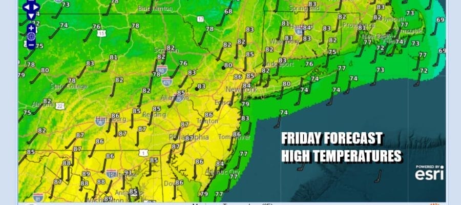
One cold front has passed and another is approaching from the west and that front will usher in a very cool air mass. Before that happens though we have a very warm and somewhat humid day to contend with today. We will be no worse than partly sunny today. The air mass overhead to day is a warm and humid one so temperatures will respond to the warmest levels of the last couple of weeks. Highs will reach the low to middle 80s in most places. There will be winds off the ocean so temperatures at the coast will be about 5 to 7 degrees lower this afternoon and evening. Radars are nice and quiet today and will remain so overnight into Saturday morning. Most lows tonight will be in the 60s to around 70 degrees in warmer urban locations.
SATELLITE WITH LIGHTNING STRIKES

WEATHER RADAR

We move on to Saturday where we are going to see significant changes as well as the risk for thunderstorms and severe weather. The Storm Prediction Center is indicating a marginal risk up and down the coastal plain from Maine to Virginia and this includes Eastern Pennsylvania, much of the Hudson Valley of New York, New York City, all of New Jersey, Long Island and Connecticut.
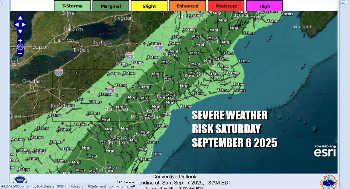
Ahead of the front we are going to see dew points rise through the 60s and skies should be cloudy to aprtly sunny. We will see some daytime heating and that is likely to take temperatures to the low and middle 80s. Then as the front arrives showers and thunderstorms will develop across Eastern Pennsylvania to Southern New England later Saturday afternoon into Saturday night. Right now the primary risk from severe thunderstorms will be strong gusty winds, though it should be noted that there is the risk for an isolated tornado or two.

Showers and thunderstorms could still be around Sunday morning at daybreak as a wave of low pressure on the front goes by. Once that happens the front makes an exit to the east and a very dry, very cool air mass builds in for the remainder of Sunday. Look for developing sunshine, a gusty breeze and Sunday temperatures that will be mostly in the low to mid 70s.
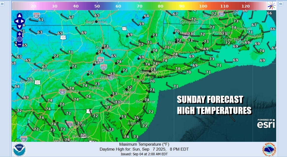
This air mass is the coolest air mass we have seen since last May and we expect to see lows in the 40s in many inland locations and mostly 50s at the coast by Monday morning. Monday dayside will be partly to mostly sunny but it will be quite cool with most highs just in the lower 70s. You can expect cooler than average temperatures to last for all of next
BE SURE TO DOWNLOAD THE FREE METEOROLOGIST JOE CIOFFI WEATHER APP &
ANGRY BEN’S FREE WEATHER APP “THE ANGRY WEATHERMAN!
MANY THANKS TO TROPICAL TIDBITS FOR THE USE OF MAPS
Please note that with regards to any severe weather, tropical storms, or hurricanes, should a storm be threatening, please consult your local National Weather Service office or your local government officials about what action you should be taking to protect life and property.


