
Very Warm Late June Weather Through Thursday
Little Rain Until Sunday With Sharp Cold Front

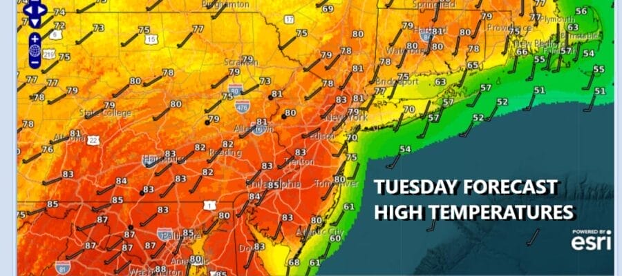
Very warm to downright hot weather conditions begin today and carry us through at least Thursday. A west southwest flow around a Bermuda high set up is going to allow temperatures to rise well into the 80s and we could see some hot spots today reach 90 degrees. We will see a fair amount of sunshine. Coastal areas will be suject to winds off the ocean especially east and south facing shorelines so those areas will see temperatures about 15 or more degrees cooler.
SATELLITE WITH LIGHTNING STRIKES

WEATHER RADAR

There is a stalled frontal boundary that lies across the Great Lakes, Upstate New York and New England and along this boundary we are seeing showers and thunderstorms that will be rolling through from time to time later today and tonight. There is some severe weather risk with these storms and the zone of risk is extending southward into areas across Pennsylvania to New England.
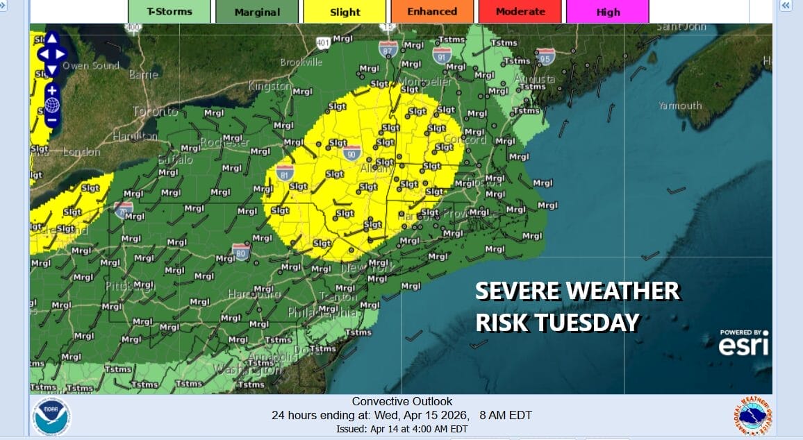
The Storm Prediction Center is indicating a marginal to slight risk for severe thunderstorms from Pennsylvania and Central New Jersey northeastward into New England. We tend to think that any thunderstorms and severe weather will be isolated in nature but the risk is higher across Northeast Pennsylvania, Northern New Jersey, the Hudson Valley and Western New England. Tonight’s lows will be in the upper 50s to mid 60s from coast to inland areas.

Wednesday will be a repeat performance of today with sunshine taking highs well up into the 80s to near 90 degrees in some inland locations. Once again we will see coastal areas, mainly south and east facing shoreline areas running 10 to 15 degrees lower thanks to the wind off the ocean. Once again there is the risk that there could be an isolated shower or thunderstorm developing inland.
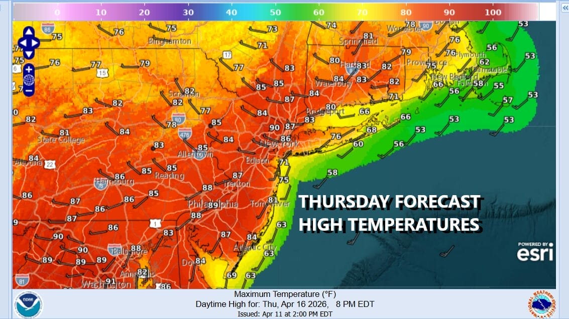
Thursday will be the third day in a row where highs will reach the upper 80s to around 90 degrees for highs with some sunshine. The coast once again will be cooler though you may have to be right along the immediate coast to see temperature impacts from the sea breeze. Friday will see slightly lower temperatures but still making it into the 80s inland. There will likely be a slightly higher chance for scattered thunderstorms as another one of these disturbances moves through. Saturday will be very warm. Sunday brings an end to the early season heatwave of sorts as a sharp cold front brings the chance for showers or a thunderstorm. That comes with a pattern flip to much colder air next week and a below average temperature scheme that will dominate the weather for the last 10 days or so of April.
BE SURE TO DOWNLOAD THE FREE METEOROLOGIST JOE CIOFFI WEATHER APP &
ANGRY BEN’S FREE WEATHER APP “THE ANGRY WEATHERMAN!
MANY THANKS TO TROPICAL TIDBITS FOR THE USE OF MAPS
Please note that with regards to any severe weather, tropical storms, or hurricanes, should a storm be threatening, please consult your local National Weather Service office or your local government officials about what action you should be taking to protect life and property.


