
Very Warm Into Early Next Week
Chance For Showers Thunderstorms Tuesday Night
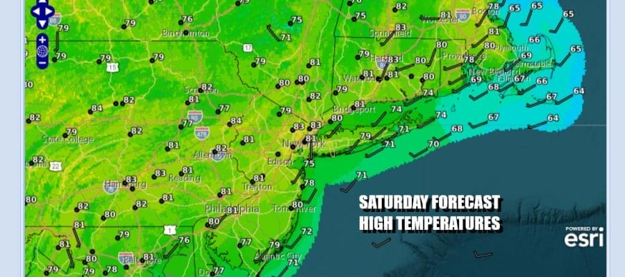
We are here at the weekend and it is going to be a warm one though humidity will remain reasonable. Skies are mainly clear up and down the Eastern Seaboard as a large high pressure area settles over the Mid Atlantic states. A west wind and lots of sunshine will take highs up to the lower 80s this afternoon in most places. Even the coolest areas like the coast will reach the upper 70s to around 80 degrees before any sea breeze takes hold. Most lows tonight will be in the mid 50s to lower 60s under mainly clear skies.
SATELLITE WITH LIGHTNING STRIKES

WEATHER RADAR

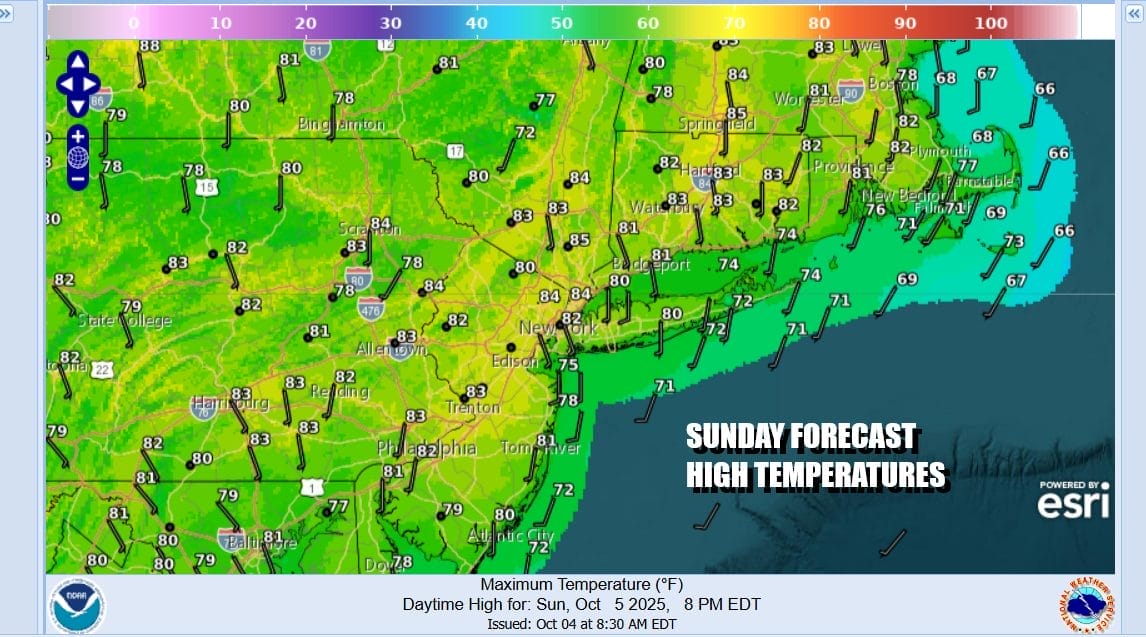
Sunday is going to be a repeat performance of Saturday because the large high to the south remains in place and will not really weaken enough until Tuesday. It will be another day of lots of sunshine. Highs will reach the lower 80s in many inland locations while local sea breezes will keep things a little lower along south adn east facing shorelines Sunday afternoon and evening.
Humidity levels will start to move higher Monday and especially Tuesday. High pressure is going to weaken and move east and that will be followed by a cold front. This will be our first opportunity for rain in nearly 2 weeks. The front will produce showers and thunderstorms well inland Tuesday afternoon and evening in Pennsylvania and Upstate New York.

The moistening up of the lower atmosphere coupled with the much longer nights will probably allow low clouds and patchy fog to develop in some areas during nighttime and early morning hours especially Monday night into Tuesday morning. Otherwise Monday will be very warm again with highs reaching the lower 80s. Nights will be in the mid 50s to lower 60s. Tuesday will also be warm ahead of the cold front with highs reaching the lower 80s. Showers and maybe a thunderstorm will move through Tuesday night followed by cooler air building in for the second half of next week.
BE SURE TO DOWNLOAD THE FREE METEOROLOGIST JOE CIOFFI WEATHER APP &
ANGRY BEN’S FREE WEATHER APP “THE ANGRY WEATHERMAN!
MANY THANKS TO TROPICAL TIDBITS FOR THE USE OF MAPS
Please note that with regards to any severe weather, tropical storms, or hurricanes, should a storm be threatening, please consult your local National Weather Service office or your local government officials about what action you should be taking to protect life and property.


