
Very Warm Humid Conditions Continue Thunderstorm Risks Inland

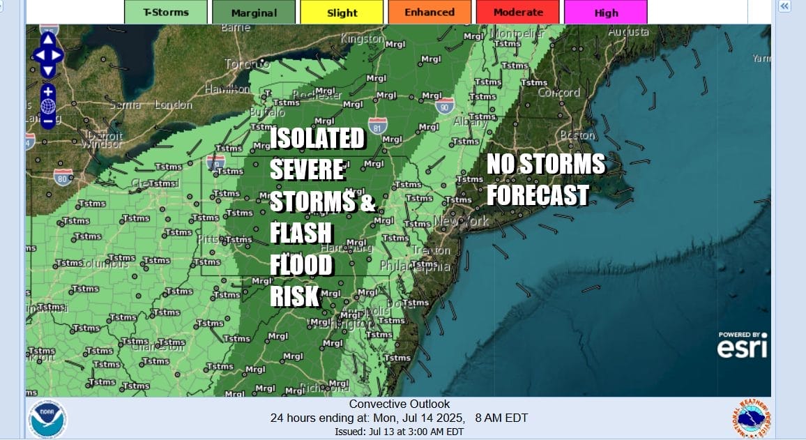
The weather pattern remains stuck as not much is moving along from west to east. Cool air remains locked up in Canada. We have very warm tropical air up and down the Eastern Seaboard. Occasional upper troughs move through that make for more widespread storm activity. One such trough approaches today but it is far enough to the west that any thunderstorms will be inland and severe weather is mostly confined to the areas along the Interstate 81 corridor from Virginia to Pennsylvania to Upstate New York.
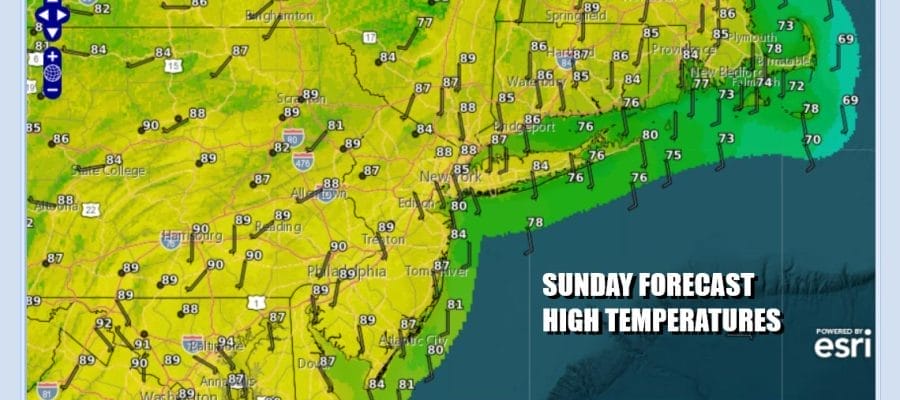
For much of Easternmost Pennsylvania to Southern New England other than an isolated storm inland, it will be a typical warm & humid July day. The wind is from the south southeast and that helps to hold temperatures down as does the occasional cloud cover. However there will be enough sunshine to take highs up to the middle and upper 80s this afternoon which is right around average during mid July. Another very warm humid night lies ahead with lows in the low to mid 70s and 60s only in some of the coolest locations inland.
SATELLITE WITH LIGHTNING STRIKES

WEATHER RADAR

Monday we will see the upper trough shift eastward and closer to the coast Monday. This will shift the area of of shower and thunderstorm risk further to the east. At this time the Storm Prediction Center is not indicating severe weather risk for Monday but I suspect we will see the risk for isolated severe thunderstorms Monday afternoon and evening. This is also a set up for thunderstorms that produce heavy rain and there is always the chance that in a slow moving heavier thunderstorm you could see some localized flash flooding.

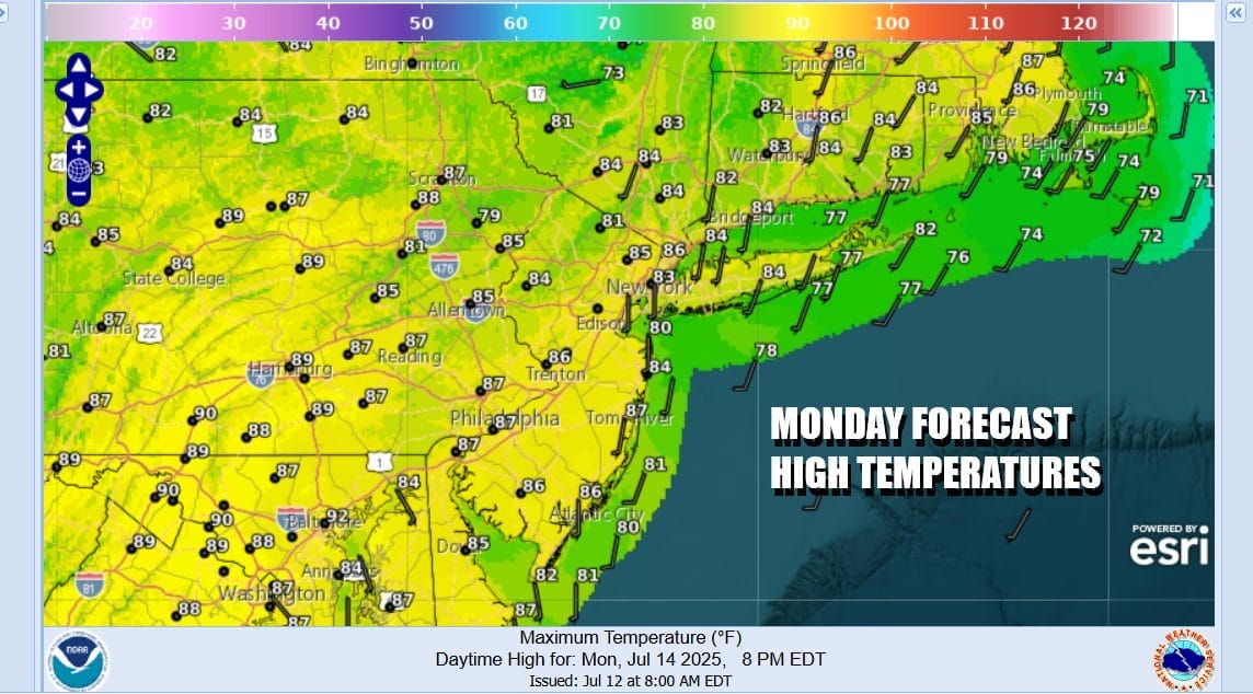
It will be very warm and humid Monday and we will probably have some sunshine for the first part of the day. Showers and thunderstorms will start to develop by late morning and become more numerous during the afternoon and evening. It does seem as these storms will be more widespread for Monday afternoon. Temperatures will reach the 80s again with high humidity. Locally heavy rain and the risk for some local flash flooding are on the table.
There isn’t much to look forward to as far as any major changes. Very warm to occasionally hot conditions continue all week long with high humidity. Highs Tuesday and Wednesday will be in the 80s to around 90 degrees. There is risk for some thunderstorm activity each day. Thursday and Friday will be the same but temperatures will be in the upper 80s and lower 90s and again the chance for scattered thunderstorms. Severe weather and localized flash flood risk will likely vary from day to day. No major changes in the pattern are forecast though we might see a short break in the humidity for a day or so 8 days from now.
BE SURE TO DOWNLOAD THE FREE METEOROLOGIST JOE CIOFFI WEATHER APP &
ANGRY BEN’S FREE WEATHER APP “THE ANGRY WEATHERMAN!
MANY THANKS TO TROPICAL TIDBITS FOR THE USE OF MAPS
Please note that with regards to any severe weather, tropical storms, or hurricanes, should a storm be threatening, please consult your local National Weather Service office or your local government officials about what action you should be taking to protect life and property.


