
Very Cold Friday Much of the Weekend Will Be Dry With Moderating Temperatures
Low temperatures this morning hit their lowest levels of the late Autumn/early Winter season so far as we bottomed in the upper teens and lower 20s in most urban and coastal areas but many areas inland bottomed in the single digits and lower teens. If you go far enough north into the Hudson Valley and New England some lows broke below zero! To the south we have clouds on the northern fringe of a storm system moving across Southern Virginia and North Carolina. This system is producing anywhere from 3 to 6 inches in the southern half of Virginia into Northern North Carolina.
SATELLITE WITH LIGHTNING STRIKES

WEATHER RADAR

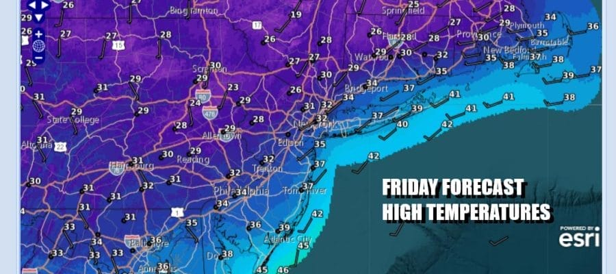
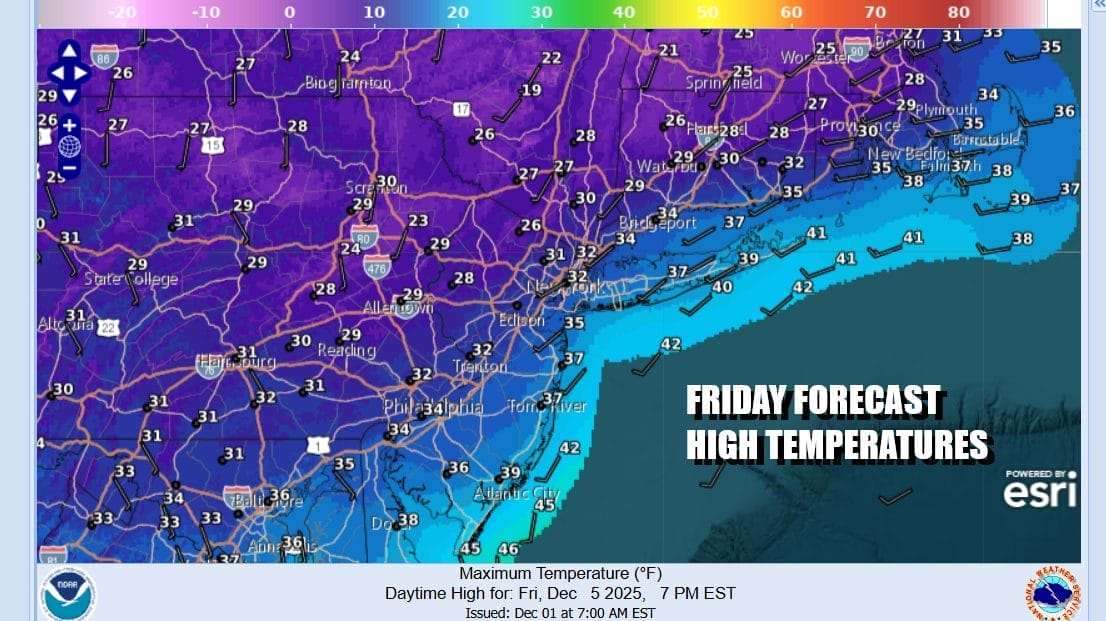
The northern fringe of this system is reaching Delaware and Southern New Jersey with some snow aloft but that is as far north as it gets. Temperatures this afternoon will top out in the upper 20s and lower 30s with high clouds along with some breaks of sunshine especially as you go north of New York City and away from the moist west southwest flow.

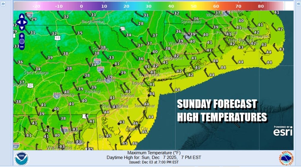
Most lows Saturday morning will be in the 20s to around 30 degrees as the core of this cold air mass moves out. The weekend is looking okay overall with sunshine and a few passing clouds for Saturday. Most highs will reach the upper 30s and lower 40s. Sunday looks to be about the same though there could be a few more clouds around with an approaching weather front but the moisture from this cold front is somewhat lacking so we do not expect much to happen other than clouds. Highs Sunday will be in the upper 30s & lower 40s.
Next week we see a series of weak weather systems with cold shots behind each one. After the Sunday front passes we are looking at a cold Monday into Tuesday. A weak weather system will pass late Tuesday and another on Wednesday. Both systems don’t seem to be showing much as they pass through. There is one for late next week that might prove to be a bit more interesting but that is a long way down the road. Have a great weekend!
BE SURE TO DOWNLOAD THE FREE METEOROLOGIST JOE CIOFFI WEATHER APP \&
ANGRY BEN’S FREE WEATHER APP “THE ANGRY WEATHERMAN!
MANY THANKS TO TROPICAL TIDBITS FOR THE USE OF MAPS
Please note that with regards to any severe weather, tropical storms, or hurricanes, should a storm be threatening, please consult your local National Weather Service office or your local government officials about what action you should be taking to protect life and property.


