

Up To An Inch or Two of Snow For Parts of Eastern Pennsylvania to Southern New England & Long Island
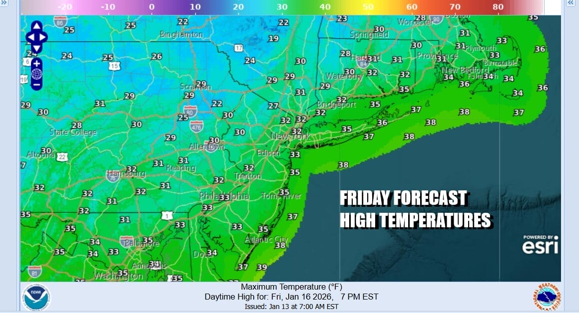
The next in a series of disturbances is beginning it’s move to the east. It is a combination warm/cold front that will move through late tonight and Saturday. Ahead of this today we started the day off with sunshine but we will see clouds begin to increase slowly this afternoon and evening. Nothing is going to happen during the day and through this evening precipitation wise. It is a cold day though and most highs will just make it back to the lower 30s. Nothing is close on the radar but you can expect to start seeing echoes pop up to the west later this afternoon and this evening.
SATELLITE WITH LIGHTNING STRIKES

WEATHER RADAR

After midnight we will begin to see some snow develop as the warm front approaches. This will bring a quick burst of snow as it moves through and out before daybreak. Then as the cold front approaches a second round of precipitation develops Saturday morning and lasts into the early and mid afternoon.

As far as what we get out of this accumulation wise, there seems to be a battle brewing between the shorter range models that want to have most of the accumulating snow north and west of Philadelphia and New York City while the global models are a little further south and have a general coating to a few inches from the Route 1 corridor in New Jersey northeast cutting across Long Island and Southern Connecticut. We think the best approach for this is to forecast a coating to a couple of inches for most places with the possibility that some inland areas could see upside surprises out of this lead system
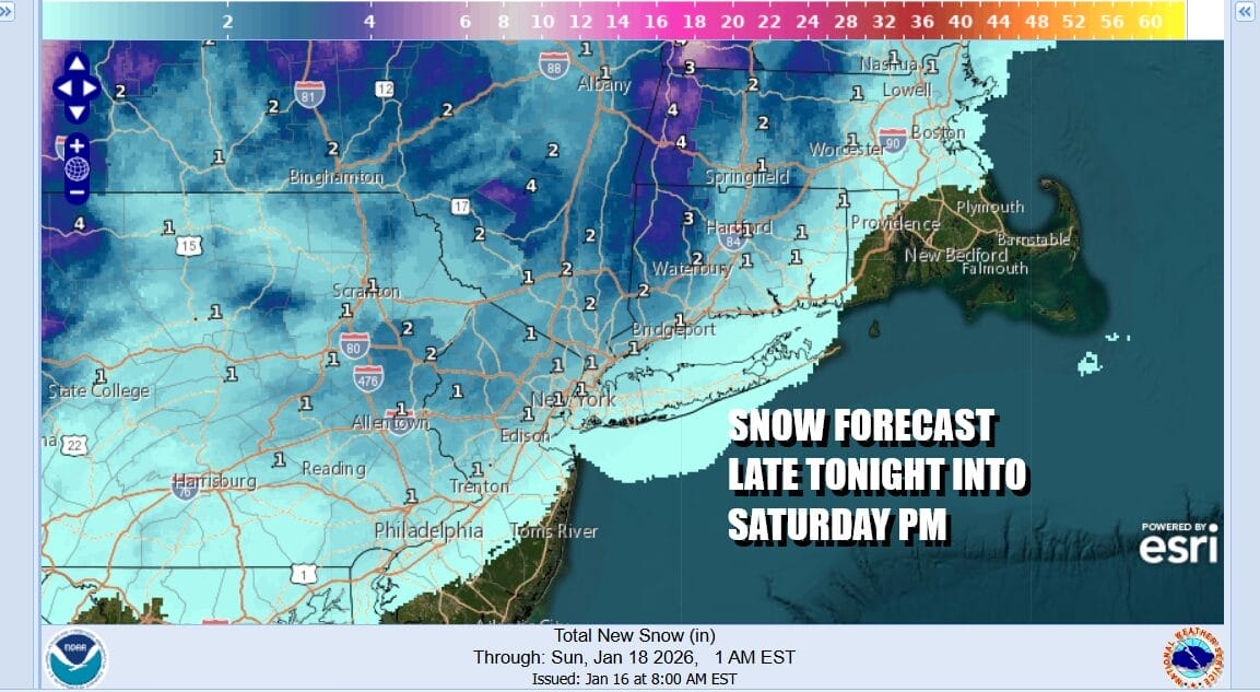
As far as temperatures go we suspect that they will hold in the lower 30s while it is snowing and to the south where less or even no snow falls (Central and South Jersey, Eastern Long Island, we will see temps rise to the mid and upper 30s. All of this is done by mid afternoon and the attention turns to Sunday where we deal with low pressure developing on the stalled front offshore.

This would be a mostly coastal event for areas across Long Island, New York City, and into Central and South Jersey while areas to the west and north would get very little. Also this system is going to be moving along so if we believe the modelling, the potential would be for a few inches near the coast. Arctic boundary and upper trough is moving into the Great Lakes at the same time. If that system is a little faster, it would kick this system out further east and out to sea which is a possibility. A slower system to the northwest would allow for the low to track closer to the coast.
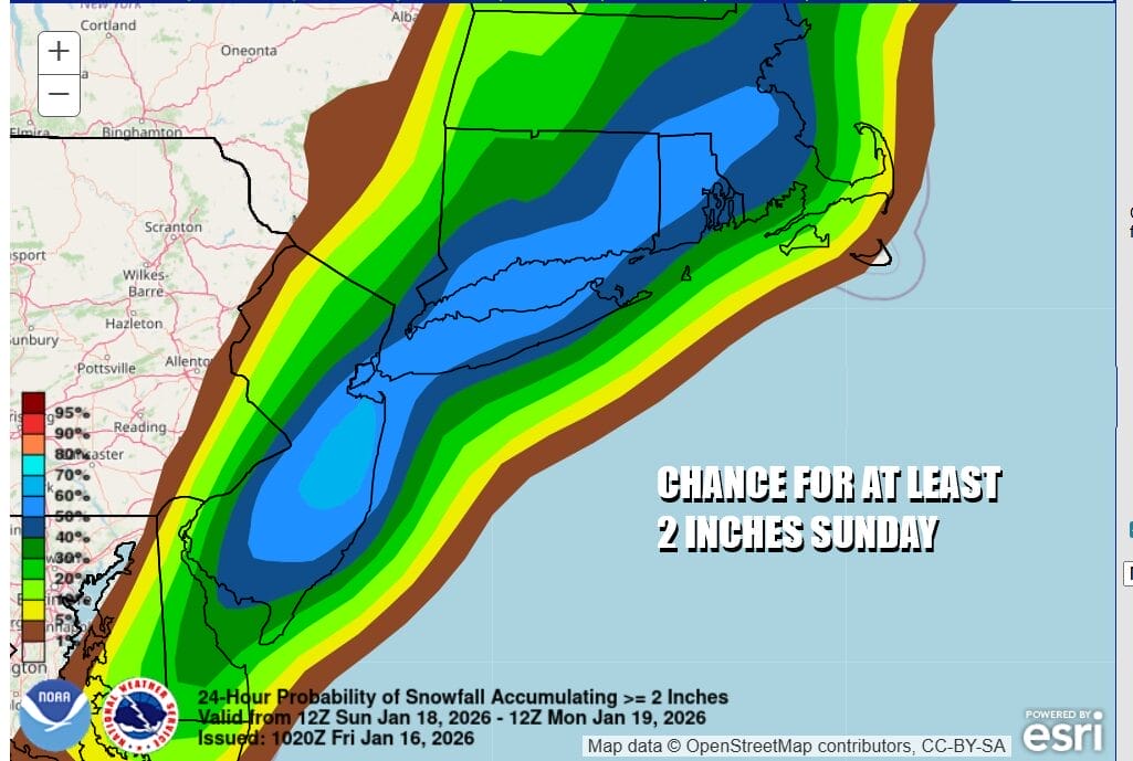
The Weather Prediction Center is indicating a 50 to 60 percent chance for at least 2 inches across a swath from Central and South Jersey to New York City, Long Island, Southeast Connecticut and Long Island. Since there are three weather systems in the puzzle, we will be watching to see how changes in the speed and strength of these systems changes the possible outcome. More on the Sunday system will be discussed after we are done with the first one.
BE SURE TO DOWNLOAD THE FREE METEOROLOGIST JOE CIOFFI WEATHER APP &
ANGRY BEN’S FREE WEATHER APP “THE ANGRY WEATHERMAN!
MANY THANKS TO TROPICAL TIDBITS FOR THE USE OF MAPS
Please note that with regards to any severe weather, tropical storms, or hurricanes, should a storm be threatening, please consult your local National Weather Service office or your local government officials about what action you should be taking to protect life and property.


