
Turning More Humid Into Sunday Severe Storm Risk Sunday PM
Low Humidity Monday Into Wednesday
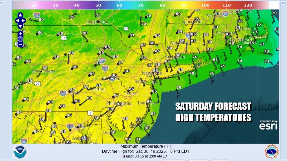
The weekend begins with what is left of a dry air mass that arrived yesterday. It is going to be short lived but we do have a better longer lasting dry air mass for next week. Today sees dew points go up but slowly. We should see some sunshine though there is a warm front setting up to the south and radars are popping up some light showers in parts of Southern Pennsylvania and Southern New Jersey but I don’t expect them to be a big deal. Most highs today will be in the low to middle 80s.
SATELLITE WITH LIGHTNING STRIKES

WEATHER RADAR

Tonight we will see a warm front move northward and that will set off some showers and maybe a thunderstorm or two in some places. Overnight temperatures will likely hold in the upper 60s and lower 70s for the most part and that sets us up for a very warm and humid Sunday. A cold front will be approaching and there likely will be showers and thunderstorms running around especially Sunday afternoon into the evening.

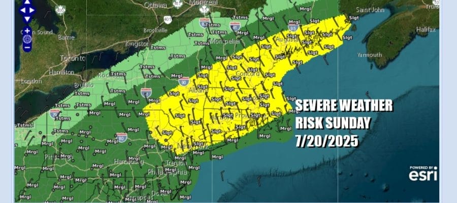
The Storm Prediction Center is indicating the possibility of severe weather with a 15 percent chance for severe storms from Northeast Pennsylvania, Northern New Jersey north and east to the Hudson Valley and much of Southern, Central and Eastern New England. A marginal risk for isolated severe storms lies to the south across the Southern halfs of New Jersey, much of the rest of Pennsylvania south into Maryland and Virginia.
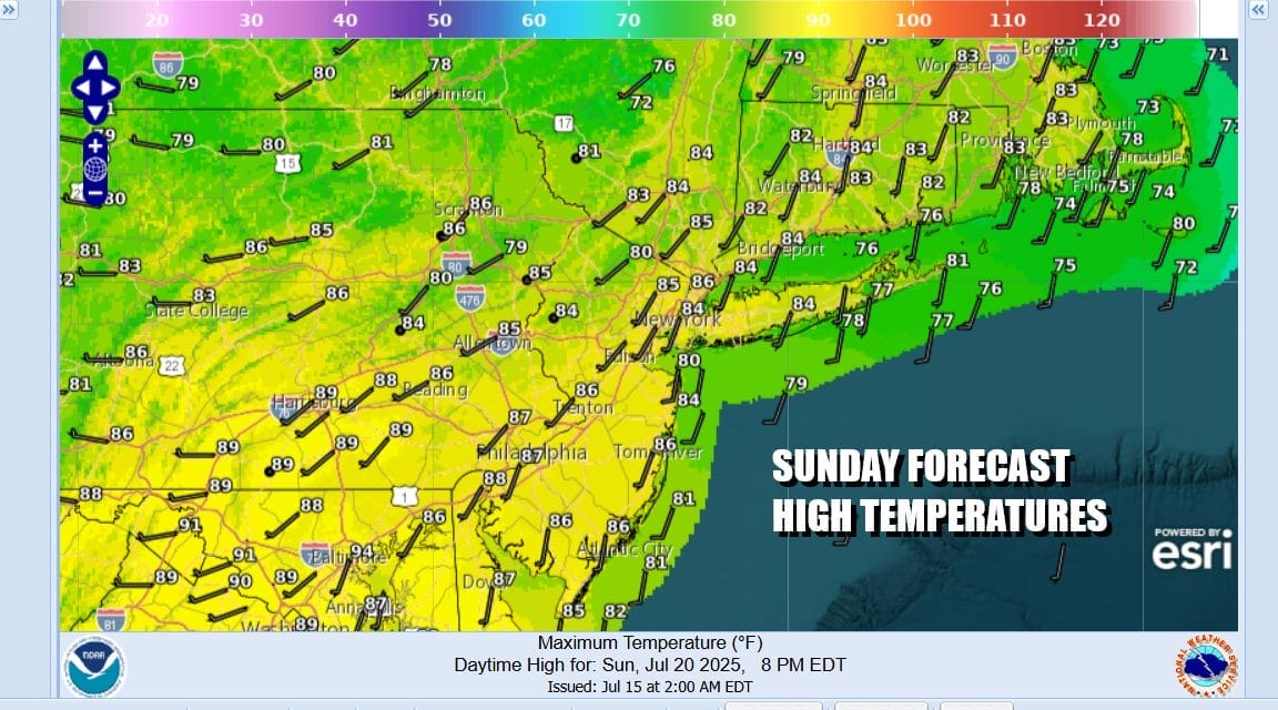
Sunday high temperatures will reach the mid to upper 80s with some warm spots touching 90 degrees. Once the cold front passes we have a nice high pressure cell building in over the Great Lakes and the Northeast for the first part of next week. This is what I would describe as a quality dry air mass that actually has some staying power and weather models show the dry air mass staying through midweek judging from the European model forecast dew points looped from Sunday night right into early Thursday.

Also coming with the dry air mass will be seasonal temperatures for this time of year. Skies should clear out nicely Sunday night with lows in the mid 60s to lower 70s, leaving us with a nice mostly sunny Monday. Look for high temperatures to reach the low and middle 80s. Dew points will be in the very comfortable 50s.

No showers or thunderstorms are forecast through at least Wednesday. Monday night into Tuesday morning we will see lows in the low to mid 60s with 50s in cool spots. Tuesday will be mostly sunny with highs reaching the lower 80s! Wednesday we should be in a range of 80 to 85 degrees for highs. Heat and humidity are likely to return late week and next weekend and perhaps the chance for some thunderstorms will return with it. Otherwise it will be a nice stretch of 3 days or perhaps 4 with no major weather issues.
BE SURE TO DOWNLOAD THE FREE METEOROLOGIST JOE CIOFFI WEATHER APP &
ANGRY BEN’S FREE WEATHER APP “THE ANGRY WEATHERMAN!
MANY THANKS TO TROPICAL TIDBITS FOR THE USE OF MAPS
Please note that with regards to any severe weather, tropical storms, or hurricanes, should a storm be threatening, please consult your local National Weather Service office or your local government officials about what action you should be taking to protect life and property.


