
The Curse of the Onshore Flow Continues For One More Day, Showers Early Sunday Morning
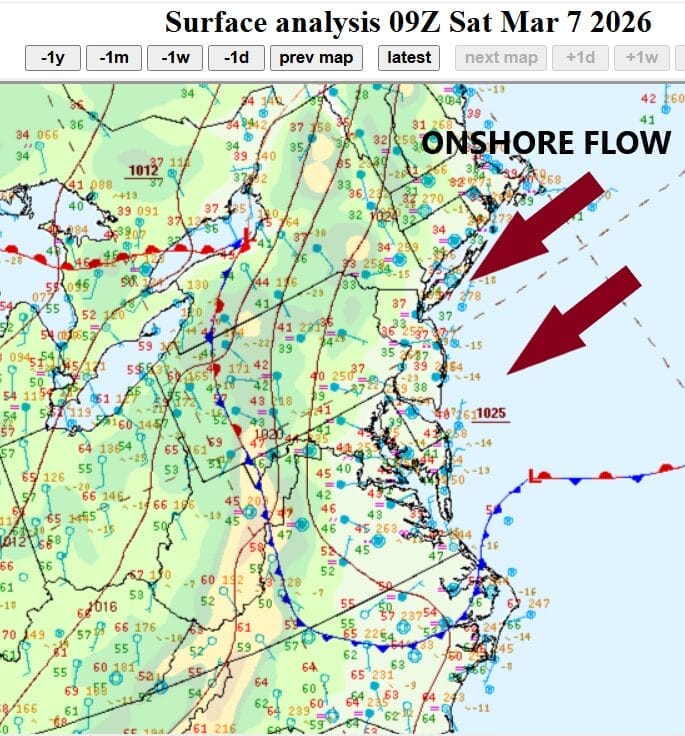
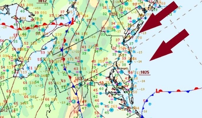
Early spring patterns are doomed by the curse of the onshore flow and that continues today. Note the stalled frontal boundary that is pinned across North Carolina, Western Virginia into Western Pennsylvania. High pressure to the northeast is wedged into the Mid Atlantic and that is going to keep skies overcast today with some fog and a little patchy light rain and drizzle especially along the coast.

Gradually as we move through the day and especially this evening, winds are going to start bending around to the southeast and south and this is ahead of a cold front that is heading east across the Midwest with showers and thunderstorms. Temperatures today are not going to get much above the low and mid 40s and that probably doesn’t happen until sometime this evening. The front to the west is producing showers and thunderstorms but it will weaken by the time it reaches the coast Sunday morning.
SATELLITE WITH LIGHTNING STRIKES

WEATHER RADAR

We can expect to see a few passing showers early Sunday morning as the front goes by but the showers will be patchy and it is possible that some areas see little or nothing. Temperatures will hold steady. The front will push slowly east so we could see some slow improvement in sky conditions Sunday afternoon but it will be a bit of a struggle. At least winds will be more from the west so high temperatures will reach the 60s in most places.

Next week is likely to be dry and warm for Monday and Tuesday as we have no onshore flow to worry about other than the usual afternoon sea breeze that develops and that will keep coastal areas of New Jersey, Long Island, and Southern New England cooler. Sunshine will take temperatures to the mid and upper 60s inland. Tuesday with some sunshine we should see inland highs reach into the 70s in many areas. The next chance for showers comes Wednesday with another approaching cold front.
BE SURE TO DOWNLOAD THE FREE METEOROLOGIST JOE CIOFFI WEATHER APP &
ANGRY BEN’S FREE WEATHER APP “THE ANGRY WEATHERMAN!
MANY THANKS TO TROPICAL TIDBITS FOR THE USE OF MAPS
Please note that with regards to any severe weather, tropical storms, or hurricanes, should a storm be threatening, please consult your local National Weather Service office or your local government officials about what action you should be taking to protect life and property.


