
Temperatures Heading for the 70s & 80s Into Midweek
With Shower Chances
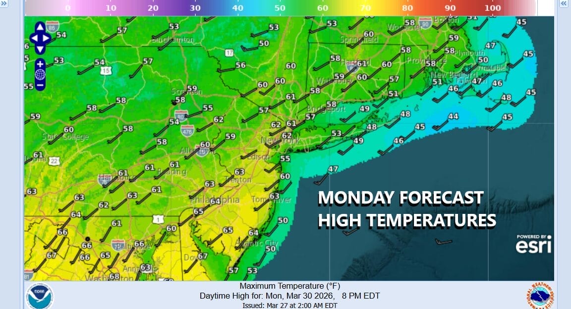
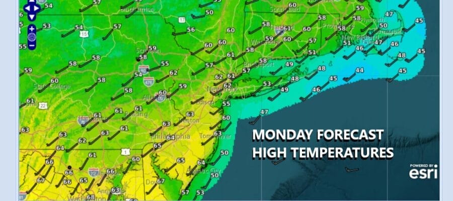
The new work week begins and we have have rising temperatures to look forward to after what was a rather cold weekend especially Saturday. But that is all past now and southwest winds have taken over. We do have some clouds streaming in ahead of a developing warm front across West Virginia and Virginia. That marks the leading edge of even warmer air that will get here Tuesday. So today it is sunshine and some clouds. Temperatures this afternoon will be topping out in the 60s except for exposed south and east facing shorelines where the sea breeze keeps temperatures in the 50s and, some cases like Eastern Long Island, just in the upper 40s to around 50.
SATELLITE WITH LIGHTNING STRIKES

WEATHER RADAR

Some showers are showing up on radars across West Virginia and Northern Virginia. That is part of the developing warm front that will move northward tonight. We could see a few scattered showers this evening across Eastern Pennsylvania to Southern New England but more than likely a higher chance after midnight into Tuesday morning.
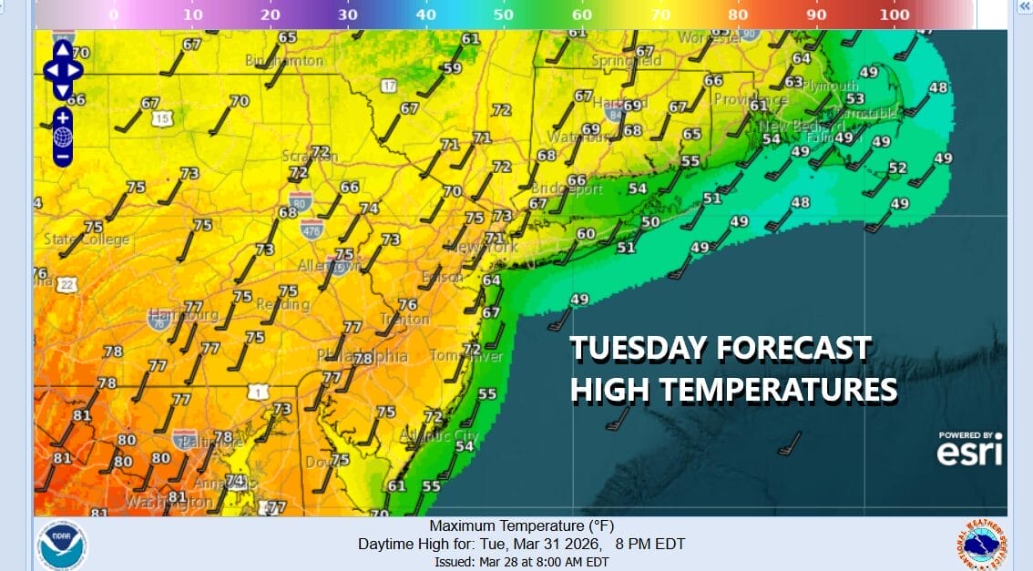
This warm front is going to move northward through Upstate New York and New England so that will allow very warm air to surge into Southeastern New York and Southern New England. Some sunshine will develop during the day Tuesday and highs will reach the 70s in most places except again coastal areas subject to a wind off the water. Some areas in South Jersey and points southward could see highs near 80.
Wednesday is going to be even warmer with more of a west wind. A cold front will be pushing southward from Upstate New York and the Great Lakes. This will allow temperatures Wednesday to reach into the 80s across much of Southeastern Pennsylvania and New Jersey. Near 80 degree highs are likely around New York City and the Lower Hudson Valley. We will see some sun but we could also see showers or a thunderstorm late in the day as this cold front passes. Thursday brings an onshore flow with a front stalled to the south. Clouds will be around Thursday and temperatures will be about 20 degrees lower with highs in the mid 50s to lower 60s. We could see this front back northward on Friday so we could go from onshore flow to warmer temperatures again as we head into the Easter Weekend. Right now it looks like we could see some showers Friday night into Saturday morning as the warm front goes by again, and then showers late Easter Sunday with a cold front. Dry weather will occur in between.
BE SURE TO DOWNLOAD THE FREE METEOROLOGIST JOE CIOFFI WEATHER APP &
ANGRY BEN’S FREE WEATHER APP “THE ANGRY WEATHERMAN!
MANY THANKS TO TROPICAL TIDBITS FOR THE USE OF MAPS
Please note that with regards to any severe weather, tropical storms, or hurricanes, should a storm be threatening, please consult your local National Weather Service office or your local government officials about what action you should be taking to protect life and property.


