
Sunshine Warmer Temperatures Next 2 Days
Back Door Front Puts Weekend In Jeopardy

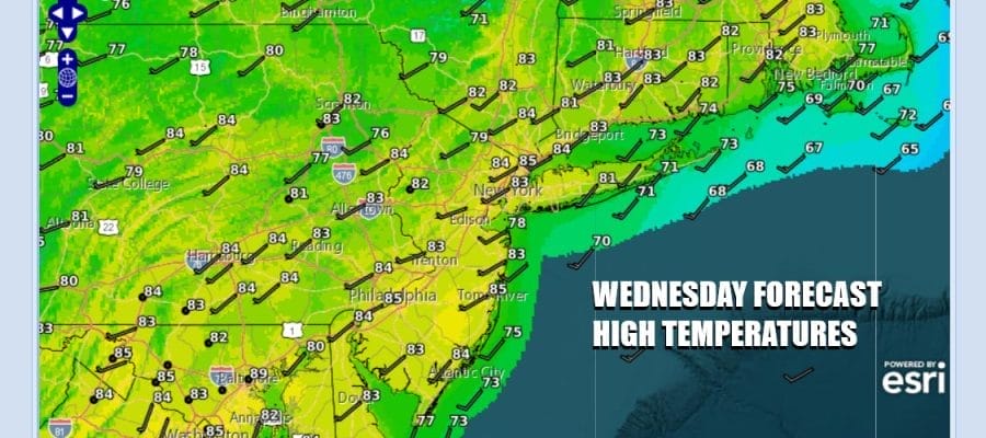
Yesterday’s weather front has finally cleared the coast and has moved offshore. High pressure is building into the Tennessee Valley and that puts us in a good place for the next couple of days for the most part. We are looking at a sunny Wednesday. Temperatures should reach into the lower 80s in most places except for the immediate coast where local sea breezes are going to develop later in the afternoon. Radars for a change are nice and quiet across much of the Northeast and Northern Mid Atlantic states.
SATELLITE WITH LIGHTNING STRIKES

WEATHER RADAR

Tonight is going to be a warm night with most lows in the 60s except for the warmest urban settings where it will be closer to 70. Thursday is going to be a very warm to hot day thanks to a west southwest wind and ahead of a backdoor front that will be slowly dropping southward from Upstate NY. There should be a fair amount of sunshine and highs will be in the mid 80s to some warm spots getting close to 90 degrees.
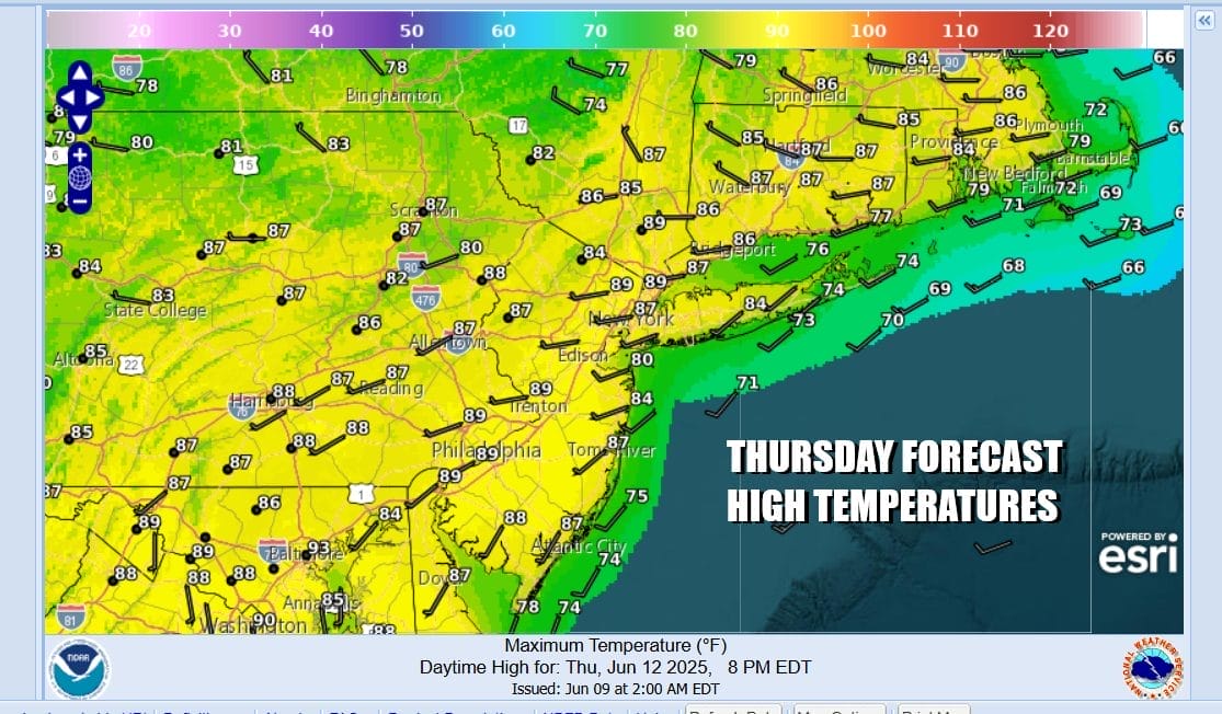
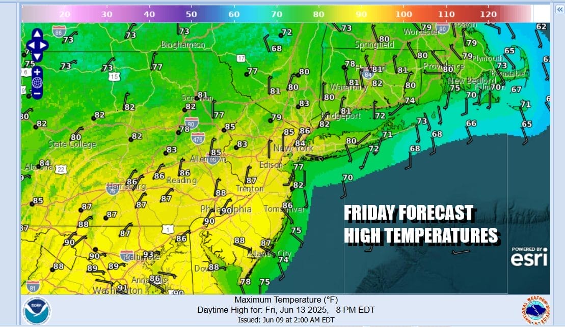
There is a very low chance for an isolated downpour or a thunderstorm and if it happens it will be well inland. The weather front will begin to slowly slide southward Thursday night and Friday and while winds will turn more to the east, the push of air from off the ocean is not going to do very much other than ease temperatures a bit Friday.

However we are going to see the “curse of the onshore flow” take hold as we move into the weekend with a stalled front to the south across the Mid Atlantic states and a wave or two of low pressure that will ripple along the frontal boundary. Ahead of it Friday we will call for a mix of sun and clouds. Most highs Friday will be in the upper 70s north and east and low to mid 80s west and south of New York City.
Over the weekend with that front to the south and the approaching wave we are likely to see more in the way of clouds both Saturday and Sunday. Showery rains are going to be around however it will not be continuous. There will be a steady period of showers Saturday night into at least part of Sunday. As for temperatures, Saturday highs will be in the upper 60s and lower 70s. Sunday highs will be in the low to mid 70s except 60s along the coast and when it is raining. If the frontal boundary sinks further south. Monday could be a better day with decreasing clouds and increasing sun from north to south with highs in the 70s to near 80 as the wind flow off the ocean continues. That will tend to hold temperatures down.
BE SURE TO DOWNLOAD THE FREE METEOROLOGIST JOE CIOFFI WEATHER APP &
ANGRY BEN’S FREE WEATHER APP “THE ANGRY WEATHERMAN!
MANY THANKS TO TROPICAL TIDBITS FOR THE USE OF MAPS
Please note that with regards to any sevurdere weather, tropical storms, or hurricanes, should a storm be threatening, please consult your local National Weather Service office or your local government officials about what action you should be taking to protect life and property.


