
Strong Winds All Day Long Rain Ends Midday & Sky Conditions Improve
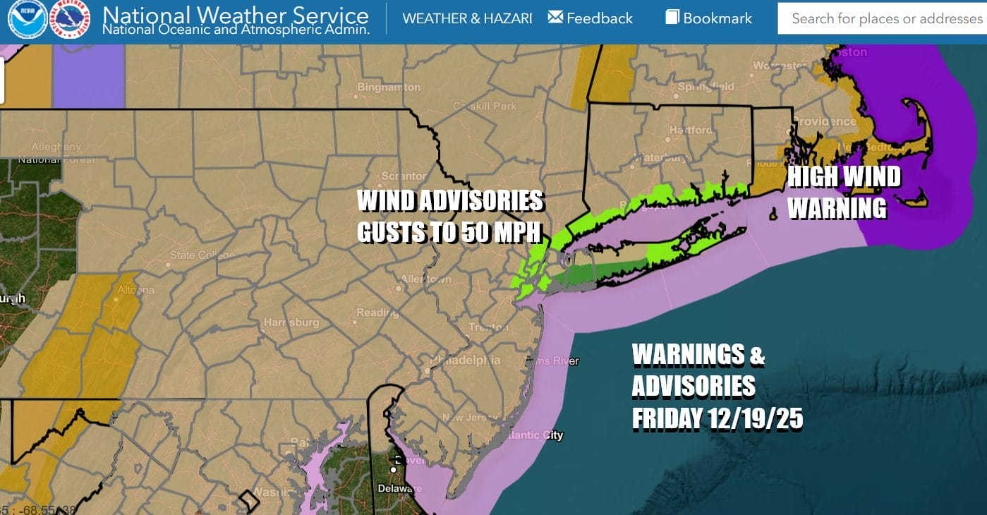
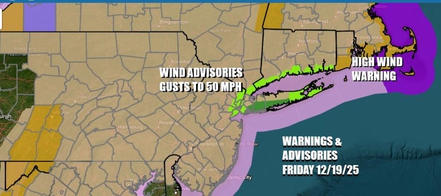
Wind Advisories continue today and into the first part of tonight for most of Pennsylvania, New York, New Jersey, Connecticut, and Long Island. We have High Wind Warnings up for Southeastern New England. Winds could gust to 50 mph in many places and in the warning area gusts could exceed 60 mph. We also have coastal flooding issues over shore areas around New York City, Long Island and Coastal Connecticut with mostly minor coastal flooding forecast.
SATELLITE WITH LIGHTNING STRIKES

WEATHER RADAR

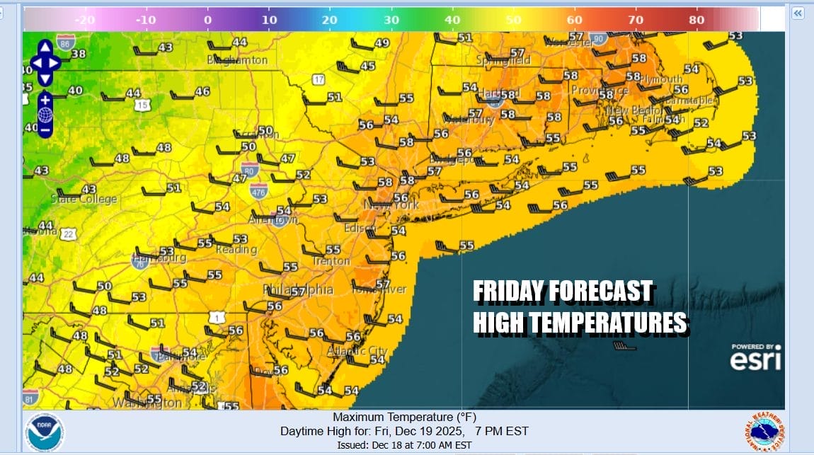
Heavy rain and thunderstorms are moving northeastward on radars. There are actually two cold front that will be passing through this morning Once the second front passes around midday, sky conditions will start to improve as the rain ends. However the wind will continue to be an issue through the afternoon and even into the first half of tonight. As far as temperatures are concerned we are in the mid 50s to near 60 and at the highs of the day during the morning. Temperatures will ease this afternoon and tonight.
It will be windy and cold tonight with skies clearing out. Temperatures by morning in the 20s and of course the wind will make it feel a lot colder. Saturday will be a nice day of sunshine and while it will still be a little windy early on, winds should ease as the day wears on. Highs Saturday will reach the upper 30s to around 40 degrees in most places.

Another cold front heads our way Sunday as another storm moves across Southern Canada but this time around the Gulf of America and the Atlantic are cut off so once the front passes, the only issue will be perhaps a few clouds and a wind shift. Sunday should be no worse than partly sunny with highs in the low to mid 40s. Colder air follows for Monday into Tuesday. We do have a warm front that will approach Monday night into Tuesday that could produce some snow inland and snow to rain along the coast. This might be a system that produces some accumulation especially inland though it should be on the light side. We will have more on this as we go through the weekend.
BE SURE TO DOWNLOAD THE FREE METEOROLOGIST JOE CIOFFI WEATHER APP &
ANGRY BEN’S FREE WEATHER APP “THE ANGRY WEATHERMAN!
MANY THANKS TO TROPICAL TIDBITS FOR THE USE OF MAPS
Please note that with regards to any severe weather, tropical storms, or hurricanes, should a storm be threatening, please consult your local National Weather Service office or your local government officials about what action you should be taking to protect life and property.


