
Slow Improvement Today Rain Late Friday Showers Thunderstorms Late Saturday
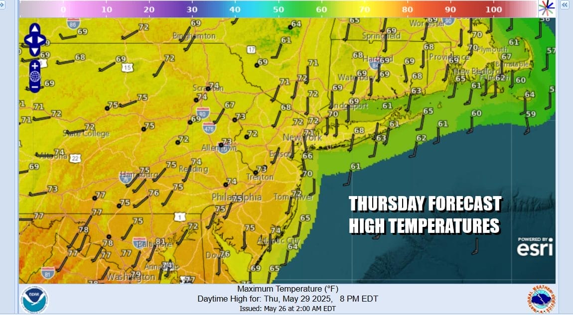
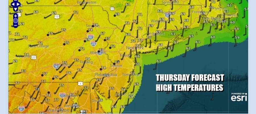
Overnight rains have now exited to the east and we are left with lots of clouds. I think the sun might poke its way through the clouds however there is still enough energy and moisture around for another shower or thunderstorm popping up later in the day into this evening. Best chances for this will be inland and they should be scattered in nature. Winds have turned more to the south so that should allow temperatures away from the ocean to climb up into the 70s today. Cooler 60s will prevail at the coast.
SATELLITE WITH LIGHTNING STRIKES

WEATHER RADAR

We will probably see clouds around tonight with most lows in the upper 50s and lower 60s. We are not done with rain as low pressure will be moving east across the Tennessee Valley to Virginia Friday. Energy from Canada will dig southeastward and that low will organize and strengthen some as it nears Delaware Bay Friday evening. From there the low will move northward Friday night bringing with it an area of moderate to heavy rain.

Once the low moves into New England Saturday morning the steady rain ends but then we have the northern upper trough that will swing around Saturday afternoon and evening. This will set off some additional showers and thunderstorms. We may also see some isolated severe thunderstorms in the mix until the trough moves off the New Jersey coast Saturday night.
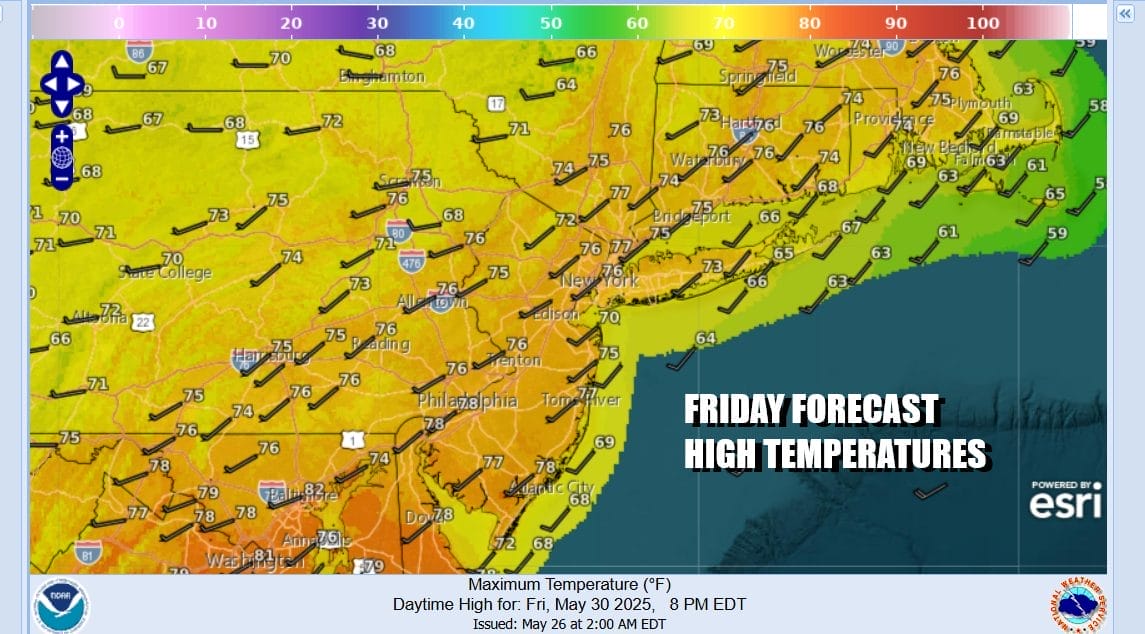
Back to Friday across Eastern Pennsylvania to Southern New England, temperatures might briefly get into the 70s but once the rain starts, temperatures will fall back into the 60s. Rain spreads from south to north reaching Southeastern New York and Long Island in the late afternoon or evening and then it becomes heavy at times overnight. The steady rain is done probably around or shortly before daybreak Saturday.

Saturday temperatures will be back into the 70s and we could see some breaks of sun Saturday morning into the afternoon which will work into an unstable atmosphere and then come the late day showers and thunderstorms from west to east. Weather conditions will finally improve Sunday when we will see a mix of sun and clouds. Sunday highs will be in the upper 60s to some lower 70s.

We do have some good news regarding next week as the east coast stormy pattern relaxes and is replaced by a building ridge of high pressure in the Eastern US. The result will be a much drier week if not rain free for much if not all of the time. Also with mostly west winds developing, temperatures will be in an uptrend and we should see highs reach the 80s in many locations midweek.
BE SURE TO DOWNLOAD THE FREE METEOROLOGIST JOE CIOFFI WEATHER APP &
ANGRY BEN’S FREE WEATHER APP “THE ANGRY WEATHERMAN!
MANY THANKS TO TROPICAL TIDBITS FOR THE USE OF MAPS
Please note that with regards to any severe weather, tropical storms, or hurricanes, should a storm be threatening, please consult your local National Weather Service office or your local government officials about what action you should be taking to protect life and property.


