
Slow Improvement Today Mostly Dry Through Friday
Showers Thunderstorms Saturday

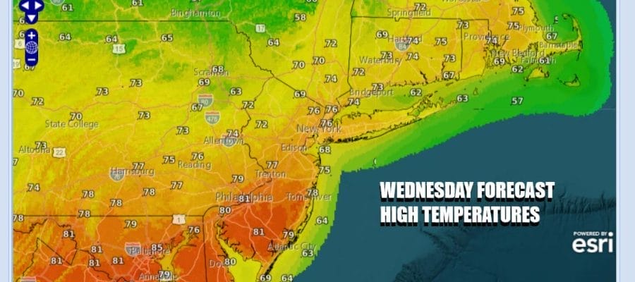
A cold front has passed through overnight and we will spend the day with slow improvement from west to east. The air behind the cold front is not especially “cold” or even cold at all. There are some leftover clouds around but we should go partly sunny before too long. Leftover warm air from yesterday still means that we could see high temperatures reaching the middle 70s to near 80 degrees in most places. Sea breezes will be confined to the immediate coast during the afternoon and early evening hours.
SATELLITE WITH LIGHTNING STRIKES

WEATHER RADAR

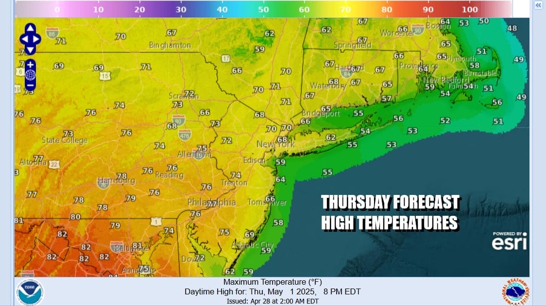
Cooler air comes in tonight and most lows will be in the mid 40s to lower 50s under clear skies, though some areas well inland could see lows drop into the upper 30s. Thursday is looking like a nice day all the way around for Eastern Pennsylvania to Southern New England with sunshine. Highs Thursday aftenroon will be mostly in the 70s except cooler 60s along south and east facing shorelines.
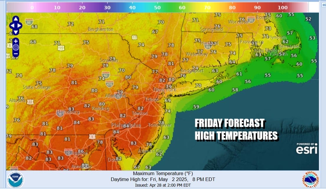
Things are going to become more complicated as we head into Friday and the weekend. Weather models are going in two different directions. The European would imply that weather conditions will not only go down hill this weekend but will stay in gloom & doom raining mode through Sunday and even into the first part of next week. The GFS model indicates that a weather front will move through Saturday and that while Saturday itself will feature showers and thunderstorms, Sunday would be a better day.

We are leaning to the idea that the more pessimistic models viewpoints have the higher probability of being correct at this stage. It will start with a warm front moving through Thursday night into Friday morning and there could be a shower or thunderstorm as that front goes by. Friday will be a cloudy to partly sunny type of day with highs reaching the 80s again except it will be cooler near the coast again with local sea breezes.
A cold front approaches Saturday so that means we have the risk for showers, thunderstorms, and possibly some severe weather risk though at the moment I would think the risk is marginal and the risk time would be late Saturday afternoon into Saturday night. The weather front stalling in an east west fashion could mean more rain or showers for Sunday. Temperatures Saturday will be in the 70s. Sunday with the flow being more onshore (wind off the ocean), highs will just be into the 60s. We will need to see more guidance over the next day or two in order to figure out which way this all goes.
BE SURE TO DOWNLOAD THE FREE METEOROLOGIST JOE CIOFFI WEATHER APP &
ANGRY BEN’S FREE WEATHER APP “THE ANGRY WEATHERMAN!
MANY THANKS TO TROPICAL TIDBITS FOR THE USE OF MAPS
Please note that with regards to any severe weather, tropical storms, or hurricanes, should a storm be threatening, please consult your local National Weather Service office or your local government officials about what action you should be taking to protect life and property.


