
Slow Improvement Continues This Weekend
Memorial Day Still Looks The Best of the 3 Days

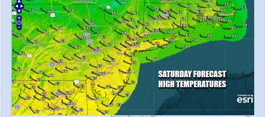
The weekend is underway but when we look at the satellite loop we can still see the rotation of clouds over much of the Northeast. This means that this will not be a picture perfect day. As you go south through New Jersey , Southeast Pennsylvania and points south you will likely see more in the way of sunshine. However if you head in the other direction, it will be more in the way of clouds with some limited sun in the mix. Throw in the chance for some inland showers like yesterday and you have a mixed weather day for Saturday. Highs today at least will be back into the low and middle 60s.
SATELLITE WITH LIGHTNING STRIKES

WEATHER RADAR

We do see patchy areas of rain on the radar north, northwest and northeast of New York City so we will have to keep an eye on this. For most of you much of the time it will be rain free. There isn’t much in the way of changes for the coming days. Gradually the rotating low in Northern New England will slide out to the east over the weekend and the stair step improvement trend continues.

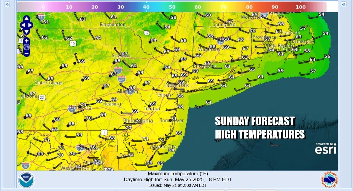
Tonight will be a chilly night with most lows in the 40s inland and low 50s coast and warmer urban areas. Sunday dayside should be drier and a little more stable in the upper atmosphere so we will go with a mix of sun and clouds and only a small chance for an inland scattered shower. Sunday temperatures will continue to move higher with more sun. Highs will reach the mid to upper 60s.
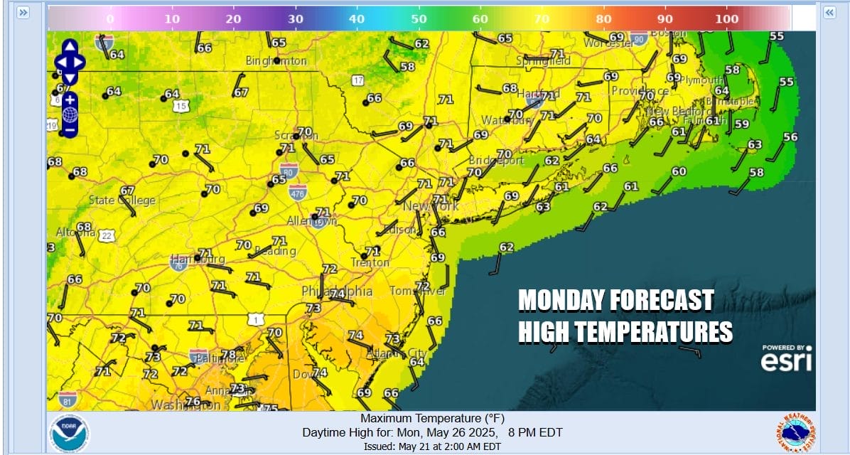
High pressure builds in for Monday, Memorial Day which will lead us to a day where skies are no worse than partly sunny. There is a weak upper trough that will move through upstate NY but we think showers will not be an issue so we aren’t going to mention them in the forecast. Monday highs will be back into the 70s in most places.
High pressure will hold on for Tuesday and we should see no worse than partly sunny skies. Highs Tuesday will be in the 70s. Then Wednesday the flow becomes more onshore and we need to watch low pressure coming out of the Plains and heading for the Lower Great Lakes. There may be some showers that move northward up the Appalachians but there is uncertainty over whether these showers make it our way. At least through the middle of next week for Eastern Pennsylvania to Southern New England there are no severe weather issues to speak of and the weather will be more reasonable over time.
BE SURE TO DOWNLOAD THE FREE METEOROLOGIST JOE CIOFFI WEATHER APP &
ANGRY BEN’S FREE WEATHER APP “THE ANGRY WEATHERMAN!
MANY THANKS TO TROPICAL TIDBITS FOR THE USE OF MAPS
Please note that with regards to any severe weather, tropical storms, or hurricanes, should a storm be threatening, please consult your local National Weather Service office or your local government officials about what action you should be taking to protect life and property.


