
Slow Improvement But Some Rain Saturday Night Into Sunday
Tropics Active With Humberto & Potential Imelda
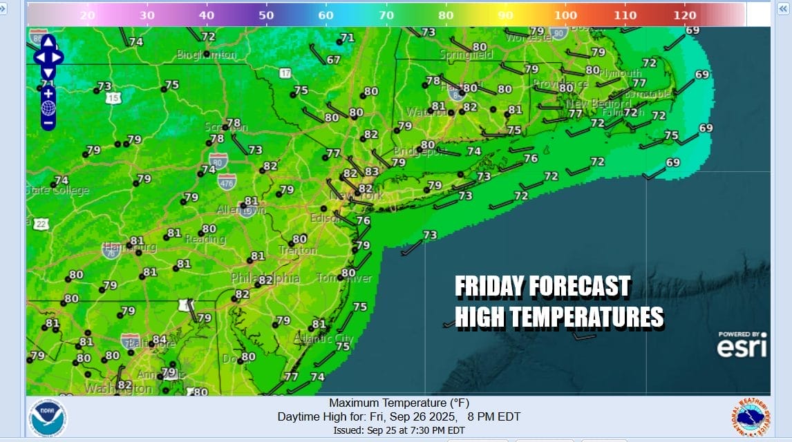
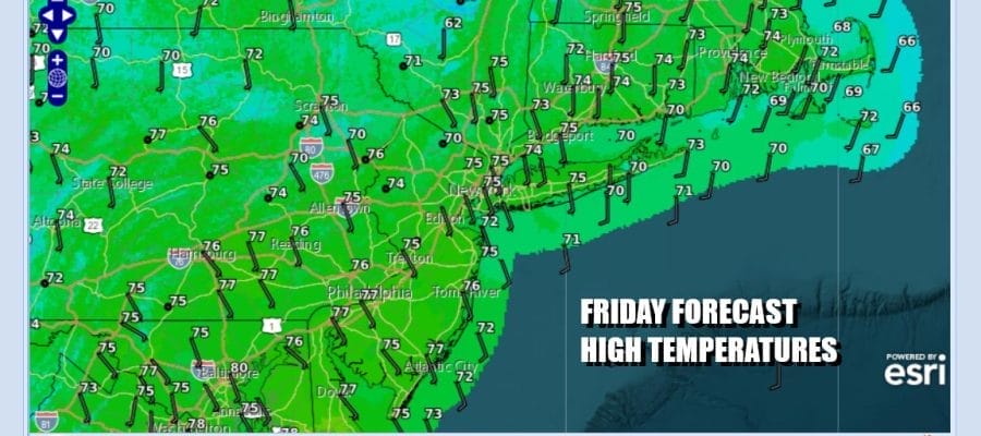
Yesterday’s weather front has moved offshore and we will spend the day with slowly improving weather conditions. Fog and leftover clouds will give way to some developing sunshine. The air that came in behind the cold front isn’t cold at all so temperatures today will be about the same or even a little warmer than yesterday. Most highs will be in the upper 70s and lower 80s. Radars show showers off shore and they should disappear off the radar view in short order. However that weather front isn’t going very far as it stalls just offshore and into the Southeast US. Most lows tonight under mainly clear skies will be in the low to mid 60s coast and warmer urban areas and 50s inland.
SATELLITE WITH LIGHTNING STRIKES

WEATHER RADAR

Moving on to the weekend where we will have Saturday of sunshine to start. Then some clouds will start to arrive from the south during the afternoon and evening. The stalled front sits near by and we will see a wave develop on that front that will move northeastward. Highs Saturday will be mostly in the 70s with an onshore wind. South and east facing shorelines will see lower highs.

While the dayside Saturday will be dry, Saturday night into Sunday morning we will see some rain and it actually could be a decent soaking rain. Moisture here is tropical in nature and we could wind up with an inch or more of rain in most places. The wave moves along and then exits to the northeast Sunday morning. Also while the wave is doing its thing, we have a potential new tropical storm near the Bahamas which, assuming it materializes, will be named Imelda. To the east of that is Hurricane Humberto which is likely to become a major hurricane over the weekend.

We will see weather conditions improve during the day Sunday though we may start out the day with leftover clouds but the rain should be done before daybreak. By Sunday afternoon across Eastern Pennsylvania to Southern New England we should be no worse than partly sunny with high temperatures mostly in the low to middle 70s.

What could be Tropical Storm Imelda will be moving northwestward from the Bahamas and it could strengthen some before landfall Monday night or early Tuesday in South Carolina. There is still quite a bit of uncertainty regarding this storm but it seems that the biggest issue is going to be heavy rains in the Carolinas and Virginia, and possibly parts of Georgia depending on the ultimate track. Imelda however is going to be pinned down to our south most if not all of this week as a very strong high builds into Eastern Canada and the Northeast. Next week could be dry all week and in fact by the middle of the week we will be seeing very cool temperatures as well as a gusty northeast wind. Monday and Tuesday should be no worse than partly sunny with highs in the low to mid 70s. Wednesday and Thursday will be breezy and cool with sunshine and highs only perhaps in the low to middle 60s!
BE SURE TO DOWNLOAD THE FREE METEOROLOGIST JOE CIOFFI WEATHER APP &
ANGRY BEN’S FREE WEATHER APP “THE ANGRY WEATHERMAN!
MANY THANKS TO TROPICAL TIDBITS FOR THE USE OF MAPS
Please note that with regards to any severe weather, tropical storms, or hurricanes, should a storm be threatening, please consult your local National Weather Service office or your local government officials about what action you should be taking to protect life and property.


