

Showery Rains Onshore Flow Back Wednesday Into Early Thursday
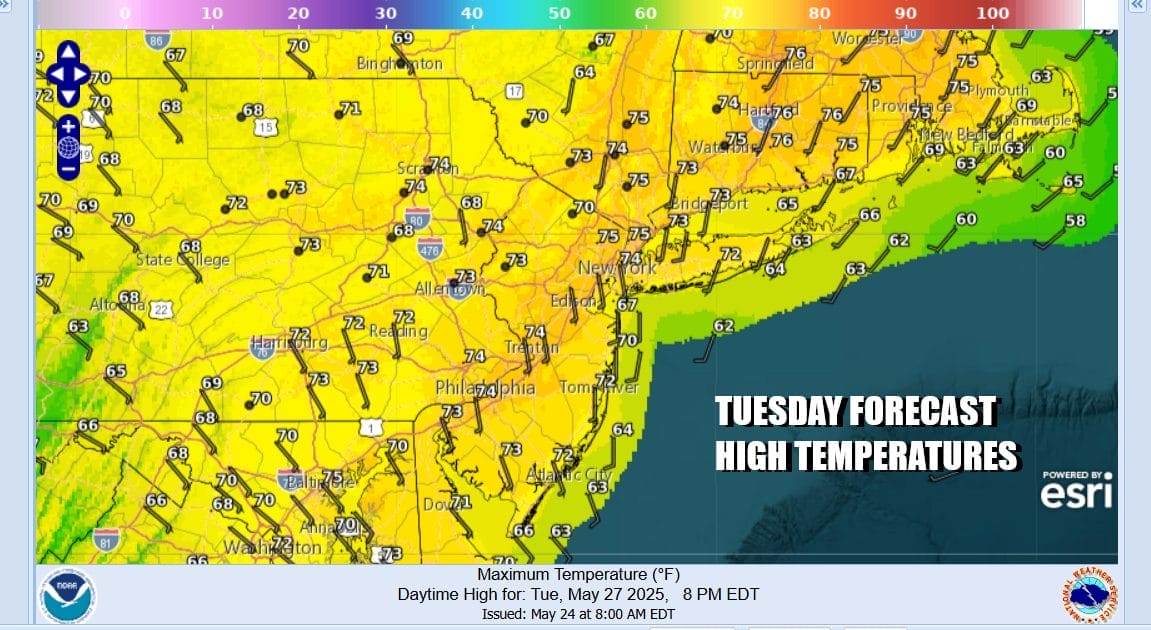
We will manage to squeeze out one more day before winds turn to the east and the “Curse of the Onshore Flow takes hold to an extent Wednesday into early Thursday. However today it should be no worse than partly sunny. We no longer have a trough over New England so there are no showers in the forecast. Some high clouds from the south could come in late in the day but there should be enough sun to take highs to the low and middle 70s especially inland. Winds off the ocean will keep south and east facing shorelines cooler.
SATELLITE WITH LIGHTNING STRIKES

WEATHER RADAR

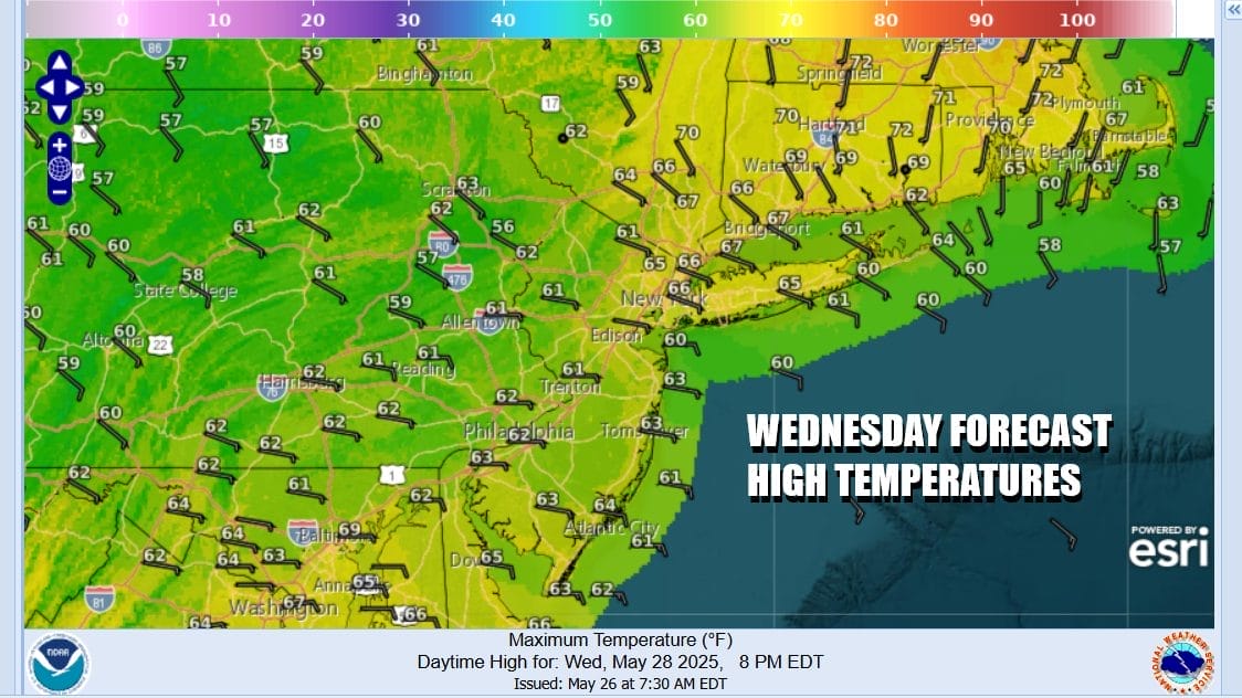
High pressure is offshore and a warm front is setting up to our south. Easterly winds will develop overnight and during the day Wednesday. Clouds will increase and thicken up. Wednesday looks to be a cloudy day overall and there will be showery rains coming up from the south as the day wears on. Most highs will be in the 60s but it will be warmer as you go north and east and cooler as you go south and southwest.
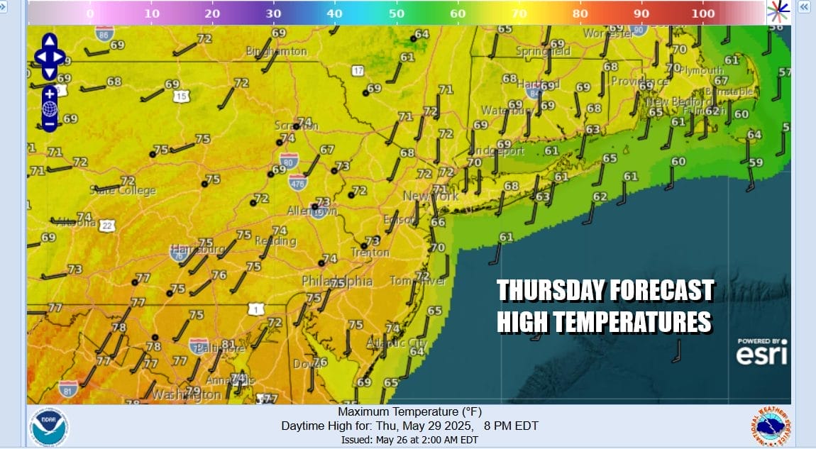
This is going to be another situation where it doesn’t rain all the time. There will be dry stretches. Also as we move into Thursday, winds will be come more south as a warm front edges northward. We also have a weather front that will stall across the Mid Atlantic states and from this we will see a wave of low pressure develop in the Carolinas and then head up the coast Friday.

This will turn into another instance where we see a period of rain Friday night into Saturday morning and then we have to wait for an upper trough to move through Saturday afternoon and with that we get some shower and thunderstorm activity. Back to Thursday where we could see showery rains early and a shower or thunderstorm late highs will be back into the 70s though it will be cooler along south and east facing shorelines.
Friday dayside will be dry with maybe some sun early before clouds increase and we get into some rain late Friday into early Saturday. If weather systems move along and they should to some extent, we should be able to see improving weather conditions Sunday however Saturday will have some rain early and then the risk of some showers or a thunderstorm or 2 Saturday afternoon and evening.
BE SURE TO DOWNLOAD THE FREE METEOROLOGIST JOE CIOFFI WEATHER APP &
ANGRY BEN’S FREE WEATHER APP “THE ANGRY WEATHERMAN!
MANY THANKS TO TROPICAL TIDBITS FOR THE USE OF MAPS
Please note that with regards to any severe weather, tropical storms, or hurricanes, should a storm be threatening, please consult your local National Weather Service office or your local government officials about what action you should be taking to protect life and property.


