
Showers Thunderstorms Severe Weather Risk Inland Today Into Saturday Morning
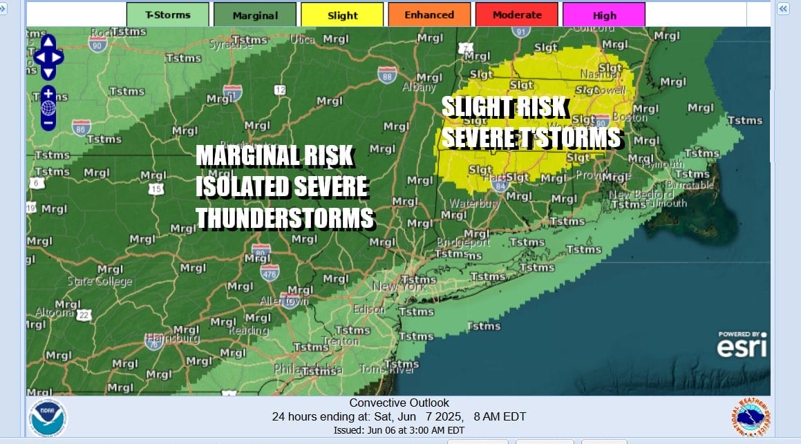
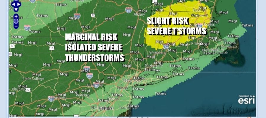
Thunderstorm activity was well to the west and northwest yesterday in Upstate NY and Pennsylvania but this is going to shift to the south today. The Storm Prediction Center is indicating much of Pennsylvania, Northern New Jersey, the Hudson Valley, Upstate NY and New England are at risk for severe thunderstorms later today into tonight. Isolated severe thunderstorms are possible but there might be a larger concentration of severe thunderstorms in Central New England including Northern Connecticut and Massachusetts and this is where the Storm Prediction Center is indicating a slight risk or 15 percent chance for severe thunderstorms.
SATELLITE WITH LIGHTNING STRIKES

WEATHER RADAR

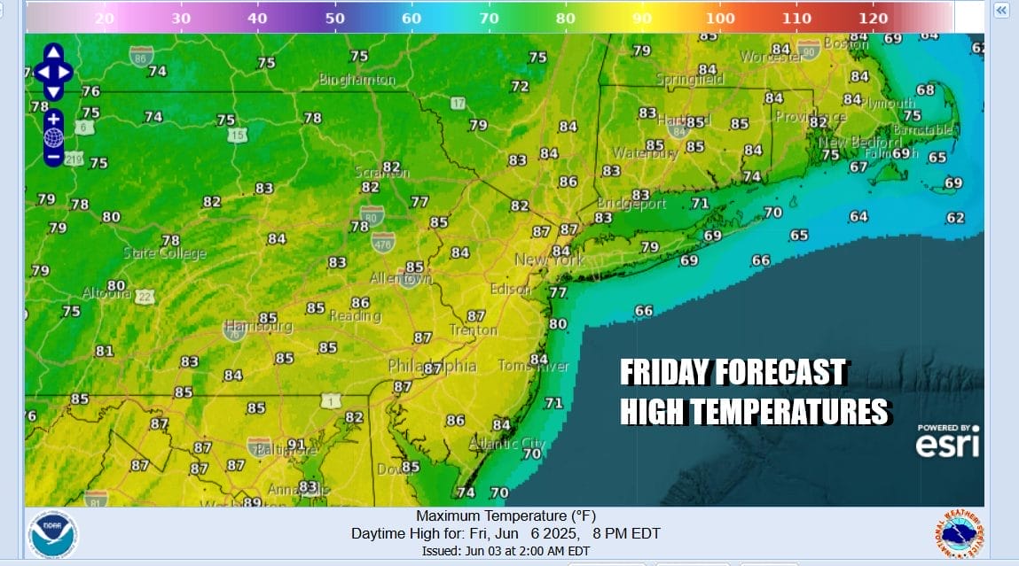
Ahead of all this today we will see partly sunny very warm and humid conditions. A weather front to the west will begin to slide slowly eastward and the northern end of the front in Upstate NY will push southward. Showers and thunderstorms will likely start to show up on radars early in the afternoon and the increase heading into this evening. Once again highs today will reach the 80s though highs will be lower than yesterday.
Showers and thunderstorms will be around this evening and tonight. The further south you go into New Jersey and points southward, the risk for thunderstorms diminishes. There may still be some scattered showers and thunderstorms around overnight and even for part of Saturday though we expect any showers Saturday to be more scattered and less organized. In fact we could see some improvement later in the day as the front moves offshore.

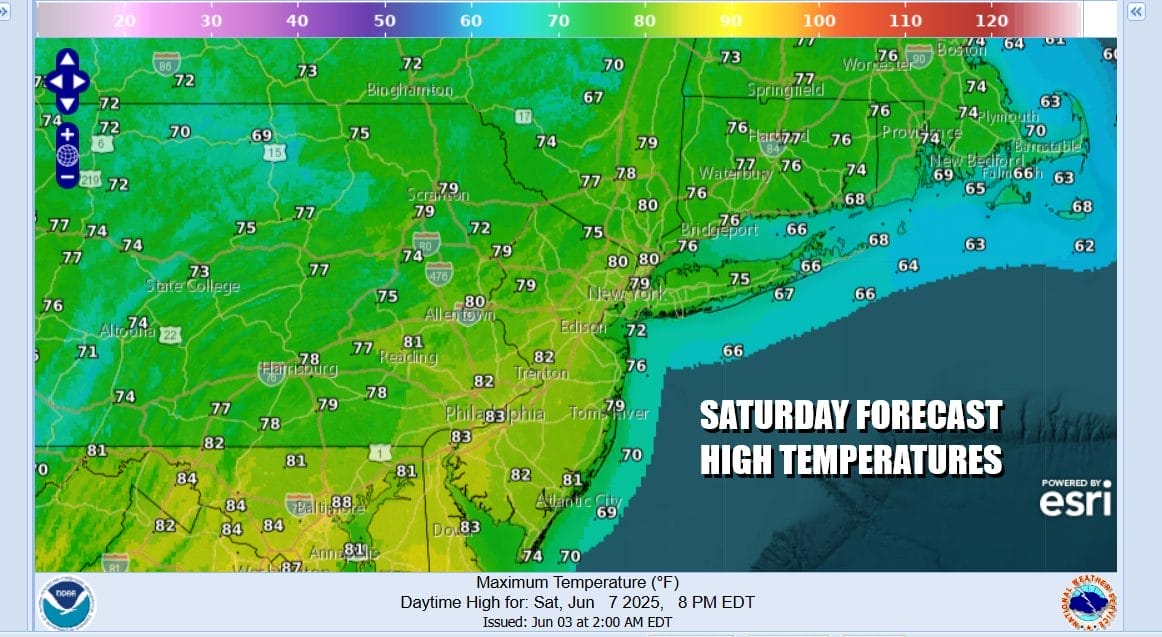
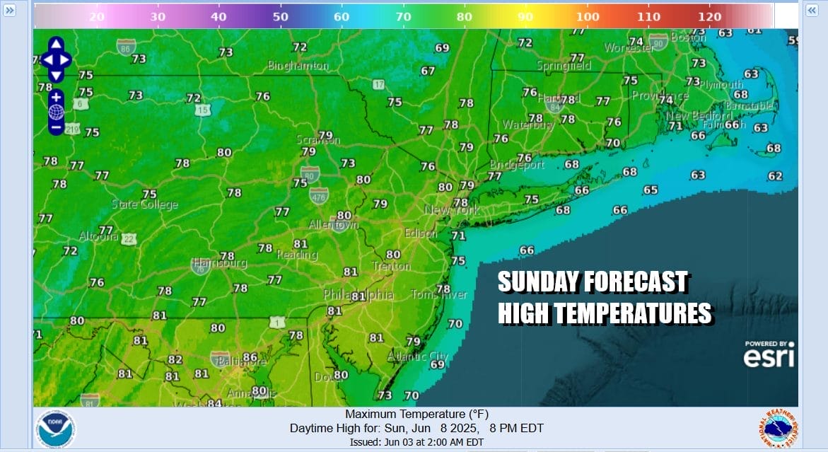
There will be a break in the activity later Saturday into early Sunday but weather models show another system coming out of the Plains and Ohio Valley and this will bring showers and thunderstorms back into the forecast for later Sunday into Sunday night. Temperatures Saturday will be mostly in the 70s and the same holds for Sunday as highs will be in the lower 70s or even the upper 60s especially when rain arrives.
We could see some improvement Monday as the weekend systems move well away to the east but there are still some disturbances in the west to east flow across the Northeast and Mid Atlantic. We can not rule out the possibility of scattered showers or thunderstorms Monday, and there is actually a higher chance for showers and thunderstorms later Tuesday as another cold front approaches from the west.
BE SURE TO DOWNLOAD THE FREE METEOROLOGIST JOE CIOFFI WEATHER APP &
ANGRY BEN’S FREE WEATHER APP “THE ANGRY WEATHERMAN!
MANY THANKS TO TROPICAL TIDBITS FOR THE USE OF MAPS
Please note that with regards to any severe weather, tropical storms, or hurricanes, should a storm be threatening, please consult your local National Weather Service office or your local government officials about what action you should be taking to protect life and property.


